


Gps Maps Michelin software
Gps Maps Michelin
Added: January 15, 2006 | Visits: 4.091
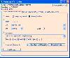 GPS Software - Download waypoints and routes from Garmin GPS. Upload waypoints and routes to Garmin GPS. Excel and Text files supported! This software is very easy to use!
Platforms: Windows
| License: Shareware | Cost: $29.95 USD | Size: 1.29 MB | Download (203): Frontbase GPS Download |
Added: January 05, 2006 | Visits: 3.129
 NavTools GPS is a small and easy to use application to connect your PC or laptop to an existing GPS (NMEA 0183 serial connection) installation. Position cata will automatically be displayed and logged on your screen, and voyage data can be exchanged and shared with the NavTools Route voyage...
Platforms: Windows
| License: Shareware | Cost: $25.00 USD | Size: 1.5 MB | Download (254): NavTools GPS Download |
Added: August 11, 2006 | Visits: 3.334
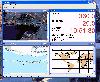
 GPS Express provides a feature rich interface to serial NMEA-0183 protocol data and works with most NMEA-0183 devices, including GPS Receivers. GPS Express is available in three versions (Standard, Professional, Graphical). STANDARD displays the title, value, and units for each parameter....
Platforms: Windows
| License: Shareware | Cost: $65.00 USD | Size: 2.1 MB | Download (169): GPS Express Standard Edition Download |
Added: January 09, 2006 | Visits: 3.142
 - you can show a current GPS data (Speed, Direction, Longitude, Latitude, Time, Date, Height);
- you can open any of scanned maps (in a "bmp" or "dib" format);
- you can calibrate the scanned maps yourself by two calibration points only (left-top and right-bottom);
- calibrations are stored...
- you can show a current GPS data (Speed, Direction, Longitude, Latitude, Time, Date, Height);
- you can open any of scanned maps (in a "bmp" or "dib" format);
- you can calibrate the scanned maps yourself by two calibration points only (left-top and right-bottom);
- calibrations are stored...
Platforms: Windows
| License: Demo | Cost: $9.50 USD | Size: 3.58 MB | Download (537): VIGps Download |
Released: March 15, 2008
|
Added: April 30, 2008 | Visits: 4.638
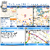 With MobiumGPS , your Windows Mobile device is turned into an advanced Mobile Navigation System with turn-by-turn voice announcements and detailed driving directions. You can search over 15 million point of interests (POIs) - places like hotels, restaurants, shopping malls and other tourist...
Platforms: Windows
| License: Demo | Cost: $9.95 USD | Size: 806.13 KB | Download (1554): Mobium GPS Navigation System Download |
Released: December 29, 2010
|
Added: January 06, 2011 | Visits: 4.315
 OkMap is a GPS and map software that:
-Works with vectorial maps and calibrates raster maps
-Organizes paths by creating waypoints, routes and tracks
-Uploads/downloads data to/from your GPS
-Uses altitude DEM data
-Supports GPS real-time navigation
-Sends/receives vehicles position...
OkMap is a GPS and map software that:
-Works with vectorial maps and calibrates raster maps
-Organizes paths by creating waypoints, routes and tracks
-Uploads/downloads data to/from your GPS
-Uses altitude DEM data
-Supports GPS real-time navigation
-Sends/receives vehicles position...
Platforms: Windows
| License: Freeware | Size: 20.25 MB | Download (1277): OkMap Download |
Added: August 11, 2008 | Visits: 1.954
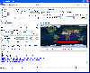
USA Photo Maps works to download aerial photos and topographical map data directly from the Microsoft TerraServer website, saving it to your hard drive and creating maps from there. With USA Photo Maps you can do the following:* Scroll and zoom operations.* See latitudes and longitudes.* See UGSS...
Platforms: Windows
| License: Freeware | Size: 5 KB | Download (524): USA Photo Maps Download |
Released: October 18, 2009
|
Added: December 19, 2009 | Visits: 1.427
 Automatic Geo/GPS location track utility for most parts of the World. Lets you know your and your friends geographic location at all times. Maps are downloaded on a per demand basis. All GPS information is stored to a database and can be readily retrieved based on a given date and time range....
Platforms: Windows, Pocket PC
| License: Shareware | Cost: $15.00 USD | Size: 2.41 MB | Download (156): GeoWatch Download |
Added: August 19, 2010 | Visits: 1.220
GPS::Babel is a Perl interface to gpsbabel. SYNOPSIS use GPS::Babel; my $babel = GPS::Babel->new(); # Read an OZIExplorer file into a data structure my $data = $babel->read(route.ozi, ozi); # Convert a file automatically choosing input and output # format based on extension...
Platforms: *nix
| License: Freeware | Size: 10.24 KB | Download (120): GPS::Babel Download |
Added: July 11, 2010 | Visits: 1.231
GPSMap is a Java application that displays maps and shows your position with the aid of a GPS device. GPSMap project can track paths, load overlays (such as shape files), and download maps from the MapBlast and Expedia servers. Whats New in This Release: - Serial communication on Windows...
Platforms: *nix
| License: Freeware | Size: 4.4 MB | Download (152): GPSMap Download |
Added: November 14, 2010 | Visits: 1.951
Crossfire Maps packages includes maps for the Crossfire MUD client. Crossfire is a multi-player graphical arcade and adventure game made for X. It has certain flavours from other games, especially Gauntlet and the rogue-like games (Nethack, Moria, Angband, and Ragnarok). Any number of players...
Platforms: *nix
| License: Freeware | Size: 21.2 MB | Download (165): Crossfire Maps Download |
Added: March 24, 2010 | Visits: 1.180
GPS::SpaceTrack is a package for calculating the position of GPS satellites. SYNOPSIS use GPS::SpaceTrack; my $obj=GPS::SpaceTrack->new(filename=>"gps.tle"); print join("t", qw{Count PRN ELEV Azim SNR USED}), "n"; foreach ($obj->getsatellitelist({lat=>38.870997, lon=>-77.05596})) { print...
Platforms: *nix
| License: Freeware | Size: 52.22 KB | Download (117): GPS::SpaceTrack Download |
Added: June 21, 2010 | Visits: 1.464
QLandkarte can view and upload map files, track and waypoint data to your Garmin GPS receiver. Garmins MapSource software is hardly the only reason for me to boot into Windows and it does not look like Garmin ever wants to address Linux users by writing a portable piece of software. So I...
Platforms: *nix
| License: Freeware | Size: 972.8 KB | Download (116): QLandkarte Download |
Added: May 22, 2010 | Visits: 1.532
Maps project is a topographal map and aerial photo generator and viewer. Maps allows users to generate topographical maps and aerial photographs of any region in the United States. It uses data provided by the USGS through the geoserver system. The interactive view lets you move around,...
Platforms: *nix
| License: Freeware | Size: 11.26 KB | Download (139): Maps Download |
Added: May 13, 2010 | Visits: 1.336
GPS::Lowrance is a Perl module connect to Lowrance and Eagle GPS devices. REQUIREMENTS The following modules are required to use this module: Carp::Assert GPS::Lowrance::LSI 0.23 Parse::Binary::FixedFormat Win32::SerialPort or Device::SerialPort If you will be using the...
Platforms: *nix
| License: Freeware | Size: 22.53 KB | Download (139): GPS::Lowrance Download |
Added: September 18, 2010 | Visits: 1.593
GPS::Lowrance::Trail is a Perl module to convert between GDM16 Trails and other formats. Installation: Installation is pretty standard: perl Makefile.PL make make test make install There is no test suite to speak of. One will be added in a later version. SYNOPSIS use...
Platforms: *nix
| License: Freeware | Size: 8.19 KB | Download (113): GPS::Lowrance::Trail Download |
Added: January 25, 2010 | Visits: 1.304
GPS Connect is a freeware program for Mac OS X which offers connectivity to Garmin GPS receivers. The intended use is to backup waypoints from the GPS to your computer. Downloaded waypoints may be saved in a native file format or exported to a variety of other formats such as tab-delimited,...
Platforms: Mac
| License: Freeware | Size: 1.2 MB | Download (108): GPS Connect Download |
Released: April 09, 2010
|
Added: July 05, 2010 | Visits: 3.474
 The Tro GPS Simulator provides a complete suite for all your GPS simulating needs and more. The Tro GPS Simulator uses the international standardized protocol NMEA-0183 for GPS data exchange. It can simulataneously send and recieve data.Furthermore it provides several input methods for GPS...
Platforms: Windows
| License: Demo | Cost: $99.00 USD | Size: 5.73 MB | Download (884): Tro GPS Simulator Download |
Released: July 21, 2010
|
Added: September 25, 2010 | Visits: 1.346
 Toolkit to add GPS and coordinate conversion functionality to your software and scripts (GPS API). All NMEA0183 protocol versions are supported and can be filtered by NMEA sentence type and talker ID. Garmin USB PVT support. Information on GPS status can also be retrieved: GPS fix quality,...
Platforms: Windows
| License: Shareware | Cost: $99.00 USD | Size: 2.2 MB | Download (121): Eye4Software GPS API Download |
Released: January 12, 2012
|
Added: February 04, 2012 | Visits: 1.492
 Bubble maps software does scatter plot and circle charts in Excel, useful for advanced business analysis.
Excel provides the ability to draw bubble maps and scatter plots, but they are less refined than a bubble map you can make with the Smart Bubble Charts software. In Excel: (1) Chart...
Bubble maps software does scatter plot and circle charts in Excel, useful for advanced business analysis.
Excel provides the ability to draw bubble maps and scatter plots, but they are less refined than a bubble map you can make with the Smart Bubble Charts software. In Excel: (1) Chart...
Platforms: Windows
| License: Shareware | Cost: $54.65 USD | Size: 16.32 MB | Download (126): Bubble Maps Software Download |