


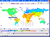
Gps Maps For Gulf software
Gps Maps For Gulf
Added: July 11, 2013 | Visits: 448
 VisPatch is a tool for patching quake maps for transparent water in glquake. Original quake didn't have their maps water-vis'ed, so people did that by themselves and prepared patch data files. This tool is used for preparing and applying those patch files. At the time this tool was written,...
Platforms: Mac
| License: Freeware | Size: 215.04 KB | Download (51): VisPatch Download |
Released: July 01, 2012
|
Added: July 01, 2012 | Visits: 505
Topos US is an app that provides access to download and view high resolution USGS topographic maps for the United States.
REGARDING MAP DATES:
You will often see a date on a downloaded map that seems pretty old. This is the date of last physical survey. This could be a long time ago. Often...
Platforms: Mac
| License: Commercial | Cost: $2.99 USD | Size: 716.8 KB | Download (49): Topos US Download |
Added: July 17, 2013 | Visits: 270
HexMapper is an application for building hex-based maps for RPGs, table-top wargames and other such games. It was written in Java 1.5, and I tried to make it as native feeling in all OSs as possible. The basic idea behind HexMapper is to start with a high level broad scale view of the world to...
Platforms: Mac
| License: Shareware | Cost: $0.00 USD | Size: 10 MB | Download (33): HexMapper Download |
Added: November 08, 2013 | Visits: 320
Download and plots data and maps for site related data such as Vs30 and Basin Depth.
Platforms: Mac
| License: Shareware | Cost: $0.00 USD | Size: 13.38 MB | Download (38): Site Data Viewer/Plotter Download |
Added: May 10, 2013 | Visits: 1.084
This project allows someone to track a GPS enabled cell phone using Google maps.For this project it is used a Motorola i355 cell phone on the Sprint/Nextel network. You need to have a data plan so that you can make updates to your website from the cellphone. Project includes J2ME cell phone...
Platforms: Windows, Mac, *nix, PHP, BSD Solaris
| License: Freeware | Download (81): GPS Tracker Download |
Added: February 15, 2010 | Visits: 2.241
GPS Tracker project allows someone to track a GPS enabled cell phone using Google maps. For this project I used a Motorola i355 cell phone on the Sprint/Nextel network. You need to have a data plan so that you can make updates to your website from the cellphone. Please read the ReadMe.txt file...
Platforms: *nix
| License: Freeware | Download (203): GPS Tracker Download |
Released: February 09, 2014
|
Added: March 16, 2014 | Visits: 1.889
 The Vutog GPS Simulator provides a complete suite for all your GPS simulation needs and more. It is designed to assist in developing, testing and debugging GPS Applications and equipment working with the NMEA-0183 protocol. It can be used for testing navigation applications and equipments indoor...
Platforms: Windows, Windows 7
| License: Shareware | Cost: $149.00 USD | Size: 5.75 MB | Download (164): Vutog GPS Simulator Download |
Released: June 13, 2012
|
Added: June 13, 2012 | Visits: 896
![]() With the new Icons-Land Vista Style GIS/GPS/Map Icon Set now it is much more comfortable to use local service applications, GPS tracking and GIS applications, and any kind of mapping applications. GIS/GPS/Map Icons are meant to help users to orient oneself when using maps, to facilitate their...
With the new Icons-Land Vista Style GIS/GPS/Map Icon Set now it is much more comfortable to use local service applications, GPS tracking and GIS applications, and any kind of mapping applications. GIS/GPS/Map Icons are meant to help users to orient oneself when using maps, to facilitate their...
Platforms: Windows, Mac, Pocket PC, Java, Handheld/Mobile Other
| License: Demo | Cost: $120.00 USD | Size: 2.53 MB | Download (57): Icons-Land Vista Style GIS/GPS/MAP Icon Set Download |
Released: September 07, 2014
|
Added: September 21, 2014 | Visits: 750
![]() With the new Icons-Land GIS/GPS/Map Vector Icons now it is much more comfortable to use local service applications, GPS tracking and GIS applications, and any kind of mapping applications.
GIS/GPS/Map Icons are meant to help users to orient oneself when using maps, to facilitate their...
With the new Icons-Land GIS/GPS/Map Vector Icons now it is much more comfortable to use local service applications, GPS tracking and GIS applications, and any kind of mapping applications.
GIS/GPS/Map Icons are meant to help users to orient oneself when using maps, to facilitate their...
Platforms: Windows, Mac, Windows 8, Windows 7, iOS
| License: Demo | Cost: $180.00 USD | Size: 5.56 MB | Download (40): Icons-Land GIS/GPS/MAP Vector Icons Download |
Released: August 10, 2023
|
Added: August 23, 2023 | Visits: 331
 iToolab AnyGo for iOS as the most professional location changer app, it can help you change GPS location and simulate GPS movements for Pokemon Go or LBS apps. 1. Fake GPS location to anywhere: Teleport Mode can change your location with one click. 2.Simulate GPS movements: You can choose two...
Platforms: iOS, iPhone,iPod,iPad,iTouch
| License: Full Trial | Cost: $19.99 USD | Size: 5.35 MB | Download (1018): iToolab AnyGo for iOS Download |
Added: June 21, 2010 | Visits: 1.464
QLandkarte can view and upload map files, track and waypoint data to your Garmin GPS receiver. Garmins MapSource software is hardly the only reason for me to boot into Windows and it does not look like Garmin ever wants to address Linux users by writing a portable piece of software. So I...
Platforms: *nix
| License: Freeware | Size: 972.8 KB | Download (116): QLandkarte Download |
Added: January 25, 2010 | Visits: 945
GPSNavX is the solution for the boater that wants to take the Macintosh aboard for real-time display of position on full color marine Softcharts and BSB raster charts.Just plug your GPS into your Macintosh and watch as your boat moves along in real-time, plotting a track behind the boat and...
Platforms: Mac
| License: Shareware | Cost: $0.00 USD | Download (155): GPSNavX Download |
Released: October 23, 2012
|
Added: October 23, 2012 | Visits: 650
GPS Utility is an easy-to-use application that provides management and manipulation of GPS information. You can use it to transfer data to/from a GPS receiver and store the data in PC files in one of several text formats.
The program converts between different map datums and many coordinate...
Platforms: Windows
| License: Freeware | Size: 1.87 MB | Download (469): GPS Utility Download |
Added: August 08, 2013 | Visits: 549
By Qingdu Li,Institute for Nonlinear Systems, Chongqing University of Posts and Telecommunications, Chongqing, 400065, China.Email: liqd@cqupt.edu.cn or qingdu_li@163.comAs one of the most important results in chaotic dynamics, topological horseshoe theory provides a powerful tool in rigorous...
Platforms: Matlab
| License: Shareware | Cost: $0.00 USD | Size: 890.88 KB | Download (49): A toolbox for finding horseshoes in 2D maps Download |
Added: August 17, 2013 | Visits: 531
The Maps Management Module is an addon module for PHP-Nuke. It is a full Module for managing "maps" for any type of game.Administration Features:List of maps to edit are now in a dropdown list.Add and edit Descriptions, images, and links.Upload Images!Module Features:Page numbering.Configure how...
Platforms: PHP
| License: Freeware | Size: 51.2 KB | Download (48): Maps Management Module Download |
Released: December 12, 2023
|
Added: December 23, 2023 | Visits: 1.234
 Universal Maps Downloader is a tool that help you to get small tile images from Google Maps, Openstreetmap, Yandex Maps, Yahoo Maps, Mapquest, Gaode map, Tencent Maps, Baidu Maps, Tianditu, Arcgis Online, OneMap, Whereis, mapy.cz, Mappy, Waze, Sentinel-2 map, Strava Gloabal Heatmap, Wikimapia,...
Platforms: Windows 8, Windows 7, Windows
| License: Shareware | Cost: $69.00 USD | Size: 30.7 MB | Download (147): Universal Maps Downloader |
Released: July 01, 2005
|
Added: March 03, 2006 | Visits: 3.957
 A good travelogue often requires a map showing the destinations or route. With MapCreator you can create the maps necessary for this purpose. The map type, extract and scale are freely adjustable. The maps are of a very high quality and can be used in all media without query and cost.
Platforms: Windows
| License: Freeware | Size: 29.61 MB | Download (565): MapCreator Free Edition Download |
Added: January 25, 2010 | Visits: 874
Terrabrowser is an internet browser for satellite photos and topographical maps which are obtained from the Microsoft Terra Server. The map data is provided by the U.S. Geological Survey (USGS) and therefore only covers the United States at this time (although expansion to other map servers may...
Platforms: Mac
| License: Shareware | Cost: $0.00 USD | Download (98): Terrabrowser Download |
Released: February 07, 2012
|
Added: February 26, 2012 | Visits: 1.135
 Free standalone software DataPult Desktop creates heat maps from your data quickly and efficiently.
Key features:
Direct data import from MS Excel with one click.
The ability to create animated maps of data over several years.
Interactive maps and diagrams.
39 map...
Free standalone software DataPult Desktop creates heat maps from your data quickly and efficiently.
Key features:
Direct data import from MS Excel with one click.
The ability to create animated maps of data over several years.
Interactive maps and diagrams.
39 map...
Platforms: Windows
| License: Freeware | Size: 20.96 MB | Download (95): DataPult Desktop Download |
Released: June 09, 2012
|
Added: June 09, 2012 | Visits: 338
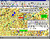 OziExplorer is interactive, it allows you to work, on your computer screen, with digital maps that you have purchased or scanned yourself. By using these maps OziExplorer allows you to plan your trip by creating waypoints, routes and tracks on screen and upload these to your GPS.
With...
OziExplorer is interactive, it allows you to work, on your computer screen, with digital maps that you have purchased or scanned yourself. By using these maps OziExplorer allows you to plan your trip by creating waypoints, routes and tracks on screen and upload these to your GPS.
With...
Platforms: Windows
| License: Shareware | Cost: $95.00 USD | Size: 7 MB | Download (431): OziExplorer Download |