


Gps Data Logger software
Gps Data Logger
Added: September 19, 2013 | Visits: 355
 MobileAction i-gotU Mac/Linux support igotu2gpx is a command-line utility to provide i-gotU GPS travel logger support under Linux and Mac OS X. At the moment, the following functionality is implemented: - access via serial port (Windows) or libusb (Linux) - dump of the internal flash memory -...
Platforms: *nix
MobileAction i-gotU Mac/Linux support igotu2gpx is a command-line utility to provide i-gotU GPS travel logger support under Linux and Mac OS X. At the moment, the following functionality is implemented: - access via serial port (Windows) or libusb (Linux) - dump of the internal flash memory -...
Platforms: *nix
| License: Freeware | Size: 235.52 KB | Download (34): igotu2gpx Download |
Added: October 27, 2013 | Visits: 813
OpenGTS??a*zNz ("Open GPS Tracking System") is the first available open source project designed specifically to provide web-based GPS tracking services for a "fleet" of vehicles. To date, OpenGTS??a*zNz has been downloaded and put to use in over 90 countries around the world to track many 1000's...
Platforms: Mac
| License: Freeware | Size: 3.97 MB | Download (44): OpenGTS Download |
Added: August 19, 2010 | Visits: 1.230
GPS::Babel is a Perl interface to gpsbabel. SYNOPSIS use GPS::Babel; my $babel = GPS::Babel->new(); # Read an OZIExplorer file into a data structure my $data = $babel->read(route.ozi, ozi); # Convert a file automatically choosing input and output # format based on extension...
Platforms: *nix
| License: Freeware | Size: 10.24 KB | Download (121): GPS::Babel Download |
Released: April 09, 2010
|
Added: July 05, 2010 | Visits: 3.485
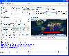 The Tro GPS Simulator provides a complete suite for all your GPS simulating needs and more. The Tro GPS Simulator uses the international standardized protocol NMEA-0183 for GPS data exchange. It can simulataneously send and recieve data.Furthermore it provides several input methods for GPS...
Platforms: Windows
The Tro GPS Simulator provides a complete suite for all your GPS simulating needs and more. The Tro GPS Simulator uses the international standardized protocol NMEA-0183 for GPS data exchange. It can simulataneously send and recieve data.Furthermore it provides several input methods for GPS...
Platforms: Windows
| License: Demo | Cost: $99.00 USD | Size: 5.73 MB | Download (884): Tro GPS Simulator Download |
Released: October 12, 2010
|
Added: October 18, 2010 | Visits: 1.162
 TCP Logger AX is addon for the Advanced TCP Data Logger software.
Capturing and logging data transferred via TCP/IP or UDP ports is one of the common tasks in industrial networks. Whether you want to gather data from a terminal server with dozens of RS232 or RS485 devices connected to it, or...
Platforms: Windows
TCP Logger AX is addon for the Advanced TCP Data Logger software.
Capturing and logging data transferred via TCP/IP or UDP ports is one of the common tasks in industrial networks. Whether you want to gather data from a terminal server with dozens of RS232 or RS485 devices connected to it, or...
Platforms: Windows
| License: Shareware | Cost: $44.95 USD | Size: 685.59 KB | Download (124): TCP Logger AX Download |
Released: September 02, 2012
|
Added: September 02, 2012 | Visits: 643
Develop precise, efficient, and reliable GPS software in record time with this multithreaded component for desktop and mobile devices, including PocketPC, Windows CE, Tablet PC, Smartphone and now Windows Mobile! Over fifty classes in one lightweight assembly give you unparalleled features while...
Platforms: Windows, Pocket PC, Handheld/Mobile Other
| License: Shareware | Cost: $279.00 USD | Size: 10.34 MB | Download (51): GPS.NET Download |
Added: October 10, 2006 | Visits: 3.461
 This program is a simple proxy server(port-mapper). It is an ideal tool for monitoring any network software or for researching network protocols. Log files with all traffic that has passed through this program are organized in a nice manner and can be saved in a separate folder.
What is the...
Platforms: Windows
This program is a simple proxy server(port-mapper). It is an ideal tool for monitoring any network software or for researching network protocols. Log files with all traffic that has passed through this program are organized in a nice manner and can be saved in a separate folder.
What is the...
Platforms: Windows
| License: Shareware | Cost: $17.00 USD | Size: 63 KB | Download (282): Advanced TCP Logger Download |
Added: August 12, 2008 | Visits: 1.503
 GPS library VB (.NET) toolkit reads and decodes standard GPS NMEA 183 sentences from the RS232 serial port as well as computes great circle distances and bearings. Runs as a background thread unattended. Works with Bluetooth and USB. The most current GPS data is always available on demand....
Platforms: Windows
GPS library VB (.NET) toolkit reads and decodes standard GPS NMEA 183 sentences from the RS232 serial port as well as computes great circle distances and bearings. Runs as a background thread unattended. Works with Bluetooth and USB. The most current GPS data is always available on demand....
Platforms: Windows
| License: Shareware | Cost: $105.00 USD | Size: 303 KB | Download (113): MarshallSoft GPS Component for VB Download |
Released: December 29, 2010
|
Added: January 06, 2011 | Visits: 4.325
 OkMap is a GPS and map software that:
-Works with vectorial maps and calibrates raster maps
-Organizes paths by creating waypoints, routes and tracks
-Uploads/downloads data to/from your GPS
-Uses altitude DEM data
-Supports GPS real-time navigation
-Sends/receives vehicles position...
Platforms: Windows
OkMap is a GPS and map software that:
-Works with vectorial maps and calibrates raster maps
-Organizes paths by creating waypoints, routes and tracks
-Uploads/downloads data to/from your GPS
-Uses altitude DEM data
-Supports GPS real-time navigation
-Sends/receives vehicles position...
Platforms: Windows
| License: Freeware | Size: 20.25 MB | Download (1277): OkMap Download |
Released: September 19, 2012
|
Added: September 19, 2012 | Visits: 790
 The filter module "Digital inputs filter" for our data loggers (for example, Accurate Printer Monitor ) is an additional module that provides a method to exclude less significant data records from the final data export. The module works with digital data which can be interpreted as "True/False"...
Platforms: Windows
The filter module "Digital inputs filter" for our data loggers (for example, Accurate Printer Monitor ) is an additional module that provides a method to exclude less significant data records from the final data export. The module works with digital data which can be interpreted as "True/False"...
Platforms: Windows
| License: Freeware | Download (50): Digital Inputs Filter 3.7.4 Download |
Released: July 27, 2012
|
Added: July 27, 2012 | Visits: 843
The filter module "Digital inputs filter" for our data loggers (for example, Accurate Printer Monitor ) is an additional module that provides a method to exclude less significant data records from the final data export. The module works with digital data which can be interpreted as "True/False"...
Platforms: Windows
| License: Freeware | Download (50): Digital Inputs Filter Download |
Added: March 23, 2013 | Visits: 443
The purpose of E-Collaboration for GPS/DGPS is to provide a GIS collaboration environment for the world over Internet, in which people can share and assess their measured GPS data.
Platforms: PHP
| License: Shareware | Cost: $0.00 USD | Size: 491.52 KB | Download (41): E-Collaboration for GPS/DGPS Download |
Added: June 26, 2013 | Visits: 413
The JavaGPS package enables Java applications to talk to attached GPS devices that conform to the NMEA0183 protocol. JavaGPS has the following key features: Auto-detection of attached GPS device Recording and playback of GPS data Supports raw GPS logs and has an optimised log file format....
Platforms: *nix
| License: Freeware | Size: 522.24 KB | Download (34): JavaGPS - access GPS devices from Java Download |
Added: October 14, 2006 | Visits: 5.931
 Opanda PowerExif is a professional tool to edit Exif data in images. As the best assistant to edit & modify images information for photographers, image pickers, PowerExif allows to edit & modify all Exif data freely. Not only you could manage and record photographic data and GPS data of images,...
Platforms: Windows
Opanda PowerExif is a professional tool to edit Exif data in images. As the best assistant to edit & modify images information for photographers, image pickers, PowerExif allows to edit & modify all Exif data freely. Not only you could manage and record photographic data and GPS data of images,...
Platforms: Windows
| License: Shareware | Cost: $89.99 USD | Size: 1.2 MB | Download (665): Opanda PowerExif Editor Download |
Added: January 09, 2006 | Visits: 3.148
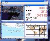 - you can show a current GPS data (Speed, Direction, Longitude, Latitude, Time, Date, Height);
- you can open any of scanned maps (in a "bmp" or "dib" format);
- you can calibrate the scanned maps yourself by two calibration points only (left-top and right-bottom);
- calibrations are stored...
Platforms: Windows
- you can show a current GPS data (Speed, Direction, Longitude, Latitude, Time, Date, Height);
- you can open any of scanned maps (in a "bmp" or "dib" format);
- you can calibrate the scanned maps yourself by two calibration points only (left-top and right-bottom);
- calibrations are stored...
Platforms: Windows
| License: Demo | Cost: $9.50 USD | Size: 3.58 MB | Download (537): VIGps Download |
Released: April 02, 2009
|
Added: April 07, 2009 | Visits: 2.207
 This component helps you to manipulate EXIF, IPTC and GPS information in JPEG and TIFF images plus known RAW formats (Canon CRW, Adobe DNG, Canon CR2, Fujifilm RAF, Minolta MRW, Nikon NEF, Pentax PEF, Sony ARW and Sony SR2). You can Change/Read/Write ALL EXIF or IPTC fields in JPEG images. The...
Platforms: Windows
This component helps you to manipulate EXIF, IPTC and GPS information in JPEG and TIFF images plus known RAW formats (Canon CRW, Adobe DNG, Canon CR2, Fujifilm RAF, Minolta MRW, Nikon NEF, Pentax PEF, Sony ARW and Sony SR2). You can Change/Read/Write ALL EXIF or IPTC fields in JPEG images. The...
Platforms: Windows
| License: Shareware | Cost: $49.95 USD | Size: 1.39 MB | Download (266): AiS EXIF Info ActiveX Download |
Released: May 25, 2018
|
Added: June 25, 2018 | Visits: 3.613
 HoudahGeo is a photo geocoding and geotagging tool for Mac. Use HoudahGeo to attach GPS coordinates and location names to your photos.
HoudahGeo writes EXIF and XMP geotags to JPEG and RAW image files. This creates a permanent record of where a photo was taken. Just like a GPS-enabled camera....
Platforms: Mac
HoudahGeo is a photo geocoding and geotagging tool for Mac. Use HoudahGeo to attach GPS coordinates and location names to your photos.
HoudahGeo writes EXIF and XMP geotags to JPEG and RAW image files. This creates a permanent record of where a photo was taken. Just like a GPS-enabled camera....
Platforms: Mac
| License: Demo | Cost: $39.00 USD | Size: 22.87 MB | Download (837): HoudahGeo Download |
Released: October 18, 2009
|
Added: December 19, 2009 | Visits: 1.437
 Automatic Geo/GPS location track utility for most parts of the World. Lets you know your and your friends geographic location at all times. Maps are downloaded on a per demand basis. All GPS information is stored to a database and can be readily retrieved based on a given date and time range....
Platforms: Windows, Pocket PC
Automatic Geo/GPS location track utility for most parts of the World. Lets you know your and your friends geographic location at all times. Maps are downloaded on a per demand basis. All GPS information is stored to a database and can be readily retrieved based on a given date and time range....
Platforms: Windows, Pocket PC
| License: Shareware | Cost: $15.00 USD | Size: 2.41 MB | Download (156): GeoWatch Download |
Added: January 25, 2010 | Visits: 756
GPSd is an open-source GPS daemon, which allows you to share data from a single GPS source with multiple applications on one or even many computers. Not only can it reproduce raw GPS data to an (effectively) unlimited number of clients, but it can also provide fully parsed, on-demand GPS...
Platforms: Mac
| License: Freeware | Size: 500 KB | Download (122): gpsdX Download |
Released: July 09, 2012
|
Added: July 09, 2012 | Visits: 590
The DataExplorer is a tool to gather, view and analyze data which comes from devices with a serial data port or other like CSV-file or USB port.
The application itself runs on several operating system with 32 or 64 bit processor and is enabled for national language support.
Devices might be...
Platforms: Windows
| License: Freeware | Download (409): DataExplorer Download |