


Gis Programming software
Gis Programming
Added: August 07, 2008 | Visits: 1.770
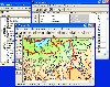
 Total GIS Converter is an affordable converter of GIZ files. It converts AEP, GRD, ADF, E00, FLT, APR, SHP, DXF, BT, TOC, RT1, DEM, DLG, ECW, IMG, DGF, GML, SID, MIF, TAB, WOR, DNG, DDF, BIL, TIF, JPEG, TTKPS, TTKGP, TTKLS, LFT, PFT, and TFT files. The target formats are TIFF, PNG, JPEG, BMP....
Platforms: Windows
| License: Shareware | Cost: $99.90 USD | Size: 2.66 KB | Download (648): Total GIS Converter Download |
Released: November 25, 2012
|
Added: November 25, 2012 | Visits: 816
 How is your web site or blog looking? If you are honest, do you really think it is as good as it could be? Well, if the answer is no, you could quickly and easily revamp it and get more traffic going through your web pages in next to no time.Java programming projects software, Advanced Applet...
Platforms: Windows
| License: Freeware | Size: 2.93 MB | Download (580): Update Your Web Site Today With New Programming Projects Software From Java Download |
Added: August 04, 2008 | Visits: 1.164
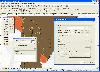
 GIS ObjectLand is a universal Geographic Information System for Windows. Key capabilities: vector-raster maps; multiuser data editing; import and export for MIF/MID (MapInfo), SHP (ArcView), DXF (AutoCAD), DBF (dBASE), CSV; setting access permissions to data for different categories of users;...
Platforms: Windows
| License: Shareware | Cost: $99.00 USD | Size: 23.54 MB | Download (537): GIS ObjectLand Download |
Released: November 04, 2012
|
Added: November 04, 2012 | Visits: 1.369
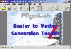 Software development kit for CAD/CAM/ GIS and graphic software developers. Converts from raster to vector and refines architect, mechanical, tech drawing, maps, math graphs, graphics for books and journals and more. ActiveX and Com Component are also available. Refines vector graphics, creates...
Platforms: Windows
| License: Freeware | Size: 2.67 MB | Download (526): Algolab Raster to Vector Conversion CAD/ Download |
Added: January 15, 2006 | Visits: 2.906
 Synopsis is a visual programming tool that dramatically accelerates software development. By dragging and dropping icons and connecting them with graphical links, it is possible to assemble complex programs in literally seconds. Synopsis is not a computer language. Synopsis provides a methodology...
Platforms: Windows
| License: Commercial | Cost: $150.00 USD | Size: 17.94 MB | Download (501): Synopsis - Visual Programming Tool Download |
Added: August 17, 2008 | Visits: 970
AdvaNum Programming Center Professional Edition is a complete milling CAD/CAM and NC verification solution. With this product you can create new or import existing part drawings, convert them into NC programs and verify results using real CNC simulation and NC programs debugging modules. And all...
Platforms: Windows
| License: Shareware | Cost: $895.00 USD | Size: 4.74 MB | Download (496): AdvaNum Programming Center Download |
Released: October 24, 2012
|
Added: October 24, 2012 | Visits: 674
 QGIS supports vector, raster, and database formats and lets you browse and create map data on your computer.
Quantum GIS (QGIS) supports many common spatial data formats (e.g. ESRI ShapeFile, geotiff). QGIS supports plugins to do things like display tracks from your GPS.
QGIS aims to be an...
QGIS supports vector, raster, and database formats and lets you browse and create map data on your computer.
Quantum GIS (QGIS) supports many common spatial data formats (e.g. ESRI ShapeFile, geotiff). QGIS supports plugins to do things like display tracks from your GPS.
QGIS aims to be an...
Platforms: Linux
| License: Freeware | Size: 1024 KB | Download (460): Quantum GIS form Linux Download |
Released: October 11, 2012
|
Added: October 11, 2012 | Visits: 772
 QGIS supports vector, raster, and database formats and lets you browse and create map data on your computer.
Quantum GIS (QGIS) supports many common spatial data formats (e.g. ESRI ShapeFile, geotiff). QGIS supports plugins to do things like display tracks from your GPS.
QGIS aims to be an...
QGIS supports vector, raster, and database formats and lets you browse and create map data on your computer.
Quantum GIS (QGIS) supports many common spatial data formats (e.g. ESRI ShapeFile, geotiff). QGIS supports plugins to do things like display tracks from your GPS.
QGIS aims to be an...
Platforms: Windows
| License: Freeware | Size: 77.3 MB | Download (453): Quantum GIS Download |
Released: July 24, 2012
|
Added: July 24, 2012 | Visits: 782
 QGIS supports vector, raster, and database formats and lets you browse and create map data on your computer.
Quantum GIS (QGIS) supports many common spatial data formats (e.g. ESRI ShapeFile, geotiff). QGIS supports plugins to do things like display tracks from your GPS.
QGIS aims to be an...
QGIS supports vector, raster, and database formats and lets you browse and create map data on your computer.
Quantum GIS (QGIS) supports many common spatial data formats (e.g. ESRI ShapeFile, geotiff). QGIS supports plugins to do things like display tracks from your GPS.
QGIS aims to be an...
Platforms: Mac
| License: Freeware | Size: 1024 KB | Download (440): Quantum GIS form Mac Download |
Released: March 29, 2020
|
Added: April 06, 2020 | Visits: 2.723
GeoDLL is a Geodetic Development Kit / Geodetic Function Library with worldwide 2D and 3D Coordinate Transformation, Datum Shift, Meridian Convergence and Extra Parameter with highest accuracy. Furthermore: Helmert and Molodensky Parameters, NTv2, HARN, INSPIRE, EPSG, Digital Elevation Model...
Platforms: Windows, Windows 8, Windows 7, Windows Server
| License: Shareware | Cost: $560.00 USD | Size: 5.23 MB | Download (295): GeoDLL Download |
Added: August 12, 2008 | Visits: 1.931
 Linear programming environment that incorporates large-scale linear programs solver and easy, intuitive graphical user interface to specify, import and solve any type of constrained optimization problems arising in various industrial, financial and educational areas. Optimization problems are...
Platforms: Windows
| License: Shareware | Cost: $295.00 USD | Size: 987 KB | Download (290): GIPALS - Linear Programming Environment Download |
Added: January 27, 2006 | Visits: 6.811
 Software development kit for CAD/CAM/ GIS and graphic software developers. Converts from raster to vector and refines architect, mechanical, tech drawing, maps, math graphs, graphics for books and journals and more. ActiveX and Com Component are also available. Refines vector graphics, creates...
Platforms: Windows
| License: Shareware | Cost: $99.00 USD | Size: 2.73 MB | Download (257): Algolab Raster to Vector Conversion CAD/GIS SDK Download |
Added: August 23, 2008 | Visits: 1.582
 Linear programming library that incorporates the power of linear programming solver and simplicity of integration to any software tools like Ms Visual C++, Ms Visual Basic, Borland Delphi and other that support a DLL import. The maximum number of constraints and variables is unlimited.
Platforms: Windows
| License: Shareware | Cost: $245.00 USD | Size: 439 KB | Download (195): GIPALS32 - Linear Programming Library Download |
Released: February 03, 2004
|
Added: March 24, 2006 | Visits: 3.799
 The CANVAS 9 GIS Mapping Edition adds native support for Geographic Information System (GIS) data to Canvas. You can take measurements in geographic coordinates, import industry standard SHAPE and GeoTIFF files into unlimited numbers of automatically aligned overlapping layers and choose among...
Platforms: Windows
| License: Shareware | Cost: $549.99 USD | Size: 53.3 MB | Download (188): Canvas GIS Mapping Edition Download |
Added: June 11, 2010 | Visits: 1.539
Intro to Bash Programming HOWTO is a bash programming tutorial. The Intro to Bash Programming HOWTO is meant for newbies who wish to learn how to write shell scripts for bash, the GNU Boure-Again shell. It contains several samples. It is very early in its development, but it is hoped that...
Platforms: *nix
| License: Freeware | Download (188): Intro to Bash Programming HOWTO Download |
Added: September 22, 2010 | Visits: 1.571
GIS::Distance::Polar can do Polar coordinate flat-earth distance calculations. SYNOPSIS my $calc = GIS::Distance::Polar->new(); my $distance = $calc->distance( $lon1, $lat1 => $lon2, $lat2 ); Supposedly this is a formula to better calculate distances at the poles. While implimented, this...
Platforms: *nix
| License: Freeware | Size: 8.19 KB | Download (159): GIS::Distance::Polar Download |
Released: July 25, 2007
|
Added: September 26, 2007 | Visits: 3.497
 AvisMap GIS Engine is a comprehensive SDK for the development of custom GIS applications and solutions. This SDK provides several ActiveX (OCX) controls which support Visual Basic, VB.NET, C#, Visual C++ and other ActiveX compatible programming languages, with Microsoft Visual Studio versions 6,...
Platforms: Windows
| License: Shareware | Cost: $199.00 USD | Size: 43.76 MB | Download (157): AvisMap GIS Engine Download |
Released: June 08, 2004
|
Added: October 01, 2006 | Visits: 3.129
 It is the first generic-purpose codeless visual programming system in the world. It can be used to create computer software without using computer languages. It can be used to created most applications, Interactive multimedia kiosks, sales presentations, database applications with interacticve...
Platforms: Windows
| License: Shareware | Cost: $199.00 USD | Size: 10.18 MB | Download (153): Limnor Codeless Programming System Download |
Added: August 03, 2008 | Visits: 1.400
Terminal-Complex Ltd offers you Visual Programming Armoury for C++ and Java - a heavy-duty tool of a software developer's trade. TCVPA is dedicated for professionals who employ object-oriented methodology, client-server computing, object-relational mapping, complex data storages, diagrams for...
Platforms: Windows
| License: Freeware | Size: 2.8 MB | Download (150): Visual Programming Armoury Download |
Added: September 02, 2010 | Visits: 2.487
Geo::ShapeFile is a Perl extension for handling ESRI GIS Shapefiles. SYNOPSIS use Geo::ShapeFile; my $shapefile = new Geo::ShapeFile("roads"); for(1 .. $shapefile->shapes()) { my $shape = $shapefile->get_shp_record($_); # see Geo::ShapeFile::Shape docs for what to do with $shape my...
Platforms: *nix
| License: Freeware | Size: 276.48 KB | Download (147): Geo::ShapeFile Download |