


Gis Metadata Defined software
Gis Metadata Defined
Released: February 15, 2007
|
Added: February 22, 2007 | Visits: 1.955
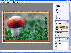 Generate high quality, loseless or lossy JPEG 2000 image documents with the power and ease of automation. Integrates a full-featured inbuilt editor and enhancement tools to give another dimension to your photos. Generate ready-to-use image documents, screensavers, and slide shows by processing...
Platforms: Windows
| License: Shareware | Cost: $50.00 USD | Size: 8.69 MB | Download (133): Oriens JPEG2000 Professional Download |
Added: August 04, 2008 | Visits: 1.164
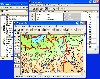 GIS ObjectLand is a universal Geographic Information System for Windows. Key capabilities: vector-raster maps; multiuser data editing; import and export for MIF/MID (MapInfo), SHP (ArcView), DXF (AutoCAD), DBF (dBASE), CSV; setting access permissions to data for different categories of users;...
Platforms: Windows
| License: Shareware | Cost: $99.00 USD | Size: 23.54 MB | Download (537): GIS ObjectLand Download |
Released: August 20, 2009
|
Added: August 26, 2009 | Visits: 2.816
 The deluxe photo data toolkit for amateur photographers and professionals alike.PIE is an image browser and viewer with perfectly integrated photo metadata and file renaming features. It extracts EXIF, XMP and IPTC information from JPG and RAW files and makes it available in a convenient and...
Platforms: Windows
| License: Shareware | Cost: $35.00 USD | Size: 3.87 MB | Download (150): Picture Information Extractor Download |
Added: August 15, 2008 | Visits: 1.045
 Active Metadata is an ActiveX component to get additional image information. Usually these includes copyright, digital camera model, or program by which this image is made. Also you can get creation date, comments, exposure time, resolution, color tables and binary information. With this...
Platforms: Windows
| License: Commercial | Cost: $8.95 USD | Size: 1.22 MB | Download (526): Active Metadata Download |
Added: August 07, 2008 | Visits: 1.770
Total GIS Converter is an affordable converter of GIZ files. It converts AEP, GRD, ADF, E00, FLT, APR, SHP, DXF, BT, TOC, RT1, DEM, DLG, ECW, IMG, DGF, GML, SID, MIF, TAB, WOR, DNG, DDF, BIL, TIF, JPEG, TTKPS, TTKGP, TTKLS, LFT, PFT, and TFT files. The target formats are TIFF, PNG, JPEG, BMP....
Platforms: Windows
| License: Shareware | Cost: $99.90 USD | Size: 2.66 KB | Download (648): Total GIS Converter Download |
Added: September 02, 2010 | Visits: 2.487
Geo::ShapeFile is a Perl extension for handling ESRI GIS Shapefiles. SYNOPSIS use Geo::ShapeFile; my $shapefile = new Geo::ShapeFile("roads"); for(1 .. $shapefile->shapes()) { my $shape = $shapefile->get_shp_record($_); # see Geo::ShapeFile::Shape docs for what to do with $shape my...
Platforms: *nix
| License: Freeware | Size: 276.48 KB | Download (147): Geo::ShapeFile Download |
Added: January 25, 2010 | Visits: 1.202
Metadata Hootenanny is a view/editor for all the spiffy metadata you can put into Quicktime movies. You know how you can view, edit and sort by your mp3s' ID3 metadata in iTunes? Well, the same metadata system exists for all your quicktime movies, too, but until now the only way to access it was...
Platforms: Mac
| License: Freeware | Download (109): Metadata Hootenanny Download |
Released: October 24, 2012
|
Added: October 24, 2012 | Visits: 674
 QGIS supports vector, raster, and database formats and lets you browse and create map data on your computer.
Quantum GIS (QGIS) supports many common spatial data formats (e.g. ESRI ShapeFile, geotiff). QGIS supports plugins to do things like display tracks from your GPS.
QGIS aims to be an...
QGIS supports vector, raster, and database formats and lets you browse and create map data on your computer.
Quantum GIS (QGIS) supports many common spatial data formats (e.g. ESRI ShapeFile, geotiff). QGIS supports plugins to do things like display tracks from your GPS.
QGIS aims to be an...
Platforms: Linux
| License: Freeware | Size: 1024 KB | Download (460): Quantum GIS form Linux Download |
Released: July 24, 2012
|
Added: July 24, 2012 | Visits: 782
 QGIS supports vector, raster, and database formats and lets you browse and create map data on your computer.
Quantum GIS (QGIS) supports many common spatial data formats (e.g. ESRI ShapeFile, geotiff). QGIS supports plugins to do things like display tracks from your GPS.
QGIS aims to be an...
QGIS supports vector, raster, and database formats and lets you browse and create map data on your computer.
Quantum GIS (QGIS) supports many common spatial data formats (e.g. ESRI ShapeFile, geotiff). QGIS supports plugins to do things like display tracks from your GPS.
QGIS aims to be an...
Platforms: Mac
| License: Freeware | Size: 1024 KB | Download (440): Quantum GIS form Mac Download |
Released: July 23, 2012
|
Added: July 23, 2012 | Visits: 482
T2K Pro integrates the rich world of GIS datasets and transfers your Geographic information data into Google earth. T2K Pro handles rich data types and access large volumes of geographic data stored in files and databases; T2K PRO handles raster (imagery), Vector Map data and GPS Tracks/...
Platforms: Windows
| License: Shareware | Cost: $90.00 USD | Size: 20.89 MB | Download (54): T2K Pro Download |
Released: June 21, 2012
|
Added: June 21, 2012 | Visits: 907
 Commonly referred to as GRASS, this is a free Geographic Information System (GIS) used for geospatial data management and analysis, image processing, graphics/maps production, spatial modeling, and visualization. GRASS is currently used in academic and commercial settings around the world, as...
Platforms: Mac
| License: Freeware | Size: 59 MB | Download (57): Grass GIS for Mac OS X Download |
Released: November 06, 2012
|
Added: November 06, 2012 | Visits: 513
 Knowledge Management and Social Networking are unleashed, for real this time, with the upcoming new version of Microsoft SharePoint 2010. SharePoint 2010 now fills the big gaps in 2007, with managed taxonomies and folksonomies, expertise finding, content rating, and commenting.
To unlock the...
Knowledge Management and Social Networking are unleashed, for real this time, with the upcoming new version of Microsoft SharePoint 2010. SharePoint 2010 now fills the big gaps in 2007, with managed taxonomies and folksonomies, expertise finding, content rating, and commenting.
To unlock the...
Platforms: Windows
| License: Shareware | Cost: $950.00 USD | Size: 97 KB | Download (49): Taxonomy Metadata for SharePoint 2010 Download |
Released: October 11, 2012
|
Added: October 11, 2012 | Visits: 772
 QGIS supports vector, raster, and database formats and lets you browse and create map data on your computer.
Quantum GIS (QGIS) supports many common spatial data formats (e.g. ESRI ShapeFile, geotiff). QGIS supports plugins to do things like display tracks from your GPS.
QGIS aims to be an...
QGIS supports vector, raster, and database formats and lets you browse and create map data on your computer.
Quantum GIS (QGIS) supports many common spatial data formats (e.g. ESRI ShapeFile, geotiff). QGIS supports plugins to do things like display tracks from your GPS.
QGIS aims to be an...
Platforms: Windows
| License: Freeware | Size: 77.3 MB | Download (453): Quantum GIS Download |
Released: June 16, 2012
|
Added: June 16, 2012 | Visits: 472
CatMDEdit is a metadata editor tool for describing resources, mainly geographic information. Developed by IAAA (University of Zaragoza) and GeoSpatiumLab S.L., sponsored by IGN Spain. Technical details: Java, XML, multiplatform, multilingual.
Platforms: Windows, Mac, Linux
| License: Freeware | Size: 80.58 MB | Download (49): CatMDEdit - metadata editor Download |
Released: November 05, 2012
|
Added: November 05, 2012 | Visits: 572
A file metadata framework for Eclipse plugins and Eclipse Rich Client Platform (RCP) applications. Includes metadata support for ID3, MPEG, Ogg Vorbis and others. Also includes two proof of concept applications: AudioMan and Quick Editor.
Platforms: Windows, Mac
| License: Freeware | Size: 6.28 MB | Download (55): Durham Metadata Framework for Eclipse Download |
Released: October 02, 2012
|
Added: October 02, 2012 | Visits: 573
GeoTools is an open source java GIS toolkit. Used for OGC based projects via GeoAPI interfaces. Includes two great SLD based renderers, raster access and reprojection. Plugns fo Shapefile, ArcGrid, ArcSDE, Postgis, OracleSpatial, MySQL and many more.
Platforms: Windows, Mac, Linux
| License: Freeware | Size: 44.2 MB | Download (50): GeoTools, the java GIS toolkit Download |
Released: June 03, 2012
|
Added: June 03, 2012 | Visits: 483
 A web based Geographic Metadata Catalog for data description and discovery. It implements international standards (e.g. ISO19115/19139, Z39.50, CSW 2.0, OGC). It originates from the United Nations and is used by many governments as geoportal software
Platforms: Windows, Mac, Linux
| License: Freeware | Size: 201.06 MB | Download (47): GeoNetwork - Geographic Metadata Catalog Download |
Released: September 06, 2012
|
Added: September 06, 2012 | Visits: 468
This is a Java API binding of the IEEE LTSC LOM (Learning Object Metadata) specification. It defines an implementation neutral Java interface for the LOM, as well as providing a default implementation of that interface, and XML marshalling functionality
Platforms: Windows, Mac, Linux
| License: Freeware | Size: 81.85 KB | Download (48): Learning Object Metadata (LOM) Java API Download |
Released: July 05, 2012
|
Added: July 05, 2012 | Visits: 260
mdm - the metadata manager. Easily create, edit, and manage your e-learning related metadata files.
Platforms: Windows, Mac, Linux
| License: Freeware | Size: 2.16 MB | Download (43): mdm - the metadata manager Download |
Released: December 25, 2012
|
Added: December 25, 2012 | Visits: 788
 The National Library of New Zealand's Metadata Extraction Tool automatically extracts preservation-related metadata from digital files, then output that metadata in XML formats. It can be used through a graphical user interface or command-line interface
Platforms: Windows, Mac, Linux
| License: Freeware | Size: 19.41 MB | Download (46): Metadata Extraction Tool Download |