


Gis Examples software
Gis Examples
Added: April 06, 2013 | Visits: 564
 Basic examples of using trapz and quad to evaluate the integral of two simple known functions between defined limits.A for loop is used to loop over the upper limits of integration. The results are compared to show the greater accuracy, efficiency and ease of use of quad for a known function
Platforms: Matlab
| License: Shareware | Cost: $0.00 USD | Size: 10 KB | Download (39): trapz and quad basic examples Download |
Added: August 28, 2013 | Visits: 598
Examples of using matlab to talk to a National Instruments (NI)DAQ card _without_ the 'data acquisition toolbox'I have mainly used code and examples from Jens Roesner here:http://www.jr-worldwi.de/work/matlab/index.htmlHowever, I had to make a few slight tweaks to get it to work for me. I have...
Platforms: Matlab
| License: Shareware | Cost: $0.00 USD | Size: 40.96 KB | Download (44): DAQmx examples Download |
Added: June 14, 2013 | Visits: 359
These two examples, which were originally posted in the MATLAB newsgroup comp.soft-sys.matlab, demonstrate how to use the nested function capability of MATLAB 7.0 (R14) and later versions to reduce the number of parameters that need to be passed into and between callbacks inside a GUI M-file....
Platforms: Matlab
| License: Shareware | Cost: $0.00 USD | Size: 10 KB | Download (44): GUI Examples using Nested Functions Download |
Released: September 14, 2014
|
Added: October 16, 2014 | Visits: 6.483
 Vextractor is a vectorizer program for transforming raster images into vector formats by building centerlines and outlines. This tool could be used for the vectorizing photo, logotypes and other line art images for use in Vector Graphics Design software. You can also vectorize charts, drawings,...
Platforms: Windows, Windows 7
| License: Shareware | Cost: $99.95 USD | Size: 2.97 MB | Download (517): Vextractor Download |
Added: September 05, 2006 | Visits: 3.277
 FlexGraphics - is a set of components for creating vector graphics applications under Borland Delphi. FlexGraphics library can be used for creation of plots, drawings, electrical, concept and mnemonic charts as well as for creation of interactive plans with high level of detail for various...
Platforms: Windows
| License: Shareware | Cost: $149.00 USD | Size: 1.25 MB | Download (172): FlexGraphics Library Download |
Added: March 27, 2006 | Visits: 3.300
EzGIS Components target applications are GIS (Geographic Information System). Although it is new on GIS market, its highlights implemented quality and a lot of features will expand your develops applications.
There are a lot of applications that you can develop with our EzGIS components, like :...
Platforms: Windows
| License: Shareware | Cost: $799.00 USD | Size: 3.61 MB | Download (219): EzGIS Download |
Released: March 04, 2003
|
Added: January 18, 2006 | Visits: 2.711
 ExGIS (OCX Control) target applications are GIS (Geographic Information System). Although it is a new kid on the block on GIS market, its highlights implemented quality and a lot of features.
There are a lot of applications that you can develop with our ExGIS components, like :
Marketing...
ExGIS (OCX Control) target applications are GIS (Geographic Information System). Although it is a new kid on the block on GIS market, its highlights implemented quality and a lot of features.
There are a lot of applications that you can develop with our ExGIS components, like :
Marketing...
Platforms: Windows, Windows CE
| License: Shareware | Cost: $599.00 USD | Size: 36.13 MB | Download (152): ExGIS Download |
Released: April 22, 2008
|
Added: April 26, 2008 | Visits: 9.510
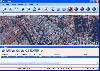
 The free AvisMap Viewer opens most GIS/CAD and raster image file types and most ArcView, ArcExplorer, and MapInfo projects. Besides just opening and viewing files, the Viewer supports an extensive list of features including visual layer properties control, legend control, thematic mapping,...
Platforms: Windows
| License: Freeware | Size: 22.28 MB | Download (1734): AvisMap Free Viewer Download |
Released: August 29, 2008
|
Added: September 12, 2008 | Visits: 2.577
 Map Export is a GIS developer oriented tool for downloading and exporting background image.
For a long time, as a GIS developer, Its well known that to find perfect background images is a suffering and painful task. But since the growing up of Google Map, things have been changed. Google Map...
Map Export is a GIS developer oriented tool for downloading and exporting background image.
For a long time, as a GIS developer, Its well known that to find perfect background images is a suffering and painful task. But since the growing up of Google Map, things have been changed. Google Map...
Platforms: Windows
| License: Shareware | Cost: $499.95 USD | Size: 2.35 MB | Download (172): Map Export Download |
Released: November 08, 2009
|
Added: November 13, 2009 | Visits: 3.488
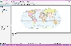 AvisMap Desktop Professional 5 is a professional desktop GIS software for map editing, managing, analysis attribute data, aid decision-making transactions and output map, print tables, 3D modeling, and other functions. As a complete analysis management tool, AvisMap Despro 5 is applicable in land...
Platforms: Windows
| License: Shareware | Cost: $499.00 USD | Size: 22.19 MB | Download (173): AvisMap Deskpro Download |
Added: January 13, 2010 | Visits: 1.904
Array::Each::Tutorial - POD giving various examples how to use Array::Each. SYNOPSIS man Array::Each man Array::Each::Tutorial or perldoc Array::Each perldoc Array::Each::Tutorial Overview This tutorial contains only POD, so dont do this: use Array::Each::Tutorial; # dont do this...
Platforms: *nix
| License: Freeware | Size: 20.48 KB | Download (121): Array::Each::Tutorial Download |
Added: May 21, 2010 | Visits: 909
CartoWeb is a comprehensive and ready-to-use Web-GIS (Geographical Information System) as well as a convenient framework for building advanced and customized applications. Developed by Camptocamp SA, it is based on the UMN MapServer engine and is released under the GNU General Public License...
Platforms: *nix
| License: Freeware | Size: 11.6 MB | Download (109): CartoWeb Download |
Added: August 08, 2010 | Visits: 1.138
Mercator Grid project is a real time strategy game using GIS data. Mercator Grid is a networked real-time strategy game that incorporates actual GIS map terrain and NATO map symbology (MIL-STD-2500B). It can be configured to include several player roles, including fire team leaders and...
Platforms: *nix
| License: Freeware | Download (96): Mercator Grid Download |
Added: October 11, 2010 | Visits: 1.610
XML::Smart::Tutorial is a Perl module with tutorials and examples for XML::Smart. SYNOPSIS This document is a tutorial for XML::Smart and shows some examples of usual things..
Platforms: *nix
| License: Freeware | Size: 50.18 KB | Download (118): XML::Smart::Tutorial Download |
Added: September 02, 2010 | Visits: 2.487
Geo::ShapeFile is a Perl extension for handling ESRI GIS Shapefiles. SYNOPSIS use Geo::ShapeFile; my $shapefile = new Geo::ShapeFile("roads"); for(1 .. $shapefile->shapes()) { my $shape = $shapefile->get_shp_record($_); # see Geo::ShapeFile::Shape docs for what to do with $shape my...
Platforms: *nix
| License: Freeware | Size: 276.48 KB | Download (147): Geo::ShapeFile Download |
Added: January 25, 2010 | Visits: 1.225
ArcExplorer is a lightweight GIS data viewer developed by ESRI. This freely available software offers an easy way to perform basic GIS functions. ArcExplorer is used for a variety of display, query, and data retrieval applications and supports a wide variety of standard data sources. It can be...
Platforms: Mac
| License: Freeware | Size: 13.3 MB | Download (161): ArcExplorer Download |
Added: January 25, 2010 | Visits: 721
GRASS GIS, commonly referred to as GRASS (Geographic Resources Analysis Support System), is a Geographic Information System (GIS) used for geospatial data management and analysis, image processing, graphics/maps production, spatial modeling, and visualization. GRASS is currently used in academic...
Platforms: Mac
| License: Freeware | Download (116): GRASS GIS Download |
Added: January 25, 2010 | Visits: 853
GPSy is a sophisticated Macintosh GPS communications and GIS mapping program. GPSy connects your Macintosh to a broad range of Global Positioning System (GPS) navigational units and has advanced mapping, logging, and data transfer features. GPSy has extensive support for USGS DRG topo maps,...
Platforms: Mac
| License: Demo | Cost: $0.00 USD | Download (104): GPSy Download |
Released: February 03, 2011
|
Added: February 27, 2011 | Visits: 1.160
 Vextractor is a vectorizer program for transforming raster images into vector formats by building centerlines and outlines. This tool could be used for the vectorizing photo, logotypes and other line art images for use in Vector Graphics Design software. You can also vectorize charts, drawings,...
Platforms: Windows
| License: Shareware | Cost: $99.95 USD | Size: 3.99 MB | Download (303): Vextractor x64 Download |
Released: April 05, 2011
|
Added: April 11, 2011 | Visits: 1.736
 CtrlCAD is a 2D source code cad for C++.It is the starting point to build your own customized drawing applications. The library is furnished in source code formats for c++
More then 1000 functions,well documented with a lot of examples.
CtrlCAD features:
- Supported formats: AutoCAD DWG/...
CtrlCAD is a 2D source code cad for C++.It is the starting point to build your own customized drawing applications. The library is furnished in source code formats for c++
More then 1000 functions,well documented with a lot of examples.
CtrlCAD features:
- Supported formats: AutoCAD DWG/...
Platforms: Windows
| License: Shareware | Cost: $1800.00 USD | Size: 2.3 MB | Download (146): CtrlCAD source code C++ Download |