


Gis software
Gis
Released: August 29, 2008
|
Added: September 12, 2008 | Visits: 2.577
 Map Export is a GIS developer oriented tool for downloading and exporting background image.
For a long time, as a GIS developer, Its well known that to find perfect background images is a suffering and painful task. But since the growing up of Google Map, things have been changed. Google Map...
Map Export is a GIS developer oriented tool for downloading and exporting background image.
For a long time, as a GIS developer, Its well known that to find perfect background images is a suffering and painful task. But since the growing up of Google Map, things have been changed. Google Map...
Platforms: Windows
| License: Shareware | Cost: $499.95 USD | Size: 2.35 MB | Download (172): Map Export Download |
Released: November 08, 2009
|
Added: November 13, 2009 | Visits: 3.488
 AvisMap Desktop Professional 5 is a professional desktop GIS software for map editing, managing, analysis attribute data, aid decision-making transactions and output map, print tables, 3D modeling, and other functions. As a complete analysis management tool, AvisMap Despro 5 is applicable in land...
Platforms: Windows
| License: Shareware | Cost: $499.00 USD | Size: 22.19 MB | Download (173): AvisMap Deskpro Download |
Added: May 21, 2010 | Visits: 909
 CartoWeb is a comprehensive and ready-to-use Web-GIS (Geographical Information System) as well as a convenient framework for building advanced and customized applications. Developed by Camptocamp SA, it is based on the UMN MapServer engine and is released under the GNU General Public License...
Platforms: *nix
| License: Freeware | Size: 11.6 MB | Download (109): CartoWeb Download |
Added: August 08, 2010 | Visits: 1.138
Mercator Grid project is a real time strategy game using GIS data. Mercator Grid is a networked real-time strategy game that incorporates actual GIS map terrain and NATO map symbology (MIL-STD-2500B). It can be configured to include several player roles, including fire team leaders and...
Platforms: *nix
| License: Freeware | Download (96): Mercator Grid Download |
Added: September 02, 2010 | Visits: 2.487
Geo::ShapeFile is a Perl extension for handling ESRI GIS Shapefiles. SYNOPSIS use Geo::ShapeFile; my $shapefile = new Geo::ShapeFile("roads"); for(1 .. $shapefile->shapes()) { my $shape = $shapefile->get_shp_record($_); # see Geo::ShapeFile::Shape docs for what to do with $shape my...
Platforms: *nix
| License: Freeware | Size: 276.48 KB | Download (147): Geo::ShapeFile Download |
Added: January 25, 2010 | Visits: 1.225
ArcExplorer is a lightweight GIS data viewer developed by ESRI. This freely available software offers an easy way to perform basic GIS functions. ArcExplorer is used for a variety of display, query, and data retrieval applications and supports a wide variety of standard data sources. It can be...
Platforms: Mac
| License: Freeware | Size: 13.3 MB | Download (161): ArcExplorer Download |
Added: January 25, 2010 | Visits: 721
GRASS GIS, commonly referred to as GRASS (Geographic Resources Analysis Support System), is a Geographic Information System (GIS) used for geospatial data management and analysis, image processing, graphics/maps production, spatial modeling, and visualization. GRASS is currently used in academic...
Platforms: Mac
| License: Freeware | Download (116): GRASS GIS Download |
Added: January 25, 2010 | Visits: 853
GPSy is a sophisticated Macintosh GPS communications and GIS mapping program. GPSy connects your Macintosh to a broad range of Global Positioning System (GPS) navigational units and has advanced mapping, logging, and data transfer features. GPSy has extensive support for USGS DRG topo maps,...
Platforms: Mac
| License: Demo | Cost: $0.00 USD | Download (104): GPSy Download |
Released: February 03, 2011
|
Added: February 27, 2011 | Visits: 1.160
 Vextractor is a vectorizer program for transforming raster images into vector formats by building centerlines and outlines. This tool could be used for the vectorizing photo, logotypes and other line art images for use in Vector Graphics Design software. You can also vectorize charts, drawings,...
Platforms: Windows
| License: Shareware | Cost: $99.95 USD | Size: 3.99 MB | Download (303): Vextractor x64 Download |
Released: May 01, 2011
|
Added: May 23, 2011 | Visits: 1.400
 Convert ESRI ShapeFiles (.SHP) geolocation data into AnyMap format to be used with AnyChart. AnyChart Flash Map Converter allows making use of a wide choice of maps with AnyChart Flash Component, a GIS visualization system that recognizes map data in AnyMap format only. AnyChart Flash Map...
Platforms: Windows
| License: Freeware | Size: 1.62 MB | Download (126): AnyChart Flash Map Converter Download |
Released: March 12, 2012
|
Added: April 02, 2012 | Visits: 1.070
 Visualize your data in 3D! Quick, easy and inexpensive. Graph Earth enables management, marketing and other business professionals to create stunning visual representations of their data, all without the time and costs associated with a full-featured GIS. Viewable by Everyone! Create one of a...
Platforms: Windows
| License: Demo | Cost: $24.95 USD | Size: 469 KB | Download (96): Graph Earth Download |
Released: June 22, 2012
|
Added: June 22, 2012 | Visits: 701
Thuban is an interactive geographic data viewer (GIS viewer) which features methods to visualize, explore, and analyze geographic information.
Thuban is an Interactive Geographic Data Viewer with the following features:
# Vector Data Support: Shapefile, PostGIS Layer and OGR
# Raster Data...
Platforms: Windows
| License: Freeware | Size: 11.22 MB | Download (429): Thuban for Windows Download |
Released: October 21, 2012
|
Added: October 21, 2012 | Visits: 739
Thuban is an interactive geographic data viewer (GIS viewer) which features methods to visualize, explore, and analyze geographic information.
Thuban is an Interactive Geographic Data Viewer with the following features:
# Vector Data Support: Shapefile, PostGIS Layer and OGR
# Raster Data...
Platforms: Linux
| License: Freeware | Size: 1.18 MB | Download (458): Thuban for Linux Download |
Released: July 23, 2012
|
Added: July 23, 2012 | Visits: 480
T2K Pro integrates the rich world of GIS datasets and transfers your Geographic information data into Google earth. T2K Pro handles rich data types and access large volumes of geographic data stored in files and databases; T2K PRO handles raster (imagery), Vector Map data and GPS Tracks/...
Platforms: Windows
| License: Shareware | Cost: $90.00 USD | Size: 20.89 MB | Download (50): T2K Pro Download |
Released: June 07, 2015
|
Added: June 16, 2015 | Visits: 8.263
 EWDraw 3D is a powerful vector graphics ActiveX for 3D and 2D visualisation and animation. You can use it for CAD,CAM,GIS and others. The EWDraw is based on Open CASCADE geometric kernel and openGL .The component is realized as a run-time Windows 64/32 bit OCX (ActiveX control). Either can be...
Platforms: Windows, Windows 7
| License: Shareware | Cost: $998.00 USD | Size: 74 MB | Download (184): EWDraw 3D ActiveX Download |
Released: June 25, 2012
|
Added: June 25, 2012 | Visits: 867
 The free AvisMap Viewer opens most GIS/CAD and raster image file types and most ArcView, ArcExplorer, and MapInfo projects. Besides just opening and viewing files, the Viewer supports an extensive list of features including visual layer properties control, legend control, thematic mapping,...
Platforms: Windows
| License: Freeware | Size: 23.17 MB | Download (449): Free Shapefile Viewer Download |
Released: November 04, 2012
|
Added: November 04, 2012 | Visits: 1.363
 Software development kit for CAD/CAM/ GIS and graphic software developers. Converts from raster to vector and refines architect, mechanical, tech drawing, maps, math graphs, graphics for books and journals and more. ActiveX and Com Component are also available. Refines vector graphics, creates...
Platforms: Windows
| License: Freeware | Size: 2.67 MB | Download (526): Algolab Raster to Vector Conversion CAD/ Download |
Released: August 21, 2012
|
Added: August 21, 2012 | Visits: 425
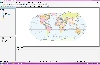
 AGIS for Windows is a mapping and simple GIS shareware package. Plot your own geographic data on the map of the world provided without the high cost and steep learning curve usually associated with this kind of software. Create high resolution publication quality images that can be pasted into...
Platforms: Windows
| License: Shareware | Cost: $49.00 USD | Size: 3.57 MB | Download (478): AGIS for Windows Download |
Released: October 04, 2012
|
Added: October 04, 2012 | Visits: 455
 Canvas is the integrated application that speeds up and streamlines your technical illustration workflow. Professionals in high tech, complex environments that require accurate and powerful visualization of technical data rely on Canvas to facilitate collaboration and improve productivity....
Platforms: Windows
| License: Shareware | Cost: $899.00 USD | Size: 130 MB | Download (44): ACDSee Canvas 12 with GIS+ Download |
Released: September 09, 2012
|
Added: September 09, 2012 | Visits: 475
 A Microstation GIS to allow pipeline design and management
Platforms: Windows
| License: Freeware | Size: 7.58 MB | Download (446): RiliView Download |