


Geosoftware
Geosoftware
Released: June 30, 2018
|
Added: August 06, 2018 | Visits: 681
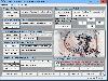 NTv2Tools Geosoftware provides a toolbox for developing and processing of NTv2 files in binary and ASCII formats. With the included tools NTv2 files can be analyzed and graphically or textual displayed, they can be converted to other file formats and areas of them can be extracted to new NTv2...
Platforms: Windows, Windows 8, Windows 7, Windows Server
| License: Shareware | Cost: $185.00 USD | Size: 8.53 MB | Download (293): NTv2Tools Download |
Released: July 13, 2017
|
Added: August 30, 2017 | Visits: 4.510
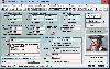
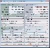
 TRANSDAT geosoftware executes coordinate transformations and geodetic datum shifts between many coordinate and reference systems of America, Australasia, Europe, Germany special and world-wide, with high precision and high speed: 1.The current and historical coordinate and reference systems of...
Platforms: Windows, Windows 8, Windows 7, Windows Server
| License: Shareware | Cost: $170.00 USD | Size: 4.43 MB | Download (325): TRANSDAT Download |
Released: December 30, 2019
|
Added: January 08, 2020 | Visits: 3.185
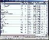
 TOPOWIN is a state-wide register of the German Topographic Cartographies, the German Basic Cartography and of localities with geo references in different coordinate systems. It is also a topographic information system. In the division of planning and execution of economical and scientific...
Platforms: Windows, Windows 8, Windows 7, Windows Server
| License: Shareware | Cost: $125.00 USD | Size: 4.56 MB | Download (271): TOPOWIN Download |
Released: July 03, 2012
|
Added: July 03, 2012 | Visits: 606
 A volume of data with map names, map numbers, corner coordinates and completing data of all official topographic maps of the Federal Republic of Germany. TK25: Data base table with data of the maps on a scale 1:25000. TK50: Table with data of the maps on a scale 1:50000. TK100: Table with data of...
Platforms: All
| License: Freeware | Size: 51.2 KB | Download (51): Geodaten German Topo Download |
Released: May 02, 2014
|
Added: May 14, 2014 | Visits: 736
 TRANSDAT geosoftware executes coordinate transformations and geodetic datum shifts between many coordinate and reference systems of America, Australasia, Europe, Germany special and world-wide, with high precision and high speed: 1.The current and historical coordinate and reference systems of...
Platforms: Windows, Windows 8, Windows 7, Windows Server
| License: Shareware | Cost: $210.00 USD | Size: 2.91 MB | Download (53): TRANSDAT English Download |