


Geological software
Geological
Added: September 10, 2006 | Visits: 3.264
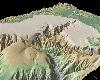
 A photo slideshow screen saver with beautiful NASA/JPL radar images of geological formations around the world. All photos are high-quality images. Other features include transition effects, black and white mode, password use, and extract photos as wallpaper, including built-in wallpaper cycling...
Platforms: Windows
| License: Freeware | Size: 1.73 MB | Download (170): Awesome Geology from Space Screen Saver Download |
Released: January 05, 2002
|
Added: March 18, 2006 | Visits: 3.060
 The 'X' in Digital 'X' Model represents 'T' in terrain model, 'G' in ground or geological model.
Rockmates Digital 'X' Model I ( DXM I ) creates contours isopachytes from a triangular mesh. Contours can be labelled, and printed. Lists of coordinates in text files can be read, triangulated and...
The 'X' in Digital 'X' Model represents 'T' in terrain model, 'G' in ground or geological model.
Rockmates Digital 'X' Model I ( DXM I ) creates contours isopachytes from a triangular mesh. Contours can be labelled, and printed. Lists of coordinates in text files can be read, triangulated and...
Platforms: Windows
| License: Shareware | Cost: $86.00 USD | Size: 364 KB | Download (487): DXM Download |
Released: June 08, 2012
|
Added: June 08, 2012 | Visits: 371
 A collection of Dashboard Widgets generally focused on displaying information provided by the United States Geological Survey (USGS). Examples include river levels information of interest to whitewater kayakers amongst others.
Platforms: Mac
| License: Freeware | Size: 188.87 KB | Download (48): Water Widgets Download |
Added: August 07, 2013 | Visits: 397
Intended for 3D geological/geophysical visualisation of layered data and will eventually form part of a geophysical visualisation package.Run ThreedDemo to get an idea of how to use. INPUTS: LayerN: The number of the layer to be plotted R: a m*n*k matrix of colour/resistivity data for each layer...
Platforms: Matlab
| License: Freeware | Size: 10 KB | Download (49): Surf3D Download |
Added: March 25, 2013 | Visits: 394
By Ola Fredin & Lena Rubensdotter; Geological Survey of NorwayUnderstanding densely sampled data from a sediment core or section can be difficult, and there are many statistical tools to tell how, for example grain size distribution varies over time/depth in a sediment sample. However, it is...
Platforms: Matlab
| License: Shareware | Cost: $0.00 USD | Size: 40.96 KB | Download (47): 3D plot of grain size data in sedimentology Download |
Released: February 09, 2002
|
Added: January 27, 2006 | Visits: 4.082
 PremiumSoft MySQL Studio is a set of graphical database management, reporting and monitoring tools for MySQL database systems. With more than 11,000 downloads already recorded in less than one month, the latest release offers new high availability, business intelligence and powerful backup...
Platforms: Windows
| License: Shareware | Cost: $64.00 USD | Size: 4.77 MB | Download (854): PremiumSoft MySQL Studio Download |
Added: July 02, 2006 | Visits: 2.640
 GeoChart is an ActiveX component designed especially for embedding map data access, display and analysis capabilities in applications. GeoChart enables applications to present numerical data more effectively. GeoChart gives you the following possibilities: 1) chart sales data such as sales over a...
Platforms: Windows
| License: Shareware | Cost: $99.00 USD | Size: 1.62 MB | Download (129): GeoChart Download |
Released: January 02, 2004
|
Added: October 02, 2006 | Visits: 2.305
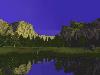 This amazing screen saver captures the beauty, and grandeur of Yosemite in full 3D. The lighting effects are spectacular as the sun sets, and moon rises. Day turns into night, and night into day every few minutes. As you sit back, and enjoy the soothing waterfalls, you can almost feel the breeze...
Platforms: Windows
| License: Shareware | Cost: $12.50 USD | Size: 12.27 MB | Download (108): 3D Amazing Yosemite Download |
Released: January 02, 2007
|
Added: January 06, 2007 | Visits: 2.635
 Imports gridded data into Microsoft MapPoint, to produce attractive data maps that resemble contour maps.
Input data consists of a value that is defined for various (gridded) geographic coordinates. Common text output formats such as CSV are supported.
Can handle imperfect data, holes,...
Imports gridded data into Microsoft MapPoint, to produce attractive data maps that resemble contour maps.
Input data consists of a value that is defined for various (gridded) geographic coordinates. Common text output formats such as CSV are supported.
Can handle imperfect data, holes,...
Platforms: Windows
| License: Shareware | Cost: $75.00 USD | Size: 2.16 MB | Download (899): GridImp Download |
Added: August 25, 2008 | Visits: 1.152
Imports gridded data into MS-MapPoint, to produce attractive data maps. Can handle imperfect data, holes, re-gridding, etc. Can be used to import such attributes as pollution data, seismic hazard, geological information, customer/population distribution, etc.Various text formats supported using...
Platforms: Windows
| License: Shareware | Cost: $60.00 USD | Size: 1.71 MB | Download (561): Grid Imp Download |
Added: January 25, 2010 | Visits: 876
Terrabrowser is an internet browser for satellite photos and topographical maps which are obtained from the Microsoft Terra Server. The map data is provided by the U.S. Geological Survey (USGS) and therefore only covers the United States at this time (although expansion to other map servers may...
Platforms: Mac
| License: Shareware | Cost: $0.00 USD | Download (98): Terrabrowser Download |
Added: January 25, 2010 | Visits: 844
Mt. St. Helens VolcanoCam Widget is more than just a simple webcam, this widget displays a half-size static image from the Mount St. Helens Volcanocam, as well as the current volcano Alert Level as assigned by the US Geological Survey. The Alert Level is not available on the volcanocam site, but...
Platforms: Mac
| License: Freeware | Download (87): Mt. St. Helens VolcanoCam Widget Download |
Added: January 25, 2010 | Visits: 599
The Whitewater Widget lets you check the flows of your favorite rivers right from your Dashboard. The widget downloads data from the USGS (United States Geological Survey) and graphs it in real time.Features:Real-time graphingSwitch between CFS and FTAdd, Edit and Delete your favorite riversmore...
Platforms: Mac
| License: Freeware | Download (101): Whitewater Widget Download |
Released: February 28, 2010
|
Added: March 20, 2010 | Visits: 896
 Quakeshakes turns your home computer into a seismic monitoring station and shows you recent worldwide earthquake activity in the past hour, day or week, giving you a dramatic visual record of the many quakes that strike the planet every day.
Quakeshakes taps into the near-live data feed of a...
Quakeshakes turns your home computer into a seismic monitoring station and shows you recent worldwide earthquake activity in the past hour, day or week, giving you a dramatic visual record of the many quakes that strike the planet every day.
Quakeshakes taps into the near-live data feed of a...
Platforms: Windows, Mac
| License: Shareware | Cost: $29.95 USD | Size: 10.67 MB | Download (198): Quakeshakes Download |
Released: May 08, 2010
|
Added: May 24, 2010 | Visits: 1.469
 Designed To Increase Sales From ANY Webpage
This simple to use software tool can effectively attract your web visitor's attention through a Facebook look-a-like chat windows.
You can make the link go to any webpage that you like:
* recommends an affiliate product
* show...
Designed To Increase Sales From ANY Webpage
This simple to use software tool can effectively attract your web visitor's attention through a Facebook look-a-like chat windows.
You can make the link go to any webpage that you like:
* recommends an affiliate product
* show...
Platforms: Windows
| License: Commercial | Cost: $27.00 USD | Size: 2 KB | Download (113): Chat Pop Box Download |
Released: October 01, 2010
|
Added: November 10, 2010 | Visits: 803
 Geotechnical engineers can use this software for day-to-day analysis and calculations. Database of formulas include common correlations such as Cc, Cs, CBR, Es, etc as well as mass-volume relations and formulas. All formulas with their equations are presented in NovoFormula and user can add new...
Platforms: Windows
| License: Shareware | Cost: $199.00 USD | Size: 4.3 MB | Download (2199): NovoFormula Download |
Released: November 06, 2012
|
Added: January 03, 2013 | Visits: 1.085
 SHAKYGROUND is a software tool designed to provide the earthquakes effects estimation in urban, industrial areas and cities.
It provides the user a friendly environment allowing the simulation of strong ground motion by means of synthetic simulation of acceleration seismograms and the...
SHAKYGROUND is a software tool designed to provide the earthquakes effects estimation in urban, industrial areas and cities.
It provides the user a friendly environment allowing the simulation of strong ground motion by means of synthetic simulation of acceleration seismograms and the...
Platforms: Windows
| License: Demo | Cost: $650.00 USD | Size: 10.85 MB | Download (106): ShakyGround Download |
Released: September 26, 2012
|
Added: September 26, 2012 | Visits: 534
 GeoMapApp is an earth science exploration and visualization application that is continually being expanded as part of the Marine Geoscience Data System (MGDS) at the Lamont-Doherty Earth Observatory of Columbia University.
The application provides direct access to the Global Multi-Resolution...
GeoMapApp is an earth science exploration and visualization application that is continually being expanded as part of the Marine Geoscience Data System (MGDS) at the Lamont-Doherty Earth Observatory of Columbia University.
The application provides direct access to the Global Multi-Resolution...
Platforms: Windows
| License: Freeware | Size: 9 MB | Download (446): GeoMapApp Download |
Released: October 17, 2012
|
Added: October 17, 2012 | Visits: 419
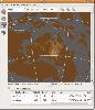
Create the GeoDatabase for the entire world. This program create the geographical location Latitude, Longitude, and Altitude (Elevation) for every city, village, region, state, county in the World. The program crawls the data from the website www.heavens-above.com which collect data from US...
Platforms: Windows
| License: Freeware | Size: 1.11 MB | Download (45): GeoMaker Download |
Released: November 20, 2012
|
Added: November 20, 2012 | Visits: 389
 GPlates is an interactive plate-tectonics visualisation program. GPlates enables interactive visualisation and manipulation of the plate-tectonic reconstructions of geological and paleo-geographic features through geological time.
Platforms: Windows, Mac, Linux
| License: Freeware | Size: 5.51 MB | Download (50): GPlates Download |