


Geographic Isolation software
Geographic Isolation
Added: August 31, 2008 | Visits: 3.343
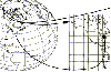
 GeoVisu is a visualization software for geographic data - graphic files, images and GPS. It provides real time GPS navigation (moving map - NMEA 0183 protocol or Garmin USB), displayed with diverse geographic data (MIF, GPX, NMEA, KML/KMZ, SHP, ECW, GeoTiff, MrSID). It can download waypoints,...
Platforms: Windows
| License: Freeware | Size: 1.5 MB | Download (1383): GeoVisu Download |
Released: January 02, 2007
|
Added: January 06, 2007 | Visits: 2.635
 Imports gridded data into Microsoft MapPoint, to produce attractive data maps that resemble contour maps.
Input data consists of a value that is defined for various (gridded) geographic coordinates. Common text output formats such as CSV are supported.
Can handle imperfect data, holes,...
Imports gridded data into Microsoft MapPoint, to produce attractive data maps that resemble contour maps.
Input data consists of a value that is defined for various (gridded) geographic coordinates. Common text output formats such as CSV are supported.
Can handle imperfect data, holes,...
Platforms: Windows
| License: Shareware | Cost: $75.00 USD | Size: 2.16 MB | Download (899): GridImp Download |
Added: November 04, 2006 | Visits: 5.962
 WhereIsIP is an interesting and powerful Internet tool to help you know the geographic location of an internet user who you are interested with . You can use it to find where a member of chatroom or email sender even ICQ friend TRULY come from , or where the website you visited is .
Simplily...
WhereIsIP is an interesting and powerful Internet tool to help you know the geographic location of an internet user who you are interested with . You can use it to find where a member of chatroom or email sender even ICQ friend TRULY come from , or where the website you visited is .
Simplily...
| License: Shareware | Cost: $19.50 USD | Size: 548 KB | Download (756): WhereIsIP Download |
Added: August 14, 2008 | Visits: 1.750
 CoordTrans converts geographic positions between different coordinate systems.Convert between UTM and WGS84.Convert between UTM and NAD27 / NAD83.And more... grids from 17 countries supported. Convert geographic coordinates (latitude / longitude) between different datums.
Platforms: Windows
| License: Shareware | Cost: $19.95 USD | Size: 669 KB | Download (744): CoordTrans Download |
Added: August 04, 2008 | Visits: 1.164
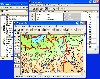 GIS ObjectLand is a universal Geographic Information System for Windows. Key capabilities: vector-raster maps; multiuser data editing; import and export for MIF/MID (MapInfo), SHP (ArcView), DXF (AutoCAD), DBF (dBASE), CSV; setting access permissions to data for different categories of users;...
Platforms: Windows
| License: Shareware | Cost: $99.00 USD | Size: 23.54 MB | Download (537): GIS ObjectLand Download |
Released: November 03, 2012
|
Added: November 03, 2012 | Visits: 991
Explore rainforest scenes and find clues to follow the trail of a missing National Geographic researcher, and discover the Lost City of the Amazon. Using the tools and clues you find along the way, trace the paths of explorers who searched for an ancient civilization. Decipher mysterious messages...
Platforms: Mac
| License: Freeware | Size: 124 MB | Download (506): Lost City of Z for Mac OS Download |
Released: November 05, 2012
|
Added: November 05, 2012 | Visits: 675
Bring National Geographic to life in Lilly Wu and the Terra Cotta Mystery, and lead a forensic expedition to settle a 2,000 year-old mystery. Emperor Qin was the first Emperor of China who died under mysterious circumstances. Was it an accident, or an assassination? Two thousand years later, the...
Platforms: Mac
| License: Freeware | Size: 192 MB | Download (502): Lilly Wu & the Terra Cotta Mystery for Mac OS Download |
Released: September 25, 2012
|
Added: September 25, 2012 | Visits: 683
 As an elite volunteer for National Geographic’s Eco Rescue team, visit over 20 river sites across the world as you save species large and small by cleaning up the environment. Start with the prototype CleanClaw, a 1 man eco-friendly crane, and upgrade your equipment as you master currents and...
Platforms: Windows
| License: Freeware | Size: 65.03 MB | Download (474): Eco Rescue Rivers Download |
Released: August 15, 2012
|
Added: August 15, 2012 | Visits: 697
Gives players the opportunity to plan a green city. As mayor of your hometown, with the promise of changing the old ways of the past, to bring about a new green future. You are working with close supporters to restore this town to former glory and beauty. Watch as Greenville transforms before...
Platforms: Mac
| License: Freeware | Size: 78 MB | Download (464): National Geographic: Plan It Green for Mac OS Download |
Released: October 21, 2012
|
Added: October 21, 2012 | Visits: 741
Thuban is an interactive geographic data viewer (GIS viewer) which features methods to visualize, explore, and analyze geographic information.
Thuban is an Interactive Geographic Data Viewer with the following features:
# Vector Data Support: Shapefile, PostGIS Layer and OGR
# Raster Data...
Platforms: Linux
| License: Freeware | Size: 1.18 MB | Download (458): Thuban for Linux Download |
Added: August 17, 2008 | Visits: 997
IPSearchLight is a software component used to identify the geographic location of website visitors, often within a few miles from the exact location. The process utilizes each visitor's IP address; this technique is silent and unintrusive. IPSearchLight is ideal for practical applications like...
Platforms: Windows
| License: Freeware | Size: 8.74 KB | Download (447): IPSearchLight GeoLocator for ASP.NET 2.0 Download |
Released: August 16, 2012
|
Added: August 16, 2012 | Visits: 526
uDig is a user-friendly desktop Internet GIS, a core element in an internet aware Geographic Information System.
The application is an open source spatial data viewer / editor, that comes with a special emphasis on the OpenGIS standards for internet GIS, the Web Map Server and Web Feature Server...
Platforms: Windows
| License: Freeware | Download (439): uDig Download |
Released: June 22, 2012
|
Added: June 22, 2012 | Visits: 701
Thuban is an interactive geographic data viewer (GIS viewer) which features methods to visualize, explore, and analyze geographic information.
Thuban is an Interactive Geographic Data Viewer with the following features:
# Vector Data Support: Shapefile, PostGIS Layer and OGR
# Raster Data...
Platforms: Windows
| License: Freeware | Size: 11.22 MB | Download (429): Thuban for Windows Download |
Added: March 04, 2010 | Visits: 2.624
Globe*Trotter project is a geographic guestbook (guestmap). It allows Web site visitors to mark where they live on a map and include their personal comments, instead of merely tacking their personal regards onto the end of a long list. It benefits your visitors because they can easily read...
Platforms: *nix
| License: Freeware | Size: 593.92 KB | Download (393): Globe*Trotter Download |
Added: August 04, 2008 | Visits: 1.680
Welcome all seismology lovers! Earthquake 3D 3.03 is a geographic tool that continually offers you information about earthquakes (or small seismic movements) that happen all over the world, almost in real time.The program is connected to the Internet to have the information continually updated,...
Platforms: Windows
| License: Freeware | Size: 9 KB | Download (352): Earthquake 3D Download |
Released: November 09, 2006
|
Added: November 14, 2006 | Visits: 4.287
 Geo World is a handy application for finding out detailed information about any country in the world. One of its advantages is that you can find the country you were looking for by Internet Country Code, Capital and etc. Also it's supplied with more than 530 images which represent flags and maps...
Platforms: Windows
| License: Shareware | Cost: $25.00 USD | Size: 6.24 MB | Download (324): Geo World Download |
Released: July 13, 2009
|
Added: July 27, 2009 | Visits: 2.045
 Ever thought about visualizing your network connections in 3D environment? Try Wandering IPs, lightweight tool that monitors TCP connections, identifies remote IP adresses and determines their geographic coordinates. Results are projected on interactive, textured 3D Globe that can be integrated...
Platforms: Windows
| License: Shareware | Cost: $12.95 USD | Size: 721.17 KB | Download (209): Wandering IPs Download |
Released: June 23, 2007
|
Added: July 30, 2007 | Visits: 2.637
 Xlight FTP Server is a high performance and easy to use ftp server software for Windows. It is designed to handle thousands of simultanous ftp clients and use very little CPU and memory.
Xlight FTP Server has three editions: personal, standard, professional. Personal edition is free for...
Xlight FTP Server is a high performance and easy to use ftp server software for Windows. It is designed to handle thousands of simultanous ftp clients and use very little CPU and memory.
Xlight FTP Server has three editions: personal, standard, professional. Personal edition is free for...
Platforms: Windows
| License: Shareware | Cost: $39.95 USD | Size: 1.27 MB | Download (199): Xlight ftp server Download |
Added: January 25, 2010 | Visits: 1.225
ArcExplorer is a lightweight GIS data viewer developed by ESRI. This freely available software offers an easy way to perform basic GIS functions. ArcExplorer is used for a variety of display, query, and data retrieval applications and supports a wide variety of standard data sources. It can be...
Platforms: Mac
| License: Freeware | Size: 13.3 MB | Download (161): ArcExplorer Download |
Released: October 18, 2009
|
Added: December 19, 2009 | Visits: 1.429
 Automatic Geo/GPS location track utility for most parts of the World. Lets you know your and your friends geographic location at all times. Maps are downloaded on a per demand basis. All GPS information is stored to a database and can be readily retrieved based on a given date and time range....
Platforms: Windows, Pocket PC
| License: Shareware | Cost: $15.00 USD | Size: 2.41 MB | Download (156): GeoWatch Download |