


Geographic Distances software
Geographic Distances
Released: December 31, 2019
|
Added: January 08, 2020 | Visits: 1.267
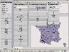
 Geodata International - World-wide database of countries with georeferenced towns, municipalities, postal codes and administrative units with WGS84 and UTM coordinates and elevations for geocoding, proximity search, navigation, distance calculation. Often is it necessarily, for an address...
Platforms: Windows, Mac, *nix, Windows 8, Windows 7, iOS, Android, iPhone,iPad
| License: Data Only | Cost: $165.00 USD | Size: 2.4 MB | Download (114): Geodata International Download |
Released: June 13, 2012
|
Added: June 13, 2012 | Visits: 444
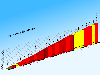 CycloGraph is a handy program to help you plot the gradient of roads using distances and heights. An Open Source alternative to Salitaker for plotting the profile of the roads you are planning to do with your bicycle. It also can import routes from kml. FEATURES: · import kml files · open...
Platforms: Windows
| License: Freeware | Size: 16.2 MB | Download (504): CycloGraph Download |
Released: June 19, 2012
|
Added: June 19, 2012 | Visits: 453
 Mallard is a handy, Java based application based on the Pintail algorithm designed to work by comparing evolutionary distances between a query and subject sequence over the length of the 16S rRNA gene (small subunit rRNA), by employing a sampling window of specified size, progressing a fixed...
Platforms: Windows
| License: Freeware | Size: 13 MB | Download (45): Mallard Download |
Released: August 05, 2012
|
Added: August 05, 2012 | Visits: 586
Web Geostatistics is a free, open-source desktop application that displays website or application usage statistics using a 3D model of Planet Earth, with all the statistics based on the geographic location of the events. It runs on Windows and Linux operating systems, because it is developed...
Platforms: Windows
| License: Freeware | Size: 41.6 MB | Download (46): Web Geostatistics Download |
Released: April 21, 2014
|
Added: July 16, 2014 | Visits: 985
 Geodata International - World-wide database of countries with georeferenced towns, municipalities, postal codes and administrative units with WGS84 and UTM coordinates and elevations for geocoding, proximity search, navigation, distance calculation. Often is it necessarily, for an address...
Platforms: Windows, Mac, *nix, DOS, Windows 8, Windows Phone, Windows 7, Windows Server, Android, Handheld, OS/2, BlackBerry,Palm,Java
| License: Demo | Cost: $205.00 USD | Size: 785.78 KB | Download (91): Geodaten International Download |
Released: September 12, 2012
|
Added: September 12, 2012 | Visits: 652
 New Zealand is notable for its geographic isolation and extraordinary fauna and flora. Due to the low population New Zealand still looks like the unpolluted paradise with clear shores, crisp waters, pure white snow and lush green foliage. The New Zealand Voyage Free screensaver shows you the...
Platforms: Windows
| License: Freeware | Size: 4.58 MB | Download (46): New Zealand Voyage Free Screensaver Download |
Released: September 25, 2012
|
Added: September 25, 2012 | Visits: 682
 As an elite volunteer for National Geographic’s Eco Rescue team, visit over 20 river sites across the world as you save species large and small by cleaning up the environment. Start with the prototype CleanClaw, a 1 man eco-friendly crane, and upgrade your equipment as you master currents and...
Platforms: Windows
| License: Freeware | Size: 65.03 MB | Download (474): Eco Rescue Rivers Download |
Added: June 15, 2013 | Visits: 295
Toolkit for processing genetic data. Currently supports (command-line): Half-IBD (Identity by descent) aka HIRs - between 2 or any number of files (in distances and cM); RAW2PED, PED2RAW conversions; regions of homozygousity and other converters.
Platforms: Mac
| License: Freeware | Size: 8.08 MB | Download (57): aisconvert Download |
Released: September 01, 2012
|
Added: September 01, 2012 | Visits: 264
 ArchiScale is a Mac OS X software that converts distances using a user-defined scale. It is also able to determine which scale is the best to draw something on a given paper format.
Platforms: Mac
| License: Freeware | Size: 449.1 KB | Download (44): ArchiScale Download |
Released: July 18, 2012
|
Added: July 18, 2012 | Visits: 385
ArgooMap is an online, map-based discussion forum, which allows participants to reference their contributions to geographic locations.
Different versions of ArguMap and ArgooMap/Argoomap were developed by students supervised by Dr. Claus Rinner at Ryerson University (Toronto, Canada) with...
Platforms: Windows, Mac, Linux
| License: Freeware | Size: 668.61 KB | Download (43): ArgooMap Download |
Released: June 16, 2012
|
Added: June 16, 2012 | Visits: 470
CatMDEdit is a metadata editor tool for describing resources, mainly geographic information. Developed by IAAA (University of Zaragoza) and GeoSpatiumLab S.L., sponsored by IGN Spain. Technical details: Java, XML, multiplatform, multilingual.
Platforms: Windows, Mac, Linux
| License: Freeware | Size: 80.58 MB | Download (49): CatMDEdit - metadata editor Download |
Released: June 25, 2012
|
Added: June 25, 2012 | Visits: 302
The Research Geographic Information Kernel developed by Charles Ehlschlaeger and team.
Platforms: Windows, Mac, Linux
| License: Freeware | Size: 2.28 MB | Download (45): Ehlschlaeger RGIK Download |
Released: August 12, 2012
|
Added: August 12, 2012 | Visits: 320
 GeOxygene aims at providing an open framework which implements OGC/ISO specifications for the development and deployment of geographic (GIS) applications. It is a open source contribution of the COGIT lab. at the IGN (the French National Mapping Agency).
Platforms: Windows, Mac, Linux
| License: Freeware | Size: 1.11 MB | Download (49): GeOxygene Download |
Released: December 16, 2012
|
Added: December 16, 2012 | Visits: 267
 Geofunctions is an open-source library of XSLT / functions, templates, stylesheets and classes devoted to the processing of geographic data in XML. The primary goal is to enable processing of GML, KML and GeoRSS in the XSLT langugage.
Platforms: Windows, Mac, Linux
| License: Freeware | Size: 7.87 MB | Download (44): Geofunctions Download |
Released: December 20, 2012
|
Added: December 20, 2012 | Visits: 127
jFuzzyDate is a lightweight java library for formatting easily readable time distances, durations and dates.
Platforms: Windows, Mac, Linux
| License: Freeware | Size: 13.79 KB | Download (48): jFuzzyDate Download |
Released: July 21, 2012
|
Added: July 21, 2012 | Visits: 411
The JUMP DB Query Plugin is an extension for the OpenJUMP GIS platform that allows OpenJUMP users to give arbitrary database queries to retrieve and display geographic feature sets.
Platforms: Windows, Mac, Linux
| License: Freeware | Size: 484.36 KB | Download (46): JUMP Database Query Plugin Download |
Released: June 08, 2012
|
Added: June 08, 2012 | Visits: 444
Mapyrus is software to plot Geographic Information System data to PostScript, PDF, SVG and web image files. Mapyrus combines a BASIC-like scripting language, reading GIS datasets and running as either a utility program, a Java Servlet, or as a webser
Platforms: Windows, Mac, Linux
| License: Freeware | Size: 3.27 MB | Download (48): mapyrus Download |
Released: June 22, 2012
|
Added: June 22, 2012 | Visits: 398
OpenBioGeoSim it's a open source software that simulates the stochastic origin and spread of species geographic ranges in a heterogeneous landscape. It's a free alternative based on Gary Entsminger's BioGeoSim.
Platforms: Windows, Mac, Linux
| License: Freeware | Size: 153.2 KB | Download (44): openBioGeoSim Download |
Released: November 21, 2012
|
Added: November 21, 2012 | Visits: 356
Mac WPS is the Cocoa Mac OS X application to track your geographic position using OS X wi-fi geo-tracking and other available hardware to detect your coordinate in the best precise way via Apple core location.
Mac WPS shows your position over a zoomable map. The map can se shown with the zoom...
Platforms: Mac
| License: Shareware | Cost: $10.00 USD | Size: 2.7 MB | Download (62): Mac WPS Download |
Released: July 21, 2012
|
Added: July 21, 2012 | Visits: 356
Geo WPS allows to track your geographic position using Mac OS X wi-fi geo-tracking and other available hardware to detect your coordinate in the best precise way via Apple core location.
Geo WPS shows your position over a zoomable map.
The map is updated live from the internet (almost all the...
Platforms: Mac
| License: Commercial | Cost: $9.99 USD | Size: 2.7 MB | Download (48): Geo WPS Download |