


Geographic software
Geographic
Added: September 17, 2010 | Visits: 1.157
 PostGIS adds support for geographic objects to the PostgreSQL object-relational database. In effect, PostGIS "spatially enables" the PostgreSQL server, allowing it to be used as a backend spatial database for geographic information systems (GIS), much like ESRIs SDE or Oracles Spatial extension....
Platforms: *nix
| License: Freeware | Size: 1.4 MB | Download (98): PostGIS Download |
Added: April 24, 2010 | Visits: 908
Geolizer is a patch for Webalizer that uses the GeoIP library to generate faster and more reliable geographic statistics than the default DNS suffix method. It is recommended that DNS reversal be disabled on your HTTP server for improved performance and more accurate statistics. It can be...
Platforms: *nix
| License: Freeware | Size: 76.8 KB | Download (92): Geolizer Download |
Added: January 25, 2010 | Visits: 1.225
ArcExplorer is a lightweight GIS data viewer developed by ESRI. This freely available software offers an easy way to perform basic GIS functions. ArcExplorer is used for a variety of display, query, and data retrieval applications and supports a wide variety of standard data sources. It can be...
Platforms: Mac
| License: Freeware | Size: 13.3 MB | Download (161): ArcExplorer Download |
Added: January 25, 2010 | Visits: 648
OwlView is a simple thematic mapping application that can combine data exported from a spreadsheet or database with geographic boundaries to produce maps that visually display patterns of spatial distribution within the data. It includes four classification methods (Equal Counts, Equal Ranges,...
Platforms: Mac
| License: Shareware | Cost: $0.00 USD | Download (86): OwlView Download |
Added: January 25, 2010 | Visits: 1.032
TrailRunner is a route planning software for all kinds of long distance sports like running, biking, hiking, inline-skating, skiing and more. If you ever asked yourself how long your workout routes are and what route you should choose for this evening - then TrailRunner should be your...
Platforms: Mac
| License: Freeware | Download (123): TrailRunner Download |
Added: January 25, 2010 | Visits: 924
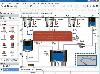
GrassPro is based on the free, open-source product "GRASS 6.0.1 GIS." It offers offers a host of ready-to-use GIS software and utilities, including: MapServer for publishing dynamic, navigable maps with layers over the Internet; PostGIS which enables spatial, geographic support for the included...
Platforms: Mac
| License: Demo | Cost: $0.00 USD | Download (109): GrassPro Download |
Released: July 23, 2012
|
Added: July 23, 2012 | Visits: 480
T2K Pro integrates the rich world of GIS datasets and transfers your Geographic information data into Google earth. T2K Pro handles rich data types and access large volumes of geographic data stored in files and databases; T2K PRO handles raster (imagery), Vector Map data and GPS Tracks/...
Platforms: Windows
| License: Shareware | Cost: $90.00 USD | Size: 20.89 MB | Download (54): T2K Pro Download |
Released: August 16, 2012
|
Added: August 16, 2012 | Visits: 526
uDig is a user-friendly desktop Internet GIS, a core element in an internet aware Geographic Information System.
The application is an open source spatial data viewer / editor, that comes with a special emphasis on the OpenGIS standards for internet GIS, the Web Map Server and Web Feature Server...
Platforms: Windows
| License: Freeware | Download (439): uDig Download |
Released: November 05, 2012
|
Added: November 05, 2012 | Visits: 675
Bring National Geographic to life in Lilly Wu and the Terra Cotta Mystery, and lead a forensic expedition to settle a 2,000 year-old mystery. Emperor Qin was the first Emperor of China who died under mysterious circumstances. Was it an accident, or an assassination? Two thousand years later, the...
Platforms: Mac
| License: Freeware | Size: 192 MB | Download (502): Lilly Wu & the Terra Cotta Mystery for Mac OS Download |
Released: November 03, 2012
|
Added: November 03, 2012 | Visits: 991
Explore rainforest scenes and find clues to follow the trail of a missing National Geographic researcher, and discover the Lost City of the Amazon. Using the tools and clues you find along the way, trace the paths of explorers who searched for an ancient civilization. Decipher mysterious messages...
Platforms: Mac
| License: Freeware | Size: 124 MB | Download (506): Lost City of Z for Mac OS Download |
Released: October 01, 2012
|
Added: October 01, 2012 | Visits: 945
 Visual Graph is a standard ActiveX component for developing graphics-related applications of various industries, such as power, coal, chemical, automation monitor, simulation, graphical modeling, graphical topology analysis, vector drawing, tables, geographic information system (GIS), workflow,...
Platforms: Windows
| License: Freeware | Size: 6.66 MB | Download (68): Visual Graph ActiveX Component Download |
Released: November 12, 2012
|
Added: November 12, 2012 | Visits: 475
With Geodesy.NET, you can quickly and easily convert geographic coordinates from one system to another. Several hundred coordinate system conversions are supported, and all conversions can be done in under three lines of code. Full support is included for both desktops as well as mobile devices!...
Platforms: Windows
| License: Shareware | Cost: $99.00 USD | Size: 61.42 MB | Download (47): Geodesy.NET Download |
Released: June 21, 2012
|
Added: June 21, 2012 | Visits: 906
 Commonly referred to as GRASS, this is a free Geographic Information System (GIS) used for geospatial data management and analysis, image processing, graphics/maps production, spatial modeling, and visualization. GRASS is currently used in academic and commercial settings around the world, as...
Platforms: Mac
| License: Freeware | Size: 59 MB | Download (57): Grass GIS for Mac OS X Download |
Released: August 05, 2012
|
Added: August 05, 2012 | Visits: 588
Web Geostatistics is a free, open-source desktop application that displays website or application usage statistics using a 3D model of Planet Earth, with all the statistics based on the geographic location of the events. It runs on Windows and Linux operating systems, because it is developed...
Platforms: Windows
| License: Freeware | Size: 41.6 MB | Download (46): Web Geostatistics Download |
Released: September 12, 2012
|
Added: September 12, 2012 | Visits: 652
 New Zealand is notable for its geographic isolation and extraordinary fauna and flora. Due to the low population New Zealand still looks like the unpolluted paradise with clear shores, crisp waters, pure white snow and lush green foliage. The New Zealand Voyage Free screensaver shows you the...
Platforms: Windows
| License: Freeware | Size: 4.58 MB | Download (46): New Zealand Voyage Free Screensaver Download |
Released: September 25, 2012
|
Added: September 25, 2012 | Visits: 683
 As an elite volunteer for National Geographic’s Eco Rescue team, visit over 20 river sites across the world as you save species large and small by cleaning up the environment. Start with the prototype CleanClaw, a 1 man eco-friendly crane, and upgrade your equipment as you master currents and...
Platforms: Windows
| License: Freeware | Size: 65.03 MB | Download (474): Eco Rescue Rivers Download |
Released: July 18, 2012
|
Added: July 18, 2012 | Visits: 385
ArgooMap is an online, map-based discussion forum, which allows participants to reference their contributions to geographic locations.
Different versions of ArguMap and ArgooMap/Argoomap were developed by students supervised by Dr. Claus Rinner at Ryerson University (Toronto, Canada) with...
Platforms: Windows, Mac, Linux
| License: Freeware | Size: 668.61 KB | Download (43): ArgooMap Download |
Released: June 16, 2012
|
Added: June 16, 2012 | Visits: 471
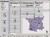
CatMDEdit is a metadata editor tool for describing resources, mainly geographic information. Developed by IAAA (University of Zaragoza) and GeoSpatiumLab S.L., sponsored by IGN Spain. Technical details: Java, XML, multiplatform, multilingual.
Platforms: Windows, Mac, Linux
| License: Freeware | Size: 80.58 MB | Download (49): CatMDEdit - metadata editor Download |
Released: June 25, 2012
|
Added: June 25, 2012 | Visits: 302
The Research Geographic Information Kernel developed by Charles Ehlschlaeger and team.
Platforms: Windows, Mac, Linux
| License: Freeware | Size: 2.28 MB | Download (45): Ehlschlaeger RGIK Download |
Released: August 12, 2012
|
Added: August 12, 2012 | Visits: 320
 GeOxygene aims at providing an open framework which implements OGC/ISO specifications for the development and deployment of geographic (GIS) applications. It is a open source contribution of the COGIT lab. at the IGN (the French National Mapping Agency).
Platforms: Windows, Mac, Linux
| License: Freeware | Size: 1.11 MB | Download (49): GeOxygene Download |