


Geographic software
Geographic
Released: January 11, 2011
|
Added: January 19, 2011 | Visits: 1.400
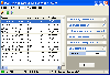
 TransLT is designed to calculate the transformation parameters and the transformation of coordinates between two coordinates systems is a fast and practical way. The software is aimed at specialists who use GPS technology to perform geodetic works.
Main features of TransLT:
- Calculation of...
TransLT is designed to calculate the transformation parameters and the transformation of coordinates between two coordinates systems is a fast and practical way. The software is aimed at specialists who use GPS technology to perform geodetic works.
Main features of TransLT:
- Calculation of...
Platforms: Windows
| License: Demo | Cost: $90.00 USD | Size: 98.37 MB | Download (2402): TransLT Download |
Released: April 22, 2008
|
Added: April 26, 2008 | Visits: 9.510
 The free AvisMap Viewer opens most GIS/CAD and raster image file types and most ArcView, ArcExplorer, and MapInfo projects. Besides just opening and viewing files, the Viewer supports an extensive list of features including visual layer properties control, legend control, thematic mapping,...
Platforms: Windows
| License: Freeware | Size: 22.28 MB | Download (1734): AvisMap Free Viewer Download |
Added: August 31, 2008 | Visits: 3.343
 GeoVisu is a visualization software for geographic data - graphic files, images and GPS. It provides real time GPS navigation (moving map - NMEA 0183 protocol or Garmin USB), displayed with diverse geographic data (MIF, GPX, NMEA, KML/KMZ, SHP, ECW, GeoTiff, MrSID). It can download waypoints,...
Platforms: Windows
| License: Freeware | Size: 1.5 MB | Download (1383): GeoVisu Download |
Added: August 12, 2008 | Visits: 6.061
Cricket is one of those sports with more followers and passion in the world. But curiously it is only limited to certain geographic areas. If you are a cricket fan, or want to discover the magic of this sport, just try it in the world of videogames with Brian Lara International Cricket.Play the...
Platforms: Windows
| License: Shareware | Cost: $0.00 USD | Size: 3 KB | Download (1326): Brian Lara International Cricket Download |
Added: August 28, 2008 | Visits: 7.739
Satellite Finder is the best way to find satellites in geostationary orbit. Simply choose a state or city, or a post code, or geographic position, and Satellite Finder will automatically create and show a complete list of all satellites for that location on the screen.Satellite Finder includes a...
Platforms: Windows
| License: Freeware | Size: 7 KB | Download (1214): Satellite Finder Download |
Released: September 17, 2021
|
Added: November 18, 2023 | Visits: 4.131
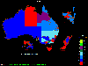 OzGIS is an extensive system for the analysis and display of geographically
referenced data. About 150 menus provide an enormous range of options for:
. importing data from databases, spreadsheets and Geographic Information
Systems (GISs) or downloaded from Census Bureaux or mapping...
OzGIS is an extensive system for the analysis and display of geographically
referenced data. About 150 menus provide an enormous range of options for:
. importing data from databases, spreadsheets and Geographic Information
Systems (GISs) or downloaded from Census Bureaux or mapping...
Platforms: Windows, Windows 8, Windows 7, Windows Server
| License: Freeware | Size: 313 KB | Download (1146): OzGIS Download |
Released: August 08, 2019
|
Added: September 09, 2019 | Visits: 2.899
 AnyMap JS Maps is an advanced JavaScript/HTML5 mapping library which makes you able to easily create interactive maps that look great on any device including PCs, Macs, iPhones, iPads, Android devices and others - on any platform and in any browser.
AnyMap JS is perfect for interactive...
AnyMap JS Maps is an advanced JavaScript/HTML5 mapping library which makes you able to easily create interactive maps that look great on any device including PCs, Macs, iPhones, iPads, Android devices and others - on any platform and in any browser.
AnyMap JS is perfect for interactive...
Platforms: Windows, Mac, *nix, Windows 8, Windows 7, Windows Server, iOS, Android, iPhone,iPad
| License: Shareware | Cost: $49.00 USD | Size: 17.81 MB | Download (1022): AnyMap JS Maps Download |
Released: March 19, 2014
|
Added: April 15, 2014 | Visits: 6.160
 A world-class tool for network scanning, monitoring and administration:
- NETWATCH: multiple host availability and response time monitoring; notifications (e-mail, message, sound) on host availability issues; current and historical charts for response times and percentage of lost packets;...
A world-class tool for network scanning, monitoring and administration:
- NETWATCH: multiple host availability and response time monitoring; notifications (e-mail, message, sound) on host availability issues; current and historical charts for response times and percentage of lost packets;...
Platforms: Windows, Windows 8, Windows 7, Windows Server
| License: Freeware | Size: 35.19 MB | Download (982): Axence NetTools Download |
Released: January 02, 2007
|
Added: January 06, 2007 | Visits: 2.635
 Imports gridded data into Microsoft MapPoint, to produce attractive data maps that resemble contour maps.
Input data consists of a value that is defined for various (gridded) geographic coordinates. Common text output formats such as CSV are supported.
Can handle imperfect data, holes,...
Imports gridded data into Microsoft MapPoint, to produce attractive data maps that resemble contour maps.
Input data consists of a value that is defined for various (gridded) geographic coordinates. Common text output formats such as CSV are supported.
Can handle imperfect data, holes,...
Platforms: Windows
| License: Shareware | Cost: $75.00 USD | Size: 2.16 MB | Download (899): GridImp Download |
Released: September 14, 2011
|
Added: October 03, 2011 | Visits: 1.707
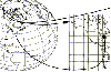
 For the implementation of the INSPIRE directive all so far in Germany available geo references with Gauss-Krueger / DHDN coordinates now must be converted to UTM / ETRS89 coordinates for future use. BetaDLL supports the development of geodetic software on various platforms for this...
Platforms: Windows, Mac, *nix, Windows CE, Pocket PC, iPhone,iPod,Palm,Handheld/Mobile Other,Java
| License: Shareware | Cost: $685.00 USD | Size: 1.04 MB | Download (854): BetaDLL Download |
Added: November 04, 2006 | Visits: 5.961
 WhereIsIP is an interesting and powerful Internet tool to help you know the geographic location of an internet user who you are interested with . You can use it to find where a member of chatroom or email sender even ICQ friend TRULY come from , or where the website you visited is .
Simplily...
WhereIsIP is an interesting and powerful Internet tool to help you know the geographic location of an internet user who you are interested with . You can use it to find where a member of chatroom or email sender even ICQ friend TRULY come from , or where the website you visited is .
Simplily...
| License: Shareware | Cost: $19.50 USD | Size: 548 KB | Download (750): WhereIsIP Download |
Added: August 14, 2008 | Visits: 1.749
 CoordTrans converts geographic positions between different coordinate systems.Convert between UTM and WGS84.Convert between UTM and NAD27 / NAD83.And more... grids from 17 countries supported. Convert geographic coordinates (latitude / longitude) between different datums.
Platforms: Windows
| License: Shareware | Cost: $19.95 USD | Size: 669 KB | Download (744): CoordTrans Download |
Released: September 05, 2010
|
Added: September 17, 2010 | Visits: 3.743
 PolyMap is a desktop mapping program that lets you use your own data to customize the maps supplied with the program. Use the built-in spreadsheet to enter data or paste it from other Windows applications. Alternatively, you can use the import feature to bring in data from external spreadsheets,...
Platforms: Windows
| License: Shareware | Cost: $89.95 USD | Size: 7.37 MB | Download (712): Polymap Download |
Released: November 19, 2012
|
Added: November 19, 2012 | Visits: 587
 Virtual Ticket Developer is an application platform for quickly creating team productivity and project management apps. It uniquely combines an easy to use database, project workflow and scheduling, to-do lists, forms, reports, and file & document management capabilities. Some apps can be built...
Platforms: Windows, Mac
| License: Shareware | Cost: $499.00 USD | Size: 17.38 MB | Download (581): Virtual Ticket Developer Professional Download |
Released: June 26, 2007
|
Added: September 05, 2007 | Visits: 8.764
 PC Mesh Anonymous Web Surfing is an Internet utility to let users surf the Web anonymously by masking their IP address.
IP address is the unique identification number of any computer connected to the Internet and is detectable by any website that the user is visiting.
IP address contains...
PC Mesh Anonymous Web Surfing is an Internet utility to let users surf the Web anonymously by masking their IP address.
IP address is the unique identification number of any computer connected to the Internet and is detectable by any website that the user is visiting.
IP address contains...
Platforms: Windows
| License: Shareware | Cost: $39.95 USD | Size: 954.62 KB | Download (551): PC Mesh Anonymous Web Surfing Download |
Added: August 27, 2008 | Visits: 1.011
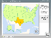 Know Your USA is a software application developed to help users expand their knowledge of USA geography. Each geographic feature of the USA is covered in detail including regions, states, state capitals, major cities, rivers, mountains and lakes. Know Your USA is great software for learning all...
Platforms: Windows
| License: Shareware | Cost: $24.95 USD | Size: 15.5 KB | Download (549): Know Your USA Download |
Released: September 17, 2012
|
Added: September 17, 2012 | Visits: 642
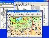
 Global Mapper is more than just a utility; it has built in functionality for distance and area calculations, raster blending, feathering, spectral analysis and contrast adjustment, elevation querying, line of sight calculations, cut-and-fill volume calculations, as well as advanced capabilities...
Platforms: Windows
| License: Demo | Cost: $349.00 USD | Size: 30 MB | Download (547): Global Mapper x64 Download |
Added: August 04, 2008 | Visits: 1.164
 GIS ObjectLand is a universal Geographic Information System for Windows. Key capabilities: vector-raster maps; multiuser data editing; import and export for MIF/MID (MapInfo), SHP (ArcView), DXF (AutoCAD), DBF (dBASE), CSV; setting access permissions to data for different categories of users;...
Platforms: Windows
| License: Shareware | Cost: $99.00 USD | Size: 23.54 MB | Download (537): GIS ObjectLand Download |
Released: January 06, 2013
|
Added: January 06, 2013 | Visits: 530
 SWIFT Mobile provides live weather radar and other weather data on your PDA, PocketPC, or SmartPhone. Location-based technology allows custom weather displays and automatic alerts to severe weather before it arrives. An indispensable tool for business travelers, outdoorsmen, emergency management...
Platforms: Windows, Pocket PC
| License: Shareware | Cost: $9.95 USD | Size: 1.25 MB | Download (537): SWIFT Mobile Download |
Released: August 25, 2012
|
Added: August 25, 2012 | Visits: 594
 Global Mapper is more than just a utility; it has built in functionality for distance and area calculations, raster blending, feathering, spectral analysis and contrast adjustment, elevation querying, line of sight calculations, cut-and-fill volume calculations, as well as advanced capabilities...
Platforms: Windows
| License: Demo | Cost: $349.00 USD | Size: 39.6 MB | Download (533): Global Mapper Download |