


Geo Data International Houses software
Geo Data International Houses
Released: April 21, 2014
|
Added: July 16, 2014 | Visits: 986
 Geodata International - World-wide database of countries with georeferenced towns, municipalities, postal codes and administrative units with WGS84 and UTM coordinates and elevations for geocoding, proximity search, navigation, distance calculation. Often is it necessarily, for an address...
Platforms: Windows, Mac, *nix, DOS, Windows 8, Windows Phone, Windows 7, Windows Server, Android, Handheld, OS/2, BlackBerry,Palm,Java
| License: Demo | Cost: $205.00 USD | Size: 785.78 KB | Download (91): Geodaten International Download |
Released: May 23, 2014
|
Added: July 02, 2014 | Visits: 3.114
 The database tables contains geodata of the Federal Republic of Germany with geo referenced towns, municipalities, town quarters and other administrative units, postal codes, telephone preselections, nature areas, landscapes, climatic zones and official topographical cartographies. The data...
Platforms: Windows, Mac, *nix, DOS, Windows 8, Windows Phone, Windows 7, Windows Server, Palm OS, Android, Handheld, OS/2, BlackBerry,Java
| License: Demo | Cost: $205.00 USD | Size: 1.79 MB | Download (128): Geodaten Deutschland Download |
Released: October 18, 2012
|
Added: October 18, 2012 | Visits: 635
 The database tables contains geodata of the Federal Republic of Germany with geo referenced towns, municipalities, town quarters and other administrative units, postal codes, telephone preselections and nature areas, landscapes and climatic zones. The data contain coordinates for navigation and...
Platforms: All
| License: Shareware | Cost: $195.00 USD | Size: 1.63 MB | Download (53): Geodaten German Admin Download |
Released: December 31, 2019
|
Added: January 08, 2020 | Visits: 1.300
 The database tables contains geodata of the Federal Republic of Germany with geo referenced towns, municipalities, town quarters and other administrative units, postal codes, telephone preselections, nature areas, landscapes, climatic zones and official topographical cartographies. The data...
Platforms: Windows, Mac, *nix, Windows 8, Windows 7, Windows Server, iOS, Android, iPhone,iPad
| License: Data Only | Cost: $175.00 USD | Size: 3.61 MB | Download (156): Geodata Germany Download |
Released: March 08, 2014
|
Added: April 03, 2014 | Visits: 908
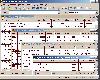
 Modern ribbon-based data manipulation tool for Microsoft SQL Server
Main features:
Quick database browser.
Database oriented perspective, database projects.
Table designer, edit columns, keys, uniques, checks.
Database editor, view and and views, stored procedures, functions,...
Modern ribbon-based data manipulation tool for Microsoft SQL Server
Main features:
Quick database browser.
Database oriented perspective, database projects.
Table designer, edit columns, keys, uniques, checks.
Database editor, view and and views, stored procedures, functions,...
Platforms: Windows 7, Windows
| License: Shareware | Cost: $26.00 USD | Size: 5.44 MB | Download (72): DbMouse Download |
Released: January 05, 2015
|
Added: January 14, 2015 | Visits: 1.654
 Modern ribbon-based data manipulation tool for Microsoft SQL Server
Main features:
Quick database browser.
Database oriented perspective, database projects.
Table designer, edit columns, keys, uniques, checks.
Database editor, view and and views, stored procedures, functions,...
Modern ribbon-based data manipulation tool for Microsoft SQL Server
Main features:
Quick database browser.
Database oriented perspective, database projects.
Table designer, edit columns, keys, uniques, checks.
Database editor, view and and views, stored procedures, functions,...
Platforms: Windows 7, Windows
| License: Freeware | Size: 6.23 MB | Download (57): DbMouse FREE Download |
Added: August 27, 2008 | Visits: 1.086
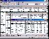
 For the area of the Federal Republic of Germany more than 19 million house coordinates with a coverage of 100% are available. The geo data offered here are in high-precision quality and are present in different coordinate and reference systems. House Coordinates or also called Geo Coded Building...
Platforms: Windows
| License: Demo | Cost: $1250.00 USD | Size: 117 KB | Download (96): Geodaten German Houses (English) Download |
Released: August 23, 2017
|
Added: August 28, 2017 | Visits: 2.323
 The freeware program CONVERT from KilletSoft converts data files to other data formats and character sets. For the import in MySQL or SQL databases the 'CREATE TABLE' script can be generated. Thus the import of the data in any data base management system or file system will be possible....
Platforms: Windows, Windows 8, Windows 7, Windows Server
| License: Freeware | Size: 5.74 MB | Download (223): CONVERT Download |
Released: May 01, 2011
|
Added: May 23, 2011 | Visits: 1.400
 Convert ESRI ShapeFiles (.SHP) geolocation data into AnyMap format to be used with AnyChart. AnyChart Flash Map Converter allows making use of a wide choice of maps with AnyChart Flash Component, a GIS visualization system that recognizes map data in AnyMap format only. AnyChart Flash Map...
Platforms: Windows
| License: Freeware | Size: 1.62 MB | Download (126): AnyChart Flash Map Converter Download |
Added: June 21, 2013 | Visits: 443
 DESOS (Data Exchange Simulator in Orbital Scenarios) models over the whole repeat-cycle of a Low-Earth-Orbit mission the acquisitions of the scientific instrument embarked aboard the satellite and the respective downlink communication toward the set of identified ground stations.Given the orbital...
Platforms: Matlab
| License: Freeware | Size: 3.66 MB | Download (40): DESOS Download |
Added: April 12, 2013 | Visits: 709
WoW Roster is a profiler which retrieves and stores data gathered from WoW through the use of authorized addons (CharacterProfiler , GuildProfiler , and PvPLog). WoWRoster then organizes all of the data, provides a suite of presentations for the gathered data, and houses a base for addons to...
Platforms: PHP
| License: Freeware | Size: 4.49 MB | Download (56): WoW Clan Roster Module Download |
Released: October 17, 2012
|
Added: October 17, 2012 | Visits: 419
Create the GeoDatabase for the entire world. This program create the geographical location Latitude, Longitude, and Altitude (Elevation) for every city, village, region, state, county in the World. The program crawls the data from the website www.heavens-above.com which collect data from US...
Platforms: Windows
| License: Freeware | Size: 1.11 MB | Download (45): GeoMaker Download |
Released: November 15, 2011
|
Added: April 28, 2013 | Visits: 726
 Aspose.Email for Java is a Non-Graphical Java component that enables Java applications to read and write Outlook MSG files without utilizing Microsoft Outlook. It provides classes to read and update MSG files, add/remove attachments and recipients, update subject, body and other MSG file...
Platforms: Windows, *nix, Java
| License: Shareware | Cost: $599.00 USD | Size: 6.3 MB | Download (54): Aspose.Email for Java Download |
Released: October 10, 2012
|
Added: October 10, 2012 | Visits: 510
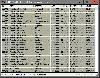
 For the area of the Federal Republic of Germany more than 2,7 million street coordinates with a coverage of 100% are available. The geo data offered here are in high-precision quality and are present in different coordinate and reference systems. Street coordinates or also called street section...
| License: Demo | Cost: $625.00 USD | Size: 68 KB | Download (49): Geodaten German Streets (deutsch) Download |
Added: May 10, 2013 | Visits: 369
It adds the coordinates using location module for each node that is created.The module also provides a choice for GeoRSS formats on outgoing RSS feeds.InstallationUnpack in your modules folder (usually /sites/all/modules/) and enable under Administer > Site Building > Modules. Requirements: -...
Platforms: Windows, Mac, *nix, PHP, BSD Solaris
| License: Freeware | Download (54): GeoRSS module Download |
Added: June 27, 2013 | Visits: 501
This module delivers support for the Mapstraction javascript library, which provides an abstraction layer for the various map providers including Google, Yahoo!, and MapQuest. It allows you to quickly display maps on your site from multiple providers and switch between providers without worrying...
Platforms: PHP
| License: Freeware | Size: 10 KB | Download (52): Mapstraction Download |
Added: June 19, 2013 | Visits: 406
Django app for developing vk.com (aka vkontakte.ru largest, Russian social network) iframe applications. Handles user authentication and registration. Installation $ pip install django-vkontakte-iframe Usage 1. Register and configure vkontakte iframe application here:...
Platforms: *nix
| License: Freeware | Size: 30.72 KB | Download (46): django-vkontakte-iframe Download |
Added: September 02, 2010 | Visits: 2.487
Geo::ShapeFile is a Perl extension for handling ESRI GIS Shapefiles. SYNOPSIS use Geo::ShapeFile; my $shapefile = new Geo::ShapeFile("roads"); for(1 .. $shapefile->shapes()) { my $shape = $shapefile->get_shp_record($_); # see Geo::ShapeFile::Shape docs for what to do with $shape my...
Platforms: *nix
| License: Freeware | Size: 276.48 KB | Download (147): Geo::ShapeFile Download |
Added: June 21, 2013 | Visits: 645
This plugin creates custom post type with geo locations for back end data entering, Google Maps Api v3 is used to display geo posts onto a map with clickable markers overlay, geo posts html content then can be displayed in a popup window. Without any change this tool can be used to build a store...
Platforms: PHP
| License: Freeware | Size: 20.48 KB | Download (44): CleanCodeNZ Geo Posts Plugin Download |
Released: April 10, 1998
|
Added: May 15, 2006 | Visits: 6.379
Multi-International Time Clock displays local (computer) time and the times at four other locations around the world in analog form and digital form. The locations are individually selectable by means of a drop down list. Data for the locations is stored in a simple text file which may accessed...
Platforms: Windows
| License: Freeware | Size: 1.81 MB | Download (527): Multi-International Time Clock Download |