


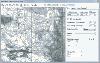
Garmin Maps Usa software
Garmin Maps Usa
Released: October 13, 2012
|
Added: October 13, 2012 | Visits: 417
 Allows you to install and manage maps on your Garmin GPS device.
Platforms: Mac
| License: Freeware | Size: 40 MB | Download (49): MapInstall for Mac OS Download |
Released: November 11, 2012
|
Added: November 11, 2012 | Visits: 960
Calendar and Day Planner eCentral is a user-friendly and fun to use all-in-one productivity tool. Calendar and Day Planner (USA Edition) lets you to easily organize your time.
With eCentral, you can easily organize your time and contacts, and browse the Web with no pop-ups. The personal...
Platforms: Windows
| License: Freeware | Download (59): Calendar and Day Planner (USA Edition) Download |
Released: June 13, 2012
|
Added: June 13, 2012 | Visits: 724
 View maps of Earth and other planets with PrettyMap! See current day and night regions, learn geography by taking the quiz, enjoy 3D elevation surfaces, measure distances between locations and create your own maps with special places! PrettyMap lets you view vector and raster maps and images...
Platforms: Windows, Pocket PC
| License: Shareware | Cost: $19.95 USD | Size: 4.02 MB | Download (56): PrettyMap - World Atlas and Maps, GPS Download |
Released: November 14, 2012
|
Added: November 14, 2012 | Visits: 368
Extract data from YellowPages.com Directory with latest and up to date information as per your customized requirement. RS ypExtractor USA provides speed with flexibility which runs targeted searches with out compromise on over all PC performance. RS ypExtractor Extract data from YellowPages.com...
Platforms: Windows
| License: Shareware | Cost: $49.96 USD | Size: 9.28 MB | Download (410): RS ypExtractor USA Download |
Released: June 20, 2012
|
Added: June 20, 2012 | Visits: 605
Free Satellite Maps is a free tool from Google which offers a satellite mapping service worldwide.These are accompanied by a street service, a route planner and information about business in almost all countries.In this way we can fly the world from satellite view or in birds eye.The level of...
Platforms: Windows
| License: Freeware | Size: 612 KB | Download (47): Free Satellite Maps Download |
Released: August 13, 2012
|
Added: August 13, 2012 | Visits: 594
Live Satellite Maps or Google maps is a web server mapping applications.Provides scrolling map images and satellite photos around the earth and even the route between different places.Since 6 October 2005, live satellite Maps is part of local Google.Google live satellite Map provides the ability...
Platforms: Windows
| License: Freeware | Size: 643 KB | Download (60): Live Satellite Maps Download |
Released: December 07, 2012
|
Added: December 07, 2012 | Visits: 527
 USA Flash Map Locator for websites, presentations and more. Easy adjustment.
Variants of using a map locator:
- Real-Estate websites
- Quick access to contact organization data, having affiliated network in USA
With this fully-clickable map you will be able to improve navigation and provide...
USA Flash Map Locator for websites, presentations and more. Easy adjustment.
Variants of using a map locator:
- Real-Estate websites
- Quick access to contact organization data, having affiliated network in USA
With this fully-clickable map you will be able to improve navigation and provide...
Platforms: Windows, Mac
| License: Demo | Cost: $69.00 USD | Size: 64 KB | Download (469): USA Map Locator Download |
Released: October 23, 2012
|
Added: October 23, 2012 | Visits: 471
 Golden SpotsMap of USA for websites, presentations and more. Easy adjustment.
Variants of using a map locator:
- Real-Estate websites
- Quick access to contact organization data, having affiliated network in USA
With this fully-clickable map you will be able to improve navigation and provide...
Golden SpotsMap of USA for websites, presentations and more. Easy adjustment.
Variants of using a map locator:
- Real-Estate websites
- Quick access to contact organization data, having affiliated network in USA
With this fully-clickable map you will be able to improve navigation and provide...
Platforms: Windows
| License: Demo | Cost: $299.00 USD | Size: 461 KB | Download (427): Golden SpotsMap of USA Download |
Released: November 09, 2012
|
Added: November 09, 2012 | Visits: 517
 Patriotic USA Flash Map for websites, presentations and more. Easy adjustment.
Variants of using a map locator:
- Real-Estate websites
- Quick access to contact organization data, having affiliated network in USA
With this fully-clickable map you will be able to improve navigation and provide...
Patriotic USA Flash Map for websites, presentations and more. Easy adjustment.
Variants of using a map locator:
- Real-Estate websites
- Quick access to contact organization data, having affiliated network in USA
With this fully-clickable map you will be able to improve navigation and provide...
Platforms: Windows, Mac
| License: Demo | Cost: $55.00 USD | Size: 182 KB | Download (421): Patriotic USA Flash Map Download |
Released: October 09, 2012
|
Added: October 09, 2012 | Visits: 433
 OkCustomMap is a software to produce Garmin Custom Maps.
Supports many map formats:
- OkMap
- Ecw
- GeoTiff
- World files
- OziExplorer
- GpsTuner
You can customize:
- The quality of the output JPEG images (0=Bad, 100=Good)
- The KML transparency (0=Transparent, 255=Opaque)
- The KML draw...
OkCustomMap is a software to produce Garmin Custom Maps.
Supports many map formats:
- OkMap
- Ecw
- GeoTiff
- World files
- OziExplorer
- GpsTuner
You can customize:
- The quality of the output JPEG images (0=Bad, 100=Good)
- The KML transparency (0=Transparent, 255=Opaque)
- The KML draw...
Platforms: Windows
| License: Freeware | Size: 3.22 MB | Download (56): OkCustomMap Download |
Released: August 22, 2012
|
Added: August 22, 2012 | Visits: 370
With yalips maps you get 4 products in 1. You are more productive, more creative and perform better on your job when using visual software tools. With the resulting visualizations you can communicate more effectively and convincingly to your collegues, your boss, your customer or the chairman of...
Platforms: Windows
| License: Shareware | Cost: $80.00 USD | Size: 29.65 MB | Download (512): yalips maps Download |
Released: August 11, 2012
|
Added: August 11, 2012 | Visits: 593
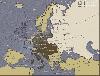
 There are very easy to customize via XML. You don't need to know Flash. The maps are 100% vectorial graphic. Get 20 maps at the price of 6. This package contains: XML Canada Map, XML USA Map, XML Central America, XML South America, XML Europe Map, XML Asia Map, XML Africa Map, XML Australia Map,...
Platforms: Windows, Mac, Other, Pocket PC, Android, BlackBerry, iPhone, iPod, iTouch, Palm
| License: Commercial | Cost: $34.00 USD | Size: 100 KB | Download (49): Maps Package Download |
Released: June 04, 2012
|
Added: June 04, 2012 | Visits: 470
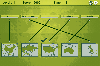 In this game there will be some country names and some maps of countries. Your task is to match the country names with the correct maps. You match them by using the mouse to draw a line to connect the dots of the country names and the maps. There are a total of 5 levels and each level will be...
Platforms: Windows
| License: Freeware | Size: 262 KB | Download (451): Mapping Maps Download |
Released: August 25, 2012
|
Added: August 25, 2012 | Visits: 418
To investigate, describe and develop methods and approaches to generating maps with computers. This is not another GIS project. This one is focused on how to develop programs which make useful end user maps and programs using map backgrounds.
Platforms: Windows, Mac, BSD, Solaris, Linux
| License: Freeware | Size: 16.57 MB | Download (49): Making Maps With Computers Download |
Released: June 04, 2012
|
Added: June 04, 2012 | Visits: 381
tinyTiM is a small and lightweight implementation of the Topic Maps API (TMAPI). The engine is implemented in Java.
Platforms: Windows, Mac, Linux
| License: Freeware | Size: 527.06 KB | Download (43): tinyTiM - The tiny Topic Maps engine Download |
Released: July 05, 2012
|
Added: July 05, 2012 | Visits: 423
 A project by Veqryn for creating, centralizing, and hosting all open-source TripleA maps, as well as other developer resources such as artwork and map makers. If you need the actual TripleA program, go here: https://sourceforge.net/projects/triplea/
Platforms: Windows, Mac, Linux
| License: Freeware | Size: 115.09 MB | Download (43): TripleA Maps Download |
Released: October 26, 2012
|
Added: October 26, 2012 | Visits: 507
RoadTrip allows you to search for points of interest (POIs), create and organize waypoints, routes and tracks, and easily send them to your Garmin GPS.
Platforms: Mac
| License: Freeware | Size: 50.3 MB | Download (55): Garmin RoadTrip Download |
Released: October 09, 2012
|
Added: October 09, 2012 | Visits: 488
Genre: Kids & Learning
About Crosscountry USA Photo Safari
Set out on a fascinating mission to find & photograph endangered animals. Visit more than 100 cities & towns as you drive around the USA. Watch out for speed traps & highway hazards! Vivid graphics & hundreds of photos make this...
Platforms: Mac
| License: Demo | Cost: $0.00 USD | Size: 45.8 MB | Download (47): Crosscountry USA Photo Safari Download |
Released: November 14, 2012
|
Added: November 14, 2012 | Visits: 741
About Outdoor Navigator
- Maps and Charts for Handheld PDAs
– Palms, Pocket PCs, Smart Phones Hike, Boat, Fish, Explore the USA
- Detailed Maps via the Internet from Maptech –Under $100
– GPS Ready
– Hi-Tech Outdoor Navigation Made Easy – Over 60,000 Maps
Maptech (Amesbury, MA)...
Platforms: Mac
| License: Demo | Cost: $0.00 USD | Size: 645.12 KB | Download (59): Outdoor Navigator 1.2 Download |
Released: August 13, 2012
|
Added: August 13, 2012 | Visits: 687
Anquet Maps for Mac is mapping, route-planning navigation software used by professional mountain guides, top mountain athletes, outdoor training centres and thousands of everyday walkers, climbers and cyclists.
With Anquet Maps for Mac you can create routes on real OS maps to print or transfer...
Platforms: Mac
| License: Freeware | Size: 4.8 MB | Download (54): Anquet Maps Download |