


Garmin Geocaching software
Garmin Geocaching
Released: October 22, 2012
|
Added: October 22, 2012 | Visits: 491
 Garmin MapInstall installs maps onto your Garmin device. MapManager copies maps and unlock codes into the right place to be accessible by MapInstall and Training Center.
Platforms: Mac
| License: Freeware | Size: 49.3 MB | Download (47): Garmin MapInstall Download |
Released: August 12, 2012
|
Added: August 12, 2012 | Visits: 421
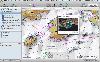 Garmin HomePort provides an interface for viewing Garmin marine chart products and managing geographic and nautical data. With HomePort, you can:
• View marine chart products pre-loaded on your GPS device, including BlueChart, BlueChart g2, and Blue
Garmin HomePort provides an interface for viewing Garmin marine chart products and managing geographic and nautical data. With HomePort, you can:
• View marine chart products pre-loaded on your GPS device, including BlueChart, BlueChart g2, and Blue
Platforms: Mac
| License: Shareware | Cost: $29.99 USD | Size: 26.6 MB | Download (91): Garmin HomePort Download |
Added: January 15, 2006 | Visits: 4.091
 GPS Software - Download waypoints and routes from Garmin GPS. Upload waypoints and routes to Garmin GPS. Excel and Text files supported! This software is very easy to use!
Platforms: Windows
| License: Shareware | Cost: $29.95 USD | Size: 1.29 MB | Download (203): Frontbase GPS Download |
Added: June 21, 2010 | Visits: 1.463
QLandkarte can view and upload map files, track and waypoint data to your Garmin GPS receiver. Garmins MapSource software is hardly the only reason for me to boot into Windows and it does not look like Garmin ever wants to address Linux users by writing a portable piece of software. So I...
Platforms: *nix
| License: Freeware | Size: 972.8 KB | Download (116): QLandkarte Download |
Added: January 25, 2010 | Visits: 742
MacCaching is a Geocache Manager support Garmin and Magallen GPS receivers. Caches are managed in Lists which can be groups of caches in a certain area, caches you own, or caches you haven't found yet. An iPod or Palm-based device can be used for Paperless Caching when sending caches to your GPS....
Platforms: Mac
| License: Freeware | Download (98): MacCaching Download |
Released: November 16, 2012
|
Added: November 16, 2012 | Visits: 485
 Provides hours of entertainment by combining the technology in your phone with one of the fastest-growing international hide and seek games - geocaching (also known as "GPS treasure hunt"). By using your Nokia's GPS and built-in Internet, Geocache Navigator™ creates a seamless and exciting...
Platforms: Handheld/Mobile Other, Java
| License: Freeware | Size: 225.28 KB | Download (528): Geocache Navigator Download |
Released: August 23, 2012
|
Added: August 23, 2012 | Visits: 665
 All-in-one software for creation of custom GPS maps compatible with Garmin GPS units. Mapwel supports routing, ESRI shapefiles, OpenStreetMap OSM, Google Earth KML and KMZ, cGPSmapper MP and GPX files. Mapwel custom GPS mapping capability and user icons editor are often used in forestry,...
Platforms: Windows
| License: Shareware | Cost: $45.00 USD | Size: 12.28 MB | Download (454): Mapwel Download |
Released: June 20, 2012
|
Added: June 20, 2012 | Visits: 780
GPX and TCX file welder is a small, easy to use application specially designed to help you substitute the missing GPS information in Garmin TCX files when devices lacking a GPS receiver are used to collect training data (Garmin FR 60, heartrate and pedometer only).
This application is also...
Platforms: Windows
| License: Freeware | Download (424): GPX and TCX file welder Download |
Released: August 13, 2012
|
Added: August 13, 2012 | Visits: 454
Allows you to load custom points of interest into your unit. The input files can be downloaded from the internet or you can create your own. With POI Loader, you can configure the unit to alert you when you are within a certain distance of a point or if you are driving over a certain speed near a...
Platforms: Mac
| License: Freeware | Size: 10.3 MB | Download (52): Garmin POI Loader for Mac OS Download |
Released: June 07, 2012
|
Added: June 07, 2012 | Visits: 379
This application converts the XML Polar file (from polarpersonaltrainer.com) to TCX Garmin file. All websites which register your trainers don't allow XML files from Polar. Tested with these models: RS300X, CS200
Platforms: Windows, Mac, Linux
| License: Freeware | Size: 352.08 KB | Download (57): XML Polar to TCX Garmin Converter Download |
Added: June 19, 2013 | Visits: 348
This is a MacOSX framework to communcate with Garmin USB devices.
Platforms: Mac
| License: Freeware | Size: 30.72 KB | Download (36): GarminKit Download |
Added: August 05, 2013 | Visits: 400
GPStrans is a program which allows track, route, and waypoint data to be transferred to and from a Garmin GPS. It also supports Mayko mXmap formats which enable you to create a route using your 'favorite' map and load the data into the GPS. Tracks r
Platforms: *nix
| License: Freeware | Size: 81.92 KB | Download (35): gpstrans Download |
Added: November 27, 2013 | Visits: 663
Garble is a portable modular C++ program and library for interfacing to Garmin GPS receivers.
Platforms: *nix
| License: Freeware | Size: 20.48 KB | Download (41): Garble Download |
Added: September 15, 2006 | Visits: 3.027
 Create thumbnail based web photo galleries. Interfaces with Garmin GPS units for creating georeferenced images, EXIF support, customizable HTML template files, integrated FTP, program automation, image batch processor, XML image description support, copyright stamper, built-in e-mailer, an HTTP...
Platforms: Windows
| License: Commercial | Cost: $39.95 USD | Size: 4.7 MB | Download (218): RoboPhoto Download |
Released: November 10, 2007
|
Added: November 20, 2007 | Visits: 6.089
 Geocode digital images with latitude, longitude, altitude, and direction information. RoboGEO stamps this information onto the actual photo or writes it to the EXIF headers, allowing you to permanently geotag and link your photos to the GPS coordinates. All writing to the EXIF and IPTC headers...
Platforms: Windows
| License: Demo | Cost: $39.95 USD | Size: 8.28 MB | Download (1179): RoboGEO Download |
Added: August 10, 2008 | Visits: 3.457
Add GPS support to your C# or VB.NET application.Works with Garmin, Magellan, Navman or any NMEA 0183 enabled GPS. Support for UTM, SPCS (NAD83/NAD27), British National Grid, Swiss Grid, Irish Grid and many more national coordinate systems. Many examples included to get you started. For Windows...
Platforms: Windows, Windows CE
| License: Shareware | Cost: $79.00 USD | Size: 186 KB | Download (540): GpsTools .NET Download |
Added: January 25, 2010 | Visits: 1.303
GPS Connect is a freeware program for Mac OS X which offers connectivity to Garmin GPS receivers. The intended use is to backup waypoints from the GPS to your computer. Downloaded waypoints may be saved in a native file format or exported to a variety of other formats such as tab-delimited,...
Platforms: Mac
| License: Freeware | Size: 1.2 MB | Download (108): GPS Connect Download |
Added: January 25, 2010 | Visits: 696
Mac SimpleGPS is Macintosh application designed to manage waypoints, routes and tracks on your GPSR (global positioning satellite receiver). The best use for Mac SimpleGPS is to download .LOC (waypoint location) files from GeoCaching.com and transfer them to your GPSr. It is also a great way to...
Platforms: Mac
| License: Freeware | Download (101): Mac SimpleGPS Download |
Added: January 25, 2010 | Visits: 701
The ILCrashReporter framework enables developers to easily integrate crash reporting facilities into existing or new applications.The ILCrashReporter works much like the Crash Reporter built into the operating system. However, for some reason Apple does not provide a way for developers to get...
Platforms: Mac
| License: Freeware | Size: 176 KB | Download (90): ILCrashReporter Download |
Added: January 25, 2010 | Visits: 784
LoadMyTracks is a utility that allows users of the Macintosh to download track, route, and waypoint information from a variety of GPS receivers from Garmin, Magellan, TomTom, Sony, Lowrance, Timex, and turn them into GPX files or KML files (for use with Google Earth). LoadMyTracks can also send...
Platforms: Mac
| License: Demo | Cost: $0.00 USD | Download (125): LoadMyTracks Download |