


Garmin Etrex software
Garmin Etrex
Added: January 25, 2010 | Visits: 1.398
 GPSUtility displays GPS data including speed, bearing, position and satellite information.
Platforms: Mac
| License: Freeware | Download (148): GPSUtility Download |
Added: January 25, 2010 | Visits: 696
Mac SimpleGPS is Macintosh application designed to manage waypoints, routes and tracks on your GPSR (global positioning satellite receiver). The best use for Mac SimpleGPS is to download .LOC (waypoint location) files from GeoCaching.com and transfer them to your GPSr. It is also a great way to...
Platforms: Mac
| License: Freeware | Download (101): Mac SimpleGPS Download |
Added: January 25, 2010 | Visits: 701
The ILCrashReporter framework enables developers to easily integrate crash reporting facilities into existing or new applications.The ILCrashReporter works much like the Crash Reporter built into the operating system. However, for some reason Apple does not provide a way for developers to get...
Platforms: Mac
| License: Freeware | Size: 176 KB | Download (90): ILCrashReporter Download |
Added: January 25, 2010 | Visits: 707
The Garmin iQue 3600 is a PalmOS 5 PDA with built-in GPS capabilities and comes with Windows software only. iQue Conduit allows you to export tracks and waypoints from the iQue to your Mac during a HotSync operation. Data is exported in the standard XML-based GPX format and can then be brought...
Platforms: Mac
| License: Freeware | Size: 115 KB | Download (102): iQue Conduit Download |
Added: January 25, 2010 | Visits: 853
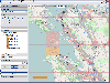
GPSy is a sophisticated Macintosh GPS communications and GIS mapping program. GPSy connects your Macintosh to a broad range of Global Positioning System (GPS) navigational units and has advanced mapping, logging, and data transfer features. GPSy has extensive support for USGS DRG topo maps,...
Platforms: Mac
| License: Demo | Cost: $0.00 USD | Download (104): GPSy Download |
Added: January 25, 2010 | Visits: 810
Geocaching Menu makes it easy to download geocaching waypoints from webpages directly to your GPS device without the need of first saving these on the computer. Geocaching is an outdoor activity that most often involves the use of a Global Positioning System ("GPS") receiver or traditional...
Platforms: Mac
| License: Shareware | Cost: $0.00 USD | Download (108): Geocaching Menu Download |
Added: January 25, 2010 | Visits: 784
LoadMyTracks is a utility that allows users of the Macintosh to download track, route, and waypoint information from a variety of GPS receivers from Garmin, Magellan, TomTom, Sony, Lowrance, Timex, and turn them into GPX files or KML files (for use with Google Earth). LoadMyTracks can also send...
Platforms: Mac
| License: Demo | Cost: $0.00 USD | Download (125): LoadMyTracks Download |
Added: January 25, 2010 | Visits: 752
RouteBuddy is a GPS mapping application for OS X. All the essential functions of your GPS device are supported; all you need is a Mac, a GPS, and of course RouteBuddy.Supports USGlobalSat DevicesSupports Garmin USB DevicesSupports NMEA CommunicationTransfer Waypoints, Routes and TracksHere are...
Platforms: Mac
| License: Demo | Cost: $0.00 USD | Download (113): RouteBuddy Download |
Added: January 25, 2010 | Visits: 848
MacENC is the professional solution for the mariner that wants to take the Mac aboard for real-time display of position on the vector format S-57/S-63 ENCs (Electronic Navigational Charts) AND raster format BSB and Softcharts. Plug your GPS into your Mac and watch as your vessel moves along in...
Platforms: Mac
| License: Demo | Cost: $0.00 USD | Download (134): MacENC Download |
Added: January 25, 2010 | Visits: 1.123
TrackRunner is a GPS-enabled exercise logbook.Coupled with a GPS receiver and using LoadMyTracks from ClueTrust to connect to your GPS device, you'll be able to log your workouts and keep track of distance, time, elevation, heart-rate etc. Activities can be organized into categories, and by...
Platforms: Mac
| License: Freeware | Download (108): TrackRunner Download |
Released: May 28, 2012
|
Added: July 18, 2012 | Visits: 1.066
 RouteConverter displays, modifies, enriches and converts GPS data between over 75 formats. It works without installation under Linux, Mac OS X and Windows, automatically detects the format of a file, supports drag and drop, undo and redo, offers a map view onto the positions of routes, tracks and...
Platforms: Windows, Mac, *nix, Windows 7, Solaris,FreeBSD,OpenBSD,Java
| License: Freeware | Size: 6.61 MB | Download (152): RouteConverter Download |
Released: July 19, 2012
|
Added: July 19, 2012 | Visits: 828
 Mobile Atlas Creator (formerly known as TrekBuddy Atlas Creator) is an open source (GPL) program which creates offline atlases for GPS handhelds and cell phone applications like TrekBuddy, AndNav and other Android and WindowsCE based applications.
For the full list of supported applications...
Mobile Atlas Creator (formerly known as TrekBuddy Atlas Creator) is an open source (GPL) program which creates offline atlases for GPS handhelds and cell phone applications like TrekBuddy, AndNav and other Android and WindowsCE based applications.
For the full list of supported applications...
Platforms: Windows
| License: Freeware | Size: 2 MB | Download (398): Mobile Atlas Creator Download |
Released: September 04, 2012
|
Added: September 04, 2012 | Visits: 746
 Mobile Atlas Creator (formerly known as TrekBuddy Atlas Creator) is an open source (GPL) program which creates offline atlases for GPS handhelds and cell phone applications like TrekBuddy, AndNav and other Android and WindowsCE based applications.
For the full list of supported applications...
Mobile Atlas Creator (formerly known as TrekBuddy Atlas Creator) is an open source (GPL) program which creates offline atlases for GPS handhelds and cell phone applications like TrekBuddy, AndNav and other Android and WindowsCE based applications.
For the full list of supported applications...
Platforms: Mac
| License: Freeware | Size: 1.6 MB | Download (448): Mobile Atlas Creator for Mac OS X Download |
Released: October 11, 2012
|
Added: October 11, 2012 | Visits: 598
QLandkarte GT is a handy, easy to use program specially designed to offer users a ultimate outdoor aficionado's tool.
This application offers support for GPS maps in GeoTiff format as well as Garmin's img vector map format.
for WindowsXP, Vista, 7
Platforms: Windows, Windows Vista, 7
| License: Freeware | Download (498): QLandkarte GT Download |
Released: October 08, 2012
|
Added: October 08, 2012 | Visits: 833
ITN Converter Travel is both a route converter supporting many formats and a simple and efficient route planner. The converter supports routes file formats (roadbook) from many GPS or mapping software, the most popular are TomTom, Navigon, Garmin, MapPoint or MapSource. This converter can easily...
Platforms: Windows
| License: Freeware | Download (492): ITN Converter Travel Download |
Released: June 09, 2012
|
Added: June 09, 2012 | Visits: 338
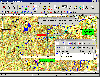 OziExplorer is interactive, it allows you to work, on your computer screen, with digital maps that you have purchased or scanned yourself. By using these maps OziExplorer allows you to plan your trip by creating waypoints, routes and tracks on screen and upload these to your GPS.
With...
OziExplorer is interactive, it allows you to work, on your computer screen, with digital maps that you have purchased or scanned yourself. By using these maps OziExplorer allows you to plan your trip by creating waypoints, routes and tracks on screen and upload these to your GPS.
With...
Platforms: Windows
| License: Shareware | Cost: $95.00 USD | Size: 7 MB | Download (425): OziExplorer Download |
Released: August 21, 2012
|
Added: August 21, 2012 | Visits: 425
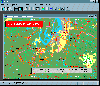 AGIS for Windows is a mapping and simple GIS shareware package. Plot your own geographic data on the map of the world provided without the high cost and steep learning curve usually associated with this kind of software. Create high resolution publication quality images that can be pasted into...
Platforms: Windows
| License: Shareware | Cost: $49.00 USD | Size: 3.57 MB | Download (478): AGIS for Windows Download |
Released: August 14, 2012
|
Added: August 14, 2012 | Visits: 690
Works as a diary for your gear. Although it is fully customizable, it is designed to track use of sports gear like running shoes, bicycles, bike parts, etc. Sports Equipment Log integrates with Garmin wireless Fitness devices, and imports activities - so mileages, dates, and activity types are...
Platforms: Mac
| License: Freeware | Size: 348.16 KB | Download (481): Sports Equipment Log for Mac OS Download |
Released: November 26, 2012
|
Added: November 26, 2012 | Visits: 546
Let this software and a GPS logger do the hard work of assigning precise Places metadata to your photos. Why import ungeotagged pictures into iPhoto, when its so straightforward to GPS-enable your favorite camera?
Geotagalogs sophisticated automatic geotagging technology combines locations from...
Platforms: Mac
| License: Freeware | Size: 13.8 MB | Download (498): Geotagalog for Mac OS Download |
Released: July 10, 2012
|
Added: July 10, 2012 | Visits: 604
An activity tracking and exercise journal software for the Mac. It lets you display, analyze and organize your indoor and outdoor workouts for sports such as running, biking, walking, hiking, skiing and many more.
rubiTrack reads tracks from GPS enabled fitness devices like the Garmin Forerunner...
Platforms: Mac
| License: Freeware | Size: 5.4 MB | Download (467): rubiTrack for Mac OS Download |