


Garmin Aviation Gps software
Garmin Aviation Gps
Released: November 12, 2012
|
Added: November 12, 2012 | Visits: 491
 Create and edit waypoints, tracklogs, routes, and insert scanned images of map. More than 160 GPS models recognized. Garmin, Magellan, Eagle and others
- Most complete free program for GPS devices
- Compatible with more than 160 GPS models
- Support for Garmin, Magellan and others
- Easily...
Platforms: Windows
Create and edit waypoints, tracklogs, routes, and insert scanned images of map. More than 160 GPS models recognized. Garmin, Magellan, Eagle and others
- Most complete free program for GPS devices
- Compatible with more than 160 GPS models
- Support for Garmin, Magellan and others
- Easily...
Platforms: Windows
| License: Freeware | Size: 54.92 MB | Download (57): GPS TrackMaker Download |
Released: June 17, 2012
|
Added: June 17, 2012 | Visits: 870
![]() GPS Tracker Data Logger acts as the server and allows you to collect data from an unlimited number of various GPS trackers simultaneously. The obtained data is processed, uniformed and written to a log file or a database. Also, the program has a set of interfaces so other applications can get...
Platforms: Windows
GPS Tracker Data Logger acts as the server and allows you to collect data from an unlimited number of various GPS trackers simultaneously. The obtained data is processed, uniformed and written to a log file or a database. Also, the program has a set of interfaces so other applications can get...
Platforms: Windows
| License: Shareware | Cost: $100.00 USD | Size: 11.83 MB | Download (64): GPS Tracker Data Logger Download |
Released: October 08, 2012
|
Added: October 08, 2012 | Visits: 581
 Virtual GPS is a GPS simulator software. You can use it to simulate a GPS receiver unit connected to your system. It's ideal when you need GPS input, but you have no signal or for development purposes. It supports various NMEA sentences, so it can be used with any GPS mapping software. You can...
Platforms: Windows, Other
Virtual GPS is a GPS simulator software. You can use it to simulate a GPS receiver unit connected to your system. It's ideal when you need GPS input, but you have no signal or for development purposes. It supports various NMEA sentences, so it can be used with any GPS mapping software. You can...
Platforms: Windows, Other
| License: Shareware | Cost: $39.99 USD | Size: 946 KB | Download (74): Virtual GPS Download |
Released: September 27, 2012
|
Added: September 27, 2012 | Visits: 710
 Complex of programs FPS provide remote monitoring of GPS receivers and visualize data on a computer operator. The program presented for the free use can track the position of only one GPS-receiver. As GPS receivers can be used smartphone with GPS operating systems to Windows Mobile 5 or 6 and...
Platforms: Windows, Mac, Unix, Linux, Linux Gnome, Linux GPL, Linux Open Source
Complex of programs FPS provide remote monitoring of GPS receivers and visualize data on a computer operator. The program presented for the free use can track the position of only one GPS-receiver. As GPS receivers can be used smartphone with GPS operating systems to Windows Mobile 5 or 6 and...
Platforms: Windows, Mac, Unix, Linux, Linux Gnome, Linux GPL, Linux Open Source
| License: Freeware | Size: 7.85 MB | Download (57): FPS система GPS мониторинга Download |
Released: November 07, 2012
|
Added: November 07, 2012 | Visits: 621
 With this tool you can add GPS coordinates to vCards - electronic business cards - that you have previously exported from e. g. Microsoft Outlook. Therefore the tool uses the address data contained within the vCards and adds the exact GPS position on that basis to the vCard. This way you can use...
Platforms: Windows
With this tool you can add GPS coordinates to vCards - electronic business cards - that you have previously exported from e. g. Microsoft Outlook. Therefore the tool uses the address data contained within the vCards and adds the exact GPS position on that basis to the vCard. This way you can use...
Platforms: Windows
| License: Freeware | Size: 1.47 MB | Download (503): GPS to vCard Download |
Released: July 11, 2012
|
Added: July 11, 2012 | Visits: 822
![]() Wialon GPS Tracking is an application characterized by its ease of use, reliability, usability, and high operational speed. The general features of the system include fuel consumption monitoring, editable template-base reports, SMS or e-mail alerts and notifications and controllable routes with...
Platforms: Windows
Wialon GPS Tracking is an application characterized by its ease of use, reliability, usability, and high operational speed. The general features of the system include fuel consumption monitoring, editable template-base reports, SMS or e-mail alerts and notifications and controllable routes with...
Platforms: Windows
| License: Demo | Cost: $0.00 USD | Size: 6.45 MB | Download (505): Wialon GPS Tracking Download |
Released: June 13, 2012
|
Added: June 13, 2012 | Visits: 901
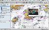
![]() With the new Icons-Land Vista Style GIS/GPS/Map Icon Set now it is much more comfortable to use local service applications, GPS tracking and GIS applications, and any kind of mapping applications. GIS/GPS/Map Icons are meant to help users to orient oneself when using maps, to facilitate their...
Platforms: Windows, Mac, Pocket PC, Java, Handheld/Mobile Other
With the new Icons-Land Vista Style GIS/GPS/Map Icon Set now it is much more comfortable to use local service applications, GPS tracking and GIS applications, and any kind of mapping applications. GIS/GPS/Map Icons are meant to help users to orient oneself when using maps, to facilitate their...
Platforms: Windows, Mac, Pocket PC, Java, Handheld/Mobile Other
| License: Demo | Cost: $120.00 USD | Size: 2.53 MB | Download (57): Icons-Land Vista Style GIS/GPS/MAP Icon Set Download |
Released: January 27, 2013
|
Added: January 27, 2013 | Visits: 1.106
 CMC Multimedia Sistem SRL ofera: Sisteme de Monitorizare Vehicule si Localizare prin GPS, Receptoare de ultima generatie GPS, Navigatie prin Sisteme GPS, Sisteme Urmarire GPS Auto, Abonamente GPS si Sisteme de Urmarire a Masinilor, GPS Tracking, Sisteme Navigatie Romania si International,...
Platforms: Windows, Mac, Unix, Linux, Palm OS 6.0, Pocket PC, RIM, Symbian, Handheld/Mobile Other, OpenVMS, Netware, BEOS, Java
CMC Multimedia Sistem SRL ofera: Sisteme de Monitorizare Vehicule si Localizare prin GPS, Receptoare de ultima generatie GPS, Navigatie prin Sisteme GPS, Sisteme Urmarire GPS Auto, Abonamente GPS si Sisteme de Urmarire a Masinilor, GPS Tracking, Sisteme Navigatie Romania si International,...
Platforms: Windows, Mac, Unix, Linux, Palm OS 6.0, Pocket PC, RIM, Symbian, Handheld/Mobile Other, OpenVMS, Netware, BEOS, Java
| License: Freeware | Size: 974 KB | Download (476): Sisteme de Localizare, Monitorizare GPS Download |
Released: August 23, 2012
|
Added: August 23, 2012 | Visits: 572
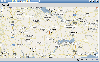
 ExpertGPS is the ultimate mapping software for Garmin, Magellan, and Lowrance GPS owners. ExpertGPS displays your waypoints, routes, and tracks on USGS topo maps and aerial photos.
Using the powerful mapping tools in ExpertGPS, you can draw your route directly on a map, search for nearby...
Platforms: Windows
ExpertGPS is the ultimate mapping software for Garmin, Magellan, and Lowrance GPS owners. ExpertGPS displays your waypoints, routes, and tracks on USGS topo maps and aerial photos.
Using the powerful mapping tools in ExpertGPS, you can draw your route directly on a map, search for nearby...
Platforms: Windows
| License: Shareware | Cost: $74.95 USD | Size: 9.1 MB | Download (441): ExpertGPS Download |
Released: August 12, 2012
|
Added: August 12, 2012 | Visits: 427
 Garmin HomePort provides an interface for viewing Garmin marine chart products and managing geographic and nautical data. With HomePort, you can:
• View marine chart products pre-loaded on your GPS device, including BlueChart, BlueChart g2, and Blue
Platforms: Mac
Garmin HomePort provides an interface for viewing Garmin marine chart products and managing geographic and nautical data. With HomePort, you can:
• View marine chart products pre-loaded on your GPS device, including BlueChart, BlueChart g2, and Blue
Platforms: Mac
| License: Shareware | Cost: $29.99 USD | Size: 26.6 MB | Download (91): Garmin HomePort Download |
Added: May 10, 2013 | Visits: 1.090
This project allows someone to track a GPS enabled cell phone using Google maps.For this project it is used a Motorola i355 cell phone on the Sprint/Nextel network. You need to have a data plan so that you can make updates to your website from the cellphone. Project includes J2ME cell phone...
Platforms: Windows, Mac, *nix, PHP, BSD Solaris
| License: Freeware | Download (81): GPS Tracker Download |
Added: August 22, 2013 | Visits: 437
I wrote GPS Inspector as an experiment to learn more about GPS and how it could be used within JAVA. I figured others might find it useful or interesting so I have posted the source (GPLv3) and binaries here. It uses parts of other java libraries including: World Wind Java, Gpsylon, JFreeChart,...
Platforms: Mac
| License: Freeware | Size: 6.08 MB | Download (50): Gps Inspector Download |
Added: August 21, 2013 | Visits: 536
Seamlessly transfer workouts from your Garmin fitness device to your computer with Garmin ANT Agent for Mac. Your computer receives data wirelessly and then sends it to Garmin Connect for later analysis.
Platforms: Mac
| License: Freeware | Size: 12.45 MB | Download (41): Garmin ANT Agent Download |
Added: October 12, 2013 | Visits: 480
GPS::Poi is a Perl module who provides a variety of low- and high-level methods for parsing 'ov2' extention file of POI (Point of Interrest ). 'ov2' is Tomtom GPS format . Tomtom is trade mark .
Platforms: *nix
| License: Freeware | Size: 10.24 KB | Download (52): GPS::Poi Download |
Added: August 05, 2013 | Visits: 410
GPStrans is a program which allows track, route, and waypoint data to be transferred to and from a Garmin GPS. It also supports Mayko mXmap formats which enable you to create a route using your 'favorite' map and load the data into the GPS. Tracks r
Platforms: *nix
| License: Freeware | Size: 81.92 KB | Download (41): gpstrans Download |
Added: November 27, 2013 | Visits: 670
Garble is a portable modular C++ program and library for interfacing to Garmin GPS receivers.
Platforms: *nix
| License: Freeware | Size: 20.48 KB | Download (41): Garble Download |
Released: September 07, 2014
|
Added: September 21, 2014 | Visits: 755
![]() With the new Icons-Land GIS/GPS/Map Vector Icons now it is much more comfortable to use local service applications, GPS tracking and GIS applications, and any kind of mapping applications.
GIS/GPS/Map Icons are meant to help users to orient oneself when using maps, to facilitate their...
Platforms: Windows, Mac, Windows 8, Windows 7, iOS
With the new Icons-Land GIS/GPS/Map Vector Icons now it is much more comfortable to use local service applications, GPS tracking and GIS applications, and any kind of mapping applications.
GIS/GPS/Map Icons are meant to help users to orient oneself when using maps, to facilitate their...
Platforms: Windows, Mac, Windows 8, Windows 7, iOS
| License: Demo | Cost: $180.00 USD | Size: 5.56 MB | Download (40): Icons-Land GIS/GPS/MAP Vector Icons Download |
Released: March 15, 2023
|
Added: April 03, 2023 | Visits: 260
 With AnyMP4 iPhone GPS Spoofer for Mac, you own one of the best GPS location spoofers for iOS devices. It lets you set the virtual GPS location within a few clicks. Whats more, you can play location-based games from anywhere in the world easily.
Key Functions:
1. Fake yours iPhone...
Platforms: Mac
With AnyMP4 iPhone GPS Spoofer for Mac, you own one of the best GPS location spoofers for iOS devices. It lets you set the virtual GPS location within a few clicks. Whats more, you can play location-based games from anywhere in the world easily.
Key Functions:
1. Fake yours iPhone...
Platforms: Mac
| License: Shareware | Cost: $9.96 USD | Size: 72.48 MB | Download (44): AnyMP4 iPhone GPS Spoofer for Mac Download |
Released: July 23, 2023
|
Added: August 09, 2023 | Visits: 340
 With this amazing location changer, you can hide location on your iOS devices, which can be a useful tool to spoof own location on social platform. It will let you set virtual locations easily and prevent data leak. After changing your GPS location on the map, it can protect yourself from being...
Platforms: Windows, Windows 8, Windows 7, Windows Server
With this amazing location changer, you can hide location on your iOS devices, which can be a useful tool to spoof own location on social platform. It will let you set virtual locations easily and prevent data leak. After changing your GPS location on the map, it can protect yourself from being...
Platforms: Windows, Windows 8, Windows 7, Windows Server
| License: Shareware | Cost: $9.96 USD | Size: 2.29 MB | Download (25): AnyMP4 iPhone GPS Spoofer Download |
Added: September 15, 2006 | Visits: 3.033
 Create thumbnail based web photo galleries. Interfaces with Garmin GPS units for creating georeferenced images, EXIF support, customizable HTML template files, integrated FTP, program automation, image batch processor, XML image description support, copyright stamper, built-in e-mailer, an HTTP...
Platforms: Windows
Create thumbnail based web photo galleries. Interfaces with Garmin GPS units for creating georeferenced images, EXIF support, customizable HTML template files, integrated FTP, program automation, image batch processor, XML image description support, copyright stamper, built-in e-mailer, an HTTP...
Platforms: Windows
| License: Commercial | Cost: $39.95 USD | Size: 4.7 MB | Download (219): RoboPhoto Download |