


Garmin Aviation software
Garmin Aviation
Added: January 25, 2010 | Visits: 1.468
 HoudahGPS allows you to transfer track log and waypoint data from your Garmin, Magellan or Wintec GPS devices. It connects via USB to the Garmin and Magellan devices. It interfaces with the Wintec WBT-100, WBT-101 and WBT-201 devices using Bluetooth. HoudahGPS may also be used to convert between...
Platforms: Mac
| License: Freeware | Download (122): HoudahGPS Download |
Released: July 21, 2010
|
Added: September 25, 2010 | Visits: 1.346
 Toolkit to add GPS and coordinate conversion functionality to your software and scripts (GPS API). All NMEA0183 protocol versions are supported and can be filtered by NMEA sentence type and talker ID. Garmin USB PVT support. Information on GPS status can also be retrieved: GPS fix quality,...
Platforms: Windows
| License: Shareware | Cost: $99.00 USD | Size: 2.2 MB | Download (121): Eye4Software GPS API Download |
Released: January 29, 2013
|
Added: February 23, 2013 | Visits: 789
![]() A stock of 86 aviation and transportation icons.Great for navigation systems, flight information desks, logistics and transportation applications. Avia Software Icons are a perfect fit for toolbars, menus, treeviews, taskbars, ribbon bars, dock UI elements, buttons, splashscreen and banner...
A stock of 86 aviation and transportation icons.Great for navigation systems, flight information desks, logistics and transportation applications. Avia Software Icons are a perfect fit for toolbars, menus, treeviews, taskbars, ribbon bars, dock UI elements, buttons, splashscreen and banner...
Platforms: Windows, Mac, *nix, Windows CE, Other,Android,iPhone,iPod
| License: Shareware | Cost: $99.95 USD | Size: 3.23 MB | Download (94): Avia Software Icons Download |
Released: October 13, 2012
|
Added: October 13, 2012 | Visits: 417
Allows you to install and manage maps on your Garmin GPS device.
Platforms: Mac
| License: Freeware | Size: 40 MB | Download (49): MapInstall for Mac OS Download |
Released: July 10, 2012
|
Added: July 10, 2012 | Visits: 418
Allows you to transfer track log and waypoint data from your Garmin, Magellan or Wintec GPS devices. It connects via USB to the Garmin and Magellan devices. It interfaces with the Wintec WBT-100, WBT-101 and WBT-201 devices using Bluetooth.
HoudahGPS may also be used to convert between the GPX,...
Platforms: Mac
| License: Freeware | Size: 1.3 MB | Download (53): HoudahGPS for Mac OS Download |
Released: September 21, 2012
|
Added: September 21, 2012 | Visits: 697
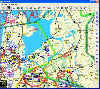 PocketFMS is the Moving Map and Flight Planning tool for PC, Tablet PC, UMPC, Pocket PC and Windows CE-based Car Navigation equipment. It comprises downloadable, worldwide maps, access to a comprehensive AeroDatabase, integrated & graphical weather with 48 hours prognosis, TCAS info and...
Platforms: Windows, Pocket PC
| License: Freeware | Size: 34.55 MB | Download (65): PocketFMS Download |
Released: June 07, 2012
|
Added: June 07, 2012 | Visits: 472
 Gpi2Gps converts Waypoints from Garmin GPI file format (i.e. Garmin POI Loader) to Google Earth (KMZ) or GPS compatible format (GPX) in a few steps. With GPI to GPs converter you are able to transform from GPI to GPs. Download your waypoints from your GPS or Palm PDAs and save it in .GPI format...
Platforms: Windows
| License: Demo | Cost: $20.00 USD | Size: 635 KB | Download (68): GPI to GPs converter Download |
Released: October 09, 2012
|
Added: October 09, 2012 | Visits: 433
 OkCustomMap is a software to produce Garmin Custom Maps.
Supports many map formats:
- OkMap
- Ecw
- GeoTiff
- World files
- OziExplorer
- GpsTuner
You can customize:
- The quality of the output JPEG images (0=Bad, 100=Good)
- The KML transparency (0=Transparent, 255=Opaque)
- The KML draw...
OkCustomMap is a software to produce Garmin Custom Maps.
Supports many map formats:
- OkMap
- Ecw
- GeoTiff
- World files
- OziExplorer
- GpsTuner
You can customize:
- The quality of the output JPEG images (0=Bad, 100=Good)
- The KML transparency (0=Transparent, 255=Opaque)
- The KML draw...
Platforms: Windows
| License: Freeware | Size: 3.22 MB | Download (56): OkCustomMap Download |
Released: November 20, 2012
|
Added: November 20, 2012 | Visits: 920
 Logbook Pro for the iPhone, iPod touch, and iPad is hands down the best pilot logbook software for Apple's iPhone, iPod touch, and iPad. Logbook Pro brings you the most popular, reliable, trusted, and proven electronic flight logbook software for pilots used in the aviation community for over a...
Platforms: Android
| License: Freeware | Size: 676 KB | Download (601): Logbook Pro for Android Download |
Released: August 23, 2012
|
Added: August 23, 2012 | Visits: 567
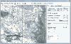
ExpertGPS is the ultimate mapping software for Garmin, Magellan, and Lowrance GPS owners. ExpertGPS displays your waypoints, routes, and tracks on USGS topo maps and aerial photos.
Using the powerful mapping tools in ExpertGPS, you can draw your route directly on a map, search for nearby...
Platforms: Windows
| License: Shareware | Cost: $74.95 USD | Size: 9.1 MB | Download (441): ExpertGPS Download |
Released: August 24, 2012
|
Added: August 24, 2012 | Visits: 493
ASTRES is used in a helpdesk of the french civil aviation and allow to manage customer tickets (with workflow and level tree-view), internal actions between actors, diffused/received documents, sent/received material, planning, stats, reporting, news...
Platforms: Windows, Mac, Linux
| License: Freeware | Size: 51.14 MB | Download (51): ASTRES Download |
Released: July 11, 2012
|
Added: July 11, 2012 | Visits: 375
FlightTrack is a 2D/3D GPS track viewing software for light aviation pilots using MacOS X.
Platforms: Mac
| License: Freeware | Size: 6.09 KB | Download (43): FlightTrack Download |
Released: October 21, 2012
|
Added: October 21, 2012 | Visits: 440
Tool for making aviation calculations done quickly and easily. Works on multiple operating systems (including MS Windows) and suitable for flight simulators (icl. MS Flight Sim.), but not for real use.
Platforms: Windows, Mac, Linux
| License: Freeware | Size: 23.26 KB | Download (46): FsCalc Download |
Released: July 13, 2012
|
Added: July 13, 2012 | Visits: 492
 The gpstoolbox project provides a portable Garmin GPS (Global Positioning System) interface library and associated utilities to support creating, transfering, and processing of route, track log, waypoint, and PVT data. Supported platforms include Linux,
Platforms: Windows, Mac, Linux
| License: Freeware | Size: 245.55 KB | Download (47): gpstoolbox Download |
Released: June 08, 2012
|
Added: June 08, 2012 | Visits: 394
 Substitutes the missing GPS information in Garmin TCX files when devices lacking a GPS receiver are used to collect training data (Garmin FR 60, heartrate and pedometer only). GpxTcxWelder integrates GPS info from a GPX v1.1 files into TCX files
Platforms: Windows, Mac, Linux
| License: Freeware | Size: 3.02 MB | Download (50): GpxTcxWelder Download |
Released: July 19, 2012
|
Added: July 19, 2012 | Visits: 410
An cross-platform, electronic logbook for general aviation pilots.
Platforms: Windows, Mac, Linux
| License: Freeware | Size: 2.1 MB | Download (57): JPilotLog Download |
Released: August 17, 2012
|
Added: August 17, 2012 | Visits: 689
 The METAR Repository or simply metarr is a web-mapping service, capable of gathering and visualizing METARs (meteorological aviation routine weather reports). So aeronautical weather information becomes browseable on a map, even for 'METAR-illiterate'
Platforms: Windows, Mac, Linux
| License: Freeware | Size: 1.02 MB | Download (51): METAR Repository Download |
Released: July 14, 2012
|
Added: July 14, 2012 | Visits: 248
 Neues Lauftagebuch als (lokale) Webanwendung zur ausführlichen Analyse und Auswertung des eigenen Lauftrainings, inklusive automatischem Import vom Garmin Forerunner und der Möglichkeit, das Programm mit Plugins zu erweitern.
Platforms: Windows, Mac, Linux
| License: Freeware | Size: 2.88 MB | Download (45): Runalyze Download |
Released: July 25, 2012
|
Added: July 25, 2012 | Visits: 442
About X-Designer
The leading Motif User Interface Builder, is used by developers worldwide in industries such as aviation, finance, manufacturing, defense and oil exploration to develop mission critical graphical applications on a wide range of Unix, Linux and embedded environments.
Are you a...
Platforms: Mac
| License: Demo | Cost: $0.00 USD | Size: 13.4 MB | Download (46): X-Designer 7.3 Download |
Released: November 12, 2012
|
Added: November 12, 2012 | Visits: 543
The first native Mac trip planning application for aviation professionals, pilots, dispatchers, flight attendants or anyone needing up to date quick access to airport, FBO, handler, hotel, transportation,catering and time and distance information world wide.
Easy to Use: Trip Plan was designed...
Platforms: Mac
| License: Demo | Cost: $129.00 USD | Size: 27.2 MB | Download (62): Trip Plan Download |