


Free Satellite Imagery software
Free Satellite Imagery
Released: June 20, 2012
|
Added: June 20, 2012 | Visits: 605
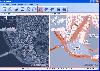
 Free Satellite Maps is a free tool from Google which offers a satellite mapping service worldwide.These are accompanied by a street service, a route planner and information about business in almost all countries.In this way we can fly the world from satellite view or in birds eye.The level of...
Platforms: Windows
| License: Freeware | Size: 612 KB | Download (47): Free Satellite Maps Download |
Released: August 20, 2012
|
Added: August 20, 2012 | Visits: 678
View amazing satellite images of earth with the free version of google earth software.Google earth is a totally free software which enables you zoom in from satellite,view,rotate or tilt just like a camera of the entire earth inside your pc.It works just point and click on any part of earth or by...
Platforms: Windows
| License: Freeware | Size: 798 KB | Download (529): Free Satellite images Download |
Added: July 08, 2013 | Visits: 438
SATGLOBE4 - This file is a higher-resolution version of "SATGLOBE," provided at the request of several users. SATGLOBE4 renders a fully manipulatable satellite view of earth at a resolution of four pixels per degree, with added international political boundaries and gridlines. The imagery was...
Platforms: Matlab
| License: Freeware | Size: 1.22 MB | Download (42): SATGLOBE4 - Visualizing Earth from Space: 3-D Rendering of NASA Satellite Imagery Download |
Released: June 27, 2008
|
Added: July 05, 2008 | Visits: 1.377
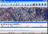
 OMapView is a professional map browser. Both satellite imagery and maps online can be viewed through it. With the cache technology, it improve the user experience of viewing map. And more, the map can be viewed even when the computer is offline. It's a multi-window application, different places...
Platforms: Windows
| License: Shareware | Cost: $29.95 USD | Size: 1.75 MB | Download (131): OMapView Download |
Released: August 29, 2008
|
Added: September 04, 2008 | Visits: 3.643
 Map View is a professional map browser. Both satellite imagery and maps online can be viewed through it. With the cache technology, it improve the user experience of viewing map. And more, the map can be viewed even when the computer is offline. It's a multi-window application, different places...
Platforms: Windows
| License: Shareware | Cost: $29.95 USD | Size: 1.91 MB | Download (274): Map View Download |
Released: August 29, 2008
|
Added: September 12, 2008 | Visits: 2.581
 Map Export is a GIS developer oriented tool for downloading and exporting background image.
For a long time, as a GIS developer, Its well known that to find perfect background images is a suffering and painful task. But since the growing up of Google Map, things have been changed. Google Map...
Map Export is a GIS developer oriented tool for downloading and exporting background image.
For a long time, as a GIS developer, Its well known that to find perfect background images is a suffering and painful task. But since the growing up of Google Map, things have been changed. Google Map...
Platforms: Windows
| License: Shareware | Cost: $499.95 USD | Size: 2.35 MB | Download (172): Map Export Download |
Released: July 18, 2012
|
Added: July 18, 2012 | Visits: 467
 Catfood Desktate is an eye catching earth simulator that combines satellite imagery, near real time cloud data and optional layers including political borders and place names. The continuously updated result can be set as your desktop wallpaper or used as a screensaver. Desktate features include:...
Platforms: Windows
| License: Shareware | Cost: $19.95 USD | Size: 9.8 MB | Download (46): Catfood Desktate Download |
Released: July 01, 2013
|
Added: June 17, 2014 | Visits: 652
 Automapki application brings web mapping and commonly available satellite imagery to AutoCAD / ZWCAD / BricsCAD base DWG editors. It allows to display your project and working area on top of your favourite web mapping source, either Open Street Map, Map Quest, Open Aerial, or any user defined WMS...
Platforms: Windows, Windows 7
| License: Shareware | Cost: $50.00 USD | Size: 102.39 MB | Download (59): Automapki Download |
Added: January 25, 2010 | Visits: 866
McIDAS-Lite is a freely available demo for the full McIDAS software (More info available at http://www.ssec.wisc.edu/mug/)This demo will connect to a variety of free online data sources for satellite data and display the images in a viewing window. Images can be looped, analyzed, and graphics...
Platforms: Mac
| License: Freeware | Size: 18.1 MB | Download (97): McIDAS-Lite Download |
Released: July 15, 2012
|
Added: July 15, 2012 | Visits: 1.173
Our state-of-the art TV on PC Software is the leader of online TV. Millions of copies sold prove that our TV on PC software sets the standard in Online TV!
Free Satellite 4 TV software gives you the opportunity to watch more than
5000 TV channels on your PC without paying monthly fees like you...
Platforms: Windows
| License: Shareware | Cost: $49.95 USD | Size: 1.42 MB | Download (494): Watch TV Online Download |
Released: July 23, 2012
|
Added: July 23, 2012 | Visits: 482
T2K Pro integrates the rich world of GIS datasets and transfers your Geographic information data into Google earth. T2K Pro handles rich data types and access large volumes of geographic data stored in files and databases; T2K PRO handles raster (imagery), Vector Map data and GPS Tracks/...
Platforms: Windows
| License: Shareware | Cost: $90.00 USD | Size: 20.89 MB | Download (54): T2K Pro Download |
Added: January 25, 2010 | Visits: 1.553
DesktopEarth 3D is a tool to visualize our planet. It uses a combination of satellite imagery and calculated data to provide real time views of the entire globe. DesktopEarth 3D features real-time cloud maps, simulated horizons and live pictures of the moon and the sun superimposed on your choice...
Platforms: Mac
| License: Shareware | Cost: $0.00 USD | Download (120): Desktop Earth 3D Download |
Released: November 01, 2011
|
Added: November 30, 2011 | Visits: 1.139
 Global Mapper is more than just a utility; it has built in functionality for distance and area calculations, raster blending, feathering, spectral analysis and contrast adjustment, elevation querying, line of sight calculations, cut-and-fill volume calculations, as well as advanced capabilities...
Platforms: Windows, Other
| License: Shareware | Cost: $399.00 USD | Size: 11.24 MB | Download (110): Create Better Maps with Global Mapper 13 Download |
Released: September 17, 2012
|
Added: September 17, 2012 | Visits: 643
 Global Mapper is more than just a utility; it has built in functionality for distance and area calculations, raster blending, feathering, spectral analysis and contrast adjustment, elevation querying, line of sight calculations, cut-and-fill volume calculations, as well as advanced capabilities...
Platforms: Windows
| License: Demo | Cost: $349.00 USD | Size: 30 MB | Download (547): Global Mapper x64 Download |
Released: August 25, 2012
|
Added: August 25, 2012 | Visits: 594
 Global Mapper is more than just a utility; it has built in functionality for distance and area calculations, raster blending, feathering, spectral analysis and contrast adjustment, elevation querying, line of sight calculations, cut-and-fill volume calculations, as well as advanced capabilities...
Platforms: Windows
| License: Demo | Cost: $349.00 USD | Size: 39.6 MB | Download (537): Global Mapper Download |
Added: May 10, 2013 | Visits: 815
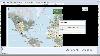
World Wind lets you zoom from satellite altitude into any place on Earth. Leveraging Landsat satellite imagery and Shuttle Radar Topography Mission data, World Wind lets you experience Earth terrain in visually rich 3D, just as if you were really there. Virtually visit any place in the world....
Platforms: Windows, C/C++,
| License: Freeware | Download (74): World Wind Download |
Added: August 22, 2013 | Visits: 432
I wrote GPS Inspector as an experiment to learn more about GPS and how it could be used within JAVA. I figured others might find it useful or interesting so I have posted the source (GPLv3) and binaries here. It uses parts of other java libraries including: World Wind Java, Gpsylon, JFreeChart,...
Platforms: Mac
| License: Freeware | Size: 6.08 MB | Download (44): Gps Inspector Download |
Added: January 25, 2010 | Visits: 649
Home Weather Center (HWC) is a weather graphing, monitoring and analysis application for Mac OS X. HWC is designed as a virtual weather station using Internet based weather sources rather than the more traditional and costly hardware based sensors.As data is gathered and stored in its database...
Platforms: Mac
| License: Shareware | Cost: $0.00 USD | Download (100): Home Weather Center Download |
Released: October 20, 2012
|
Added: October 20, 2012 | Visits: 689
 Features:
View 24K or 100K topographic maps and other topographic data.
Displays maps in 2-D or 3-D, including elevation profiles.
View and rotate maps at any angle.
Create waypoints and routes on your computer and transfer maps, waypoints, routes, tracks and geotagged photos between your...
Features:
View 24K or 100K topographic maps and other topographic data.
Displays maps in 2-D or 3-D, including elevation profiles.
View and rotate maps at any angle.
Create waypoints and routes on your computer and transfer maps, waypoints, routes, tracks and geotagged photos between your...
Platforms: Mac
| License: Freeware | Size: 51 MB | Download (67): Garmin BaseCamp for Mac OS Download |
Added: June 10, 2013 | Visits: 541
This is a program which utilizes the included functions in order to calculate 8 image indices (Bias, Correlation coefficient, DIV, Entropy, ERGAS, Q, RASE and RMSE). The purpose of the program is to produce the results fast, easily and in a convenient way for the user (see Outputs). Initially,...
Platforms: Matlab
| License: Shareware | Cost: $0.00 USD | Size: 194.56 KB | Download (49): Hyperspectral Image Index Analysis Download |