


Exif Gps Data software
Exif Gps Data
Released: October 20, 2012
|
Added: October 20, 2012 | Visits: 474
 Pace & Place is an application for managing and visualizing GPS data and sports training data. It empowers the user to track training events and combine them with geographic data. Map, waypoint, track visualizations and geo-referencing of photos.
Platforms: Windows, Mac, Linux
| License: Freeware | Size: 38.31 MB | Download (47): Pace & Place Download |
Added: November 11, 2013 | Visits: 481
Viking is a free/open source program to manage GPS data. You can import and plot tracks and waypoints, show OpenStreetMap and/or Terraserver maps under it, download geocaches for an area on the map, make new tracks and waypoints, see real-time GPS position, etc.
Platforms: Mac
| License: Freeware | Size: 993.28 KB | Download (38): Viking Download |
Added: October 04, 2013 | Visits: 376
MTKBabel is a Perl program to operate the i-Blue 747 GPS data logger. It should work also with other GPS devices based on the MediaTek MTK chipset. It is free software released under the GPL license. Features . Download data from GPS logger based on MediaTek MTK chip . Configure logging...
Platforms: *nix
| License: Freeware | Size: 30.72 KB | Download (37): MTKBabel Download |
Added: August 07, 2013 | Visits: 356
GPSDproxy is a small program which reads GPS data from a running gpsd process (http://gpsd.berlios.de/) and forwards it to a remote server via an UDP connection. GPSDproxy is intended to be run on GPS enabled mobile devices. Features . Read GPS data from gpsd . Forward data to a remote...
Platforms: *nix
| License: Freeware | Size: 71.68 KB | Download (36): GPSDproxy Download |
Released: November 22, 2013
|
Added: December 08, 2013 | Visits: 824
 JPEG Picture Auto-Rotator helps users automatically rotate pictures/photos/images in JPEG format into the correct orientation based by the EXIF meta data stored in the
pictures by digital cameras.
JPEG Picture Auto-Rotator runs on Windows XP or later systems. It's free for personal and...
JPEG Picture Auto-Rotator helps users automatically rotate pictures/photos/images in JPEG format into the correct orientation based by the EXIF meta data stored in the
pictures by digital cameras.
JPEG Picture Auto-Rotator runs on Windows XP or later systems. It's free for personal and...
Platforms: Windows, Windows 8, Windows 7
| License: Freeware | Size: 92.66 KB | Download (45): JPEG Picture Auto Rotator Download |
Added: October 14, 2006 | Visits: 5.925
 Opanda PowerExif is a professional tool to edit Exif data in images. As the best assistant to edit & modify images information for photographers, image pickers, PowerExif allows to edit & modify all Exif data freely. Not only you could manage and record photographic data and GPS data of images,...
Platforms: Windows
| License: Shareware | Cost: $89.99 USD | Size: 1.2 MB | Download (665): Opanda PowerExif Editor Download |
Released: May 25, 2018
|
Added: June 25, 2018 | Visits: 3.605
 HoudahGeo is a photo geocoding and geotagging tool for Mac. Use HoudahGeo to attach GPS coordinates and location names to your photos.
HoudahGeo writes EXIF and XMP geotags to JPEG and RAW image files. This creates a permanent record of where a photo was taken. Just like a GPS-enabled camera....
HoudahGeo is a photo geocoding and geotagging tool for Mac. Use HoudahGeo to attach GPS coordinates and location names to your photos.
HoudahGeo writes EXIF and XMP geotags to JPEG and RAW image files. This creates a permanent record of where a photo was taken. Just like a GPS-enabled camera....
Platforms: Mac
| License: Demo | Cost: $39.00 USD | Size: 22.87 MB | Download (837): HoudahGeo Download |
Added: August 19, 2010 | Visits: 1.220
GPS::Babel is a Perl interface to gpsbabel. SYNOPSIS use GPS::Babel; my $babel = GPS::Babel->new(); # Read an OZIExplorer file into a data structure my $data = $babel->read(route.ozi, ozi); # Convert a file automatically choosing input and output # format based on extension...
Platforms: *nix
| License: Freeware | Size: 10.24 KB | Download (120): GPS::Babel Download |
Released: July 31, 2017
|
Added: August 13, 2017 | Visits: 5.040
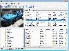 Photo EXIF Manager
 lets you read and edit EXIF tags of many popular cameras.
Photo EXIF Manager lets you view and edit most well-known digital photo EXIF tags. The edit capability extends to the more recent GPS tags too. All tags are listed in a table and grouped into...
Photo EXIF Manager
Photo EXIF Manager lets you read and edit EXIF tags of many popular cameras.
Photo EXIF Manager lets you view and edit most well-known digital photo EXIF tags. The edit capability extends to the more recent GPS tags too. All tags are listed in a table and grouped into...
Platforms: Windows, Windows 8, Windows 7, Windows Server
| License: Shareware | Cost: $19.99 USD | Size: 792 KB | Download (447): Photo EXIF Manager Download |
Released: April 10, 2002
|
Added: August 09, 2006 | Visits: 6.650
Most modern digital cameras save information about the camera settings and picture taking conditions in the images they take. This information is stored using a standard format called EXIF.
The EXIFutils are a set of command line utilities that extract, add, remove, replace, and copy EXIF...
Platforms: Windows
| License: Shareware | Cost: $14.95 USD | Size: 1.03 MB | Download (377): EXIFutils for Windows Download |
Released: April 10, 2002
|
Added: May 10, 2006 | Visits: 5.311
Most modern digital cameras save information about the camera settings and picture taking conditions in the images they take. This information is stored using a standard format called EXIF.
The EXIFutils are a set of command line utilities that extract, add, remove, replace, and copy EXIF...
Platforms: *nix
| License: Shareware | Cost: $14.95 USD | Size: 632 KB | Download (601): EXIFutils for Solaris Download |
Released: October 26, 2009
|
Added: November 03, 2009 | Visits: 4.701
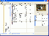 Exif Pilot Lite supports the following formats: JPEG, TIFF, PNG, DNG, NEF PEF, CRW, JP2, PSD, CR2, MRW, ARW, SR2, ORF, RAF.
View EXIF:
* Select a folder with images on the Folders panel (1).
* Choose a file on the Files Table (2).
* Read the information about the photo on the...
Exif Pilot Lite supports the following formats: JPEG, TIFF, PNG, DNG, NEF PEF, CRW, JP2, PSD, CR2, MRW, ARW, SR2, ORF, RAF.
View EXIF:
* Select a folder with images on the Folders panel (1).
* Choose a file on the Files Table (2).
* Read the information about the photo on the...
Platforms: Windows
| License: Freeware | Size: 1.74 MB | Download (1893): Exif Pilot Lite Download |
Released: April 09, 2010
|
Added: July 05, 2010 | Visits: 3.474
 The Tro GPS Simulator provides a complete suite for all your GPS simulating needs and more. The Tro GPS Simulator uses the international standardized protocol NMEA-0183 for GPS data exchange. It can simulataneously send and recieve data.Furthermore it provides several input methods for GPS...
Platforms: Windows
| License: Demo | Cost: $99.00 USD | Size: 5.73 MB | Download (884): Tro GPS Simulator Download |
Released: September 02, 2012
|
Added: September 02, 2012 | Visits: 638
Develop precise, efficient, and reliable GPS software in record time with this multithreaded component for desktop and mobile devices, including PocketPC, Windows CE, Tablet PC, Smartphone and now Windows Mobile! Over fifty classes in one lightweight assembly give you unparalleled features while...
Platforms: Windows, Pocket PC, Handheld/Mobile Other
| License: Shareware | Cost: $279.00 USD | Size: 10.34 MB | Download (51): GPS.NET Download |
Added: August 12, 2008 | Visits: 1.500
 GPS library VB (.NET) toolkit reads and decodes standard GPS NMEA 183 sentences from the RS232 serial port as well as computes great circle distances and bearings. Runs as a background thread unattended. Works with Bluetooth and USB. The most current GPS data is always available on demand....
Platforms: Windows
| License: Shareware | Cost: $105.00 USD | Size: 303 KB | Download (113): MarshallSoft GPS Component for VB Download |
Released: December 29, 2010
|
Added: January 06, 2011 | Visits: 4.315
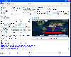
 OkMap is a GPS and map software that:
-Works with vectorial maps and calibrates raster maps
-Organizes paths by creating waypoints, routes and tracks
-Uploads/downloads data to/from your GPS
-Uses altitude DEM data
-Supports GPS real-time navigation
-Sends/receives vehicles position...
OkMap is a GPS and map software that:
-Works with vectorial maps and calibrates raster maps
-Organizes paths by creating waypoints, routes and tracks
-Uploads/downloads data to/from your GPS
-Uses altitude DEM data
-Supports GPS real-time navigation
-Sends/receives vehicles position...
Platforms: Windows
| License: Freeware | Size: 20.25 MB | Download (1277): OkMap Download |
Released: January 15, 2014
|
Added: January 21, 2014 | Visits: 1.060
 AntiPhotoSpy removes private information from photos to protect your privacy.
Did you know that each image carries text information along with its picture? This information contains data about various things including the name of the application that you have used for editing the image (e.g....
AntiPhotoSpy removes private information from photos to protect your privacy.
Did you know that each image carries text information along with its picture? This information contains data about various things including the name of the application that you have used for editing the image (e.g....
Platforms: Windows, Windows 7
| License: Shareware | Cost: $10.00 USD | Size: 3.82 MB | Download (133): AntiPhotoSpy Download |
Added: March 23, 2013 | Visits: 439
The purpose of E-Collaboration for GPS/DGPS is to provide a GIS collaboration environment for the world over Internet, in which people can share and assess their measured GPS data.
Platforms: PHP
| License: Shareware | Cost: $0.00 USD | Size: 491.52 KB | Download (40): E-Collaboration for GPS/DGPS Download |
Added: June 26, 2013 | Visits: 406
The JavaGPS package enables Java applications to talk to attached GPS devices that conform to the NMEA0183 protocol. JavaGPS has the following key features: Auto-detection of attached GPS device Recording and playback of GPS data Supports raw GPS logs and has an optimised log file format....
Platforms: *nix
| License: Freeware | Size: 522.24 KB | Download (34): JavaGPS - access GPS devices from Java Download |
Added: January 09, 2006 | Visits: 3.142
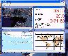 - you can show a current GPS data (Speed, Direction, Longitude, Latitude, Time, Date, Height);
- you can open any of scanned maps (in a "bmp" or "dib" format);
- you can calibrate the scanned maps yourself by two calibration points only (left-top and right-bottom);
- calibrations are stored...
- you can show a current GPS data (Speed, Direction, Longitude, Latitude, Time, Date, Height);
- you can open any of scanned maps (in a "bmp" or "dib" format);
- you can calibrate the scanned maps yourself by two calibration points only (left-top and right-bottom);
- calibrations are stored...
Platforms: Windows
| License: Demo | Cost: $9.50 USD | Size: 3.58 MB | Download (537): VIGps Download |