


Europe Maps And Routes software
Europe Maps And Routes
Added: March 28, 2013 | Visits: 442
 Plot earth in 3D sphereSeveral maps and resolutions are availableMore comprehensive map collection is available athttp://www.mediafire.com/?m2mn1mgdngt
Platforms: Matlab
| License: Freeware | Size: 17.82 MB | Download (39): Plot earth Download |
Added: May 15, 2013 | Visits: 320
CloudMade is a set of services for building maps and map applications that utilizes OpenStreetMap data. This project provides integration between Drupal and CloudMade.StatusThis project is very young and still getting its wings. The goal is to be a very lightweight integration point between...
Platforms: PHP
| License: Freeware | Size: 10 KB | Download (44): CloudMade Download |
Added: March 23, 2013 | Visits: 454
Uses Google Static Maps API to display non interactive maps and links to a real google map for the CCK fields in these modules: Addresses & LocationCurrent Formatters: * Single Loc - address text -> links to google map * Single Loc - Loc Name n address text | "Get Directions" links to google map...
Platforms: PHP
| License: Freeware | Size: 10 KB | Download (46): Location Display Download |
Added: October 12, 2013 | Visits: 437
An exceptional tool for drawing publication and vector catalog quality maps and designing cloning experiments. SimVector: Software to draw accurate plasmid maps Exceptional Publication Quality Plasmid Maps Whether you are a catalog company selling engineered plasmids or conducting restriction...
Platforms: Mac
| License: Demo | Cost: $0.00 USD | Size: 14.6 MB | Download (36): SimVector Download |
Added: October 26, 2013 | Visits: 382
Cartographica allows you to use your Mac to explore and refine data, create beautiful maps, export information for the web using Google Maps and Google Earth (via our KML Export capabilities). Merge data from several sources. Get local data from your government in CSV Latitude and Longitude (or...
Platforms: Mac
| License: Shareware | Cost: $495.00 USD | Size: 45.76 MB | Download (41): Cartographica Download |
Added: September 02, 2013 | Visits: 437
Codename: X-Phase is a simple online first person shooter with random generated maps and landscape deformation, written in Java and OpenGL (LWJGL).X-Phase uses it's own engine and runs with Linux, Mac OS X and Windows.
Platforms: *nix
| License: Freeware | Size: 11.77 MB | Download (35): Codename: X-Phase Download |
Released: October 31, 2014
|
Added: November 18, 2014 | Visits: 593
 Vextractor Lite is an auto-tracing program for converting raster images into vector formats by building centerlines and outlines. This tool could be used for the tracing photo, logotypes and other line art images for use in Vector Graphics Design software. You can also vectorize charts,...
Platforms: Windows, Windows 8, Windows 7
| License: Shareware | Cost: $49.95 USD | Size: 13.24 MB | Download (39): Vextractor Lite Download |
Released: March 03, 2015
|
Added: March 03, 2015 | Visits: 1.129
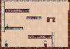 Play Hall Maze Game online for free. It is puzzle horrible adventures game and you must move the tiny object on the screen without touching any of the walls. This game creates hall maps and has many options. We hope you will enjoy this free online Hall Maze Game.
Platforms: Windows, Windows 7
| License: Freeware | Size: 3.31 MB | Download (52): Hall Maze Game Download |
Released: March 14, 2019
|
Added: June 26, 2022 | Visits: 1.141
 Raster to Vector Converter Command Line is a professional software for converting raster images to vector (vectorizer). Raster to Vector Converter Command Line converts drawings, maps and other images, including photo, logos, black-and-white illustrations from raster to vector format. The program...
Platforms: Windows, Windows 8, Windows 7, Windows Server
| License: Shareware | Cost: $299.00 USD | Size: 4.14 MB | Download (117): VeryUtils Raster to Vector Converter Command Line Download |
Released: June 13, 2012
|
Added: June 13, 2012 | Visits: 724
 View maps of Earth and other planets with PrettyMap! See current day and night regions, learn geography by taking the quiz, enjoy 3D elevation surfaces, measure distances between locations and create your own maps with special places! PrettyMap lets you view vector and raster maps and images...
Platforms: Windows, Pocket PC
| License: Shareware | Cost: $19.95 USD | Size: 4.02 MB | Download (56): PrettyMap - World Atlas and Maps, GPS Download |
Released: April 21, 2008
|
Added: February 04, 2009 | Visits: 1.481
 FusionMaps v3 helps you create animated, interactive and data-driven Flash Maps for your dynamic web applications. Using FusionMaps, you can display geographical data distributed by category, regions or entities. Ideal usage examples are statistical display of data, flight routes, office...
Platforms: Windows, Mac, *nix
| License: Shareware | Cost: $199.00 USD | Size: 26.77 MB | Download (144): FusionMaps Download |
Added: May 22, 2010 | Visits: 1.532
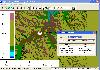
Maps project is a topographal map and aerial photo generator and viewer. Maps allows users to generate topographical maps and aerial photographs of any region in the United States. It uses data provided by the USGS through the geoserver system. The interactive view lets you move around,...
Platforms: *nix
| License: Freeware | Size: 11.26 KB | Download (139): Maps Download |
Released: January 12, 2012
|
Added: February 04, 2012 | Visits: 1.492
 Bubble maps software does scatter plot and circle charts in Excel, useful for advanced business analysis.
Excel provides the ability to draw bubble maps and scatter plots, but they are less refined than a bubble map you can make with the Smart Bubble Charts software. In Excel: (1) Chart...
Bubble maps software does scatter plot and circle charts in Excel, useful for advanced business analysis.
Excel provides the ability to draw bubble maps and scatter plots, but they are less refined than a bubble map you can make with the Smart Bubble Charts software. In Excel: (1) Chart...
Platforms: Windows
| License: Shareware | Cost: $54.65 USD | Size: 16.32 MB | Download (126): Bubble Maps Software Download |
Released: August 13, 2012
|
Added: August 13, 2012 | Visits: 687
Anquet Maps for Mac is mapping, route-planning navigation software used by professional mountain guides, top mountain athletes, outdoor training centres and thousands of everyday walkers, climbers and cyclists.
With Anquet Maps for Mac you can create routes on real OS maps to print or transfer...
Platforms: Mac
| License: Freeware | Size: 4.8 MB | Download (54): Anquet Maps Download |
Released: December 29, 2010
|
Added: January 06, 2011 | Visits: 4.315
 OkMap is a GPS and map software that:
-Works with vectorial maps and calibrates raster maps
-Organizes paths by creating waypoints, routes and tracks
-Uploads/downloads data to/from your GPS
-Uses altitude DEM data
-Supports GPS real-time navigation
-Sends/receives vehicles position...
OkMap is a GPS and map software that:
-Works with vectorial maps and calibrates raster maps
-Organizes paths by creating waypoints, routes and tracks
-Uploads/downloads data to/from your GPS
-Uses altitude DEM data
-Supports GPS real-time navigation
-Sends/receives vehicles position...
Platforms: Windows
| License: Freeware | Size: 20.25 MB | Download (1277): OkMap Download |
Released: November 01, 2011
|
Added: November 30, 2011 | Visits: 1.138
 Global Mapper is more than just a utility; it has built in functionality for distance and area calculations, raster blending, feathering, spectral analysis and contrast adjustment, elevation querying, line of sight calculations, cut-and-fill volume calculations, as well as advanced capabilities...
Platforms: Windows, Other
| License: Shareware | Cost: $399.00 USD | Size: 11.24 MB | Download (110): Create Better Maps with Global Mapper 13 Download |
Released: August 25, 2012
|
Added: August 25, 2012 | Visits: 418
To investigate, describe and develop methods and approaches to generating maps with computers. This is not another GIS project. This one is focused on how to develop programs which make useful end user maps and programs using map backgrounds.
Platforms: Windows, Mac, BSD, Solaris, Linux
| License: Freeware | Size: 16.57 MB | Download (49): Making Maps With Computers Download |
Released: September 05, 2010
|
Added: September 17, 2010 | Visits: 3.743
 PolyMap is a desktop mapping program that lets you use your own data to customize the maps supplied with the program. Use the built-in spreadsheet to enter data or paste it from other Windows applications. Alternatively, you can use the import feature to bring in data from external spreadsheets,...
Platforms: Windows
| License: Shareware | Cost: $89.95 USD | Size: 7.37 MB | Download (712): Polymap Download |
Added: September 02, 2006 | Visits: 3.002
The Legendary Tales Engine is the program which is used for playing the adventures created with the Editor. Unlike many other text-based programs it does not have a command line and the user acts with the use of a well developed GUI. The Engine also supports the loading of pictures and maps for...
Platforms: Windows
| License: Freeware | Size: 1.68 MB | Download (359): The Legendary Tales Engine and Editor Download |
Released: June 27, 2008
|
Added: July 05, 2008 | Visits: 1.377
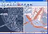 OMapView is a professional map browser. Both satellite imagery and maps online can be viewed through it. With the cache technology, it improve the user experience of viewing map. And more, the map can be viewed even when the computer is offline. It's a multi-window application, different places...
Platforms: Windows
| License: Shareware | Cost: $29.95 USD | Size: 1.75 MB | Download (131): OMapView Download |