


Europe Gps Maps software
Europe Gps Maps
Added: May 13, 2010 | Visits: 1.336
 GPS::Lowrance is a Perl module connect to Lowrance and Eagle GPS devices. REQUIREMENTS The following modules are required to use this module: Carp::Assert GPS::Lowrance::LSI 0.23 Parse::Binary::FixedFormat Win32::SerialPort or Device::SerialPort If you will be using the...
Platforms: *nix
| License: Freeware | Size: 22.53 KB | Download (139): GPS::Lowrance Download |
Added: September 18, 2010 | Visits: 1.593
GPS::Lowrance::Trail is a Perl module to convert between GDM16 Trails and other formats. Installation: Installation is pretty standard: perl Makefile.PL make make test make install There is no test suite to speak of. One will be added in a later version. SYNOPSIS use...
Platforms: *nix
| License: Freeware | Size: 8.19 KB | Download (113): GPS::Lowrance::Trail Download |
Added: January 25, 2010 | Visits: 1.304
GPS Connect is a freeware program for Mac OS X which offers connectivity to Garmin GPS receivers. The intended use is to backup waypoints from the GPS to your computer. Downloaded waypoints may be saved in a native file format or exported to a variety of other formats such as tab-delimited,...
Platforms: Mac
| License: Freeware | Size: 1.2 MB | Download (108): GPS Connect Download |
Released: April 09, 2010
|
Added: July 05, 2010 | Visits: 3.474
 The Tro GPS Simulator provides a complete suite for all your GPS simulating needs and more. The Tro GPS Simulator uses the international standardized protocol NMEA-0183 for GPS data exchange. It can simulataneously send and recieve data.Furthermore it provides several input methods for GPS...
Platforms: Windows
| License: Demo | Cost: $99.00 USD | Size: 5.73 MB | Download (884): Tro GPS Simulator Download |
Released: July 21, 2010
|
Added: September 25, 2010 | Visits: 1.346
 Toolkit to add GPS and coordinate conversion functionality to your software and scripts (GPS API). All NMEA0183 protocol versions are supported and can be filtered by NMEA sentence type and talker ID. Garmin USB PVT support. Information on GPS status can also be retrieved: GPS fix quality,...
Platforms: Windows
| License: Shareware | Cost: $99.00 USD | Size: 2.2 MB | Download (121): Eye4Software GPS API Download |
Released: January 12, 2012
|
Added: February 04, 2012 | Visits: 1.492
 Bubble maps software does scatter plot and circle charts in Excel, useful for advanced business analysis.
Excel provides the ability to draw bubble maps and scatter plots, but they are less refined than a bubble map you can make with the Smart Bubble Charts software. In Excel: (1) Chart...
Bubble maps software does scatter plot and circle charts in Excel, useful for advanced business analysis.
Excel provides the ability to draw bubble maps and scatter plots, but they are less refined than a bubble map you can make with the Smart Bubble Charts software. In Excel: (1) Chart...
Platforms: Windows
| License: Shareware | Cost: $54.65 USD | Size: 16.32 MB | Download (126): Bubble Maps Software Download |
Released: February 09, 2014
|
Added: March 16, 2014 | Visits: 1.889
 The Vutog GPS Simulator provides a complete suite for all your GPS simulation needs and more. It is designed to assist in developing, testing and debugging GPS Applications and equipment working with the NMEA-0183 protocol. It can be used for testing navigation applications and equipments indoor...
Platforms: Windows, Windows 7
| License: Shareware | Cost: $149.00 USD | Size: 5.75 MB | Download (164): Vutog GPS Simulator Download |
Released: October 23, 2012
|
Added: October 23, 2012 | Visits: 650
GPS Utility is an easy-to-use application that provides management and manipulation of GPS information. You can use it to transfer data to/from a GPS receiver and store the data in PC files in one of several text formats.
The program converts between different map datums and many coordinate...
Platforms: Windows
| License: Freeware | Size: 1.87 MB | Download (469): GPS Utility Download |
Released: June 03, 2012
|
Added: June 03, 2012 | Visits: 723
The Genome Positioning System (GPS) is a software tool to study protein-DNA interaction using ChIP-Seq data. GPS builds a probabilistic mixture model to predict the most likely positions of binding events at single-base resolution.
GPS is a Java software, so it runs on multiple platforms,...
Platforms: Windows
| License: Freeware | Download (430): GPS Download |
Released: October 26, 2012
|
Added: October 26, 2012 | Visits: 527
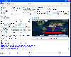
 See satellite-eye views of different parts of Europe. See pictures of Spain, England, France, Denmark, Sweden, Ireland, Germany, Italy and more.This 32-bit screen-saver engine rotates photos of different locations of Europe as seen on clear days from the earth's orbit. Over a dozen visual effects...
Platforms: Windows
| License: Shareware | Cost: $14.95 USD | Size: 2.19 MB | Download (46): A View fom Space- Europe Screensaver Download |
Released: September 02, 2012
|
Added: September 02, 2012 | Visits: 638
Develop precise, efficient, and reliable GPS software in record time with this multithreaded component for desktop and mobile devices, including PocketPC, Windows CE, Tablet PC, Smartphone and now Windows Mobile! Over fifty classes in one lightweight assembly give you unparalleled features while...
Platforms: Windows, Pocket PC, Handheld/Mobile Other
| License: Shareware | Cost: $279.00 USD | Size: 10.34 MB | Download (51): GPS.NET Download |
Released: November 18, 2012
|
Added: November 18, 2012 | Visits: 617
 The simulator provides a complete suite for all your GPS simulating needs. You can: * Replay your GPS logfiles * Multiplex your GPS receivers * Transform your GPS receiver interface * Bridge a remote GPS receiver
Platforms: Windows
| License: Shareware | Cost: $99.00 USD | Size: 4.89 MB | Download (54): GPS-Simulator Download |
Released: September 24, 2012
|
Added: September 24, 2012 | Visits: 917
This software development kit (SDK) provides the binaries and programming reference for the Bing Maps WPF Control (Beta).
When the installation completes, you can choose to open the Bing Maps WPF Control (Beta) SDK help file (BingMapsWPFControlSDK.chm).
Get Bing Maps WPF Control and give it a...
Platforms: Windows, XP, 2003, Windows Vista, 2008, 7
| License: Freeware | Download (52): Bing Maps WPF Control Download |
Released: November 12, 2012
|
Added: November 12, 2012 | Visits: 485
 Create and edit waypoints, tracklogs, routes, and insert scanned images of map. More than 160 GPS models recognized. Garmin, Magellan, Eagle and others
- Most complete free program for GPS devices
- Compatible with more than 160 GPS models
- Support for Garmin, Magellan and others
- Easily...
Create and edit waypoints, tracklogs, routes, and insert scanned images of map. More than 160 GPS models recognized. Garmin, Magellan, Eagle and others
- Most complete free program for GPS devices
- Compatible with more than 160 GPS models
- Support for Garmin, Magellan and others
- Easily...
Platforms: Windows
| License: Freeware | Size: 54.92 MB | Download (57): GPS TrackMaker Download |
Released: June 17, 2012
|
Added: June 17, 2012 | Visits: 864
![]() GPS Tracker Data Logger acts as the server and allows you to collect data from an unlimited number of various GPS trackers simultaneously. The obtained data is processed, uniformed and written to a log file or a database. Also, the program has a set of interfaces so other applications can get...
GPS Tracker Data Logger acts as the server and allows you to collect data from an unlimited number of various GPS trackers simultaneously. The obtained data is processed, uniformed and written to a log file or a database. Also, the program has a set of interfaces so other applications can get...
Platforms: Windows
| License: Shareware | Cost: $100.00 USD | Size: 11.83 MB | Download (64): GPS Tracker Data Logger Download |
Released: October 08, 2012
|
Added: October 08, 2012 | Visits: 576
 Virtual GPS is a GPS simulator software. You can use it to simulate a GPS receiver unit connected to your system. It's ideal when you need GPS input, but you have no signal or for development purposes. It supports various NMEA sentences, so it can be used with any GPS mapping software. You can...
Platforms: Windows, Other
| License: Shareware | Cost: $39.99 USD | Size: 946 KB | Download (74): Virtual GPS Download |
Released: September 27, 2012
|
Added: September 27, 2012 | Visits: 705
 Complex of programs FPS provide remote monitoring of GPS receivers and visualize data on a computer operator. The program presented for the free use can track the position of only one GPS-receiver. As GPS receivers can be used smartphone with GPS operating systems to Windows Mobile 5 or 6 and...
Platforms: Windows, Mac, Unix, Linux, Linux Gnome, Linux GPL, Linux Open Source
| License: Freeware | Size: 7.85 MB | Download (53): FPS система GPS мониторинга Download |
Released: June 13, 2012
|
Added: June 13, 2012 | Visits: 936
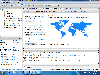
 Add realistic 3D capabilities to your online Bing Maps. Bing Maps 3D brings you another step closer to knowing "what it is like out there". You can search, browse, and organize local information viewed in three dimensions, just the way it exists in the real world. This enables you to more...
Platforms: Windows
| License: Freeware | Size: 1.2 MB | Download (511): Microsoft Bing Maps 3D Download |
Released: November 07, 2012
|
Added: November 07, 2012 | Visits: 616
 With this tool you can add GPS coordinates to vCards - electronic business cards - that you have previously exported from e. g. Microsoft Outlook. Therefore the tool uses the address data contained within the vCards and adds the exact GPS position on that basis to the vCard. This way you can use...
Platforms: Windows
| License: Freeware | Size: 1.47 MB | Download (503): GPS to vCard Download |
Released: August 07, 2012
|
Added: August 07, 2012 | Visits: 535
Hitler's Europe is an interactive software program. With over 150 (inc. zooms) full colour digital elevation data maps of Europe, USSR, North Africa and the Middle East, accompanied by 66,000 words of text in over 300 separate articles, Hitler's Europe is a very powerful and easy to use learning...
Platforms: Windows
| License: Demo | Cost: $54.99 USD | Size: 2.41 MB | Download (519): Hitler's Europe 1914-45: The Animated Atlas of the Download |