


Coordinate software
Coordinate
Released: November 20, 2015
|
Added: April 20, 2016 | Visits: 3.087
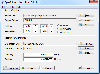 The Eye4Software Coordinate Calculator is an easy to use tool to perform map or GPS coordinate conversions. The software can be used to transform a single coordinate or a batch of coordinates read from a comma separated, database or ESRI shapefiles. The software is shipped with a MS Access...
Platforms: Windows, Windows 7
| License: Shareware | Cost: $119.00 USD | Size: 8.96 MB | Download (249): Eye4Software Coordinate Calculator Download |
Released: August 19, 2012
|
Added: August 19, 2012 | Visits: 661
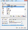 The Eye4Software Coordinate Calculator is an easy to use desktop software tool, to perform gps coordinate conversions from one coordinate system to another. It can also be used to convert coordinates between different map datums. The software can be used to convert a single coordinate, or to...
Platforms: Windows
| License: Shareware | Cost: $43.51 USD | Size: 1.4 MB | Download (462): Coordinate Calculator Download |
Released: September 17, 2012
|
Added: September 17, 2012 | Visits: 504
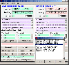
 GISEYE Coordinate Converter software is designed for conversion of coordinates from one map projection into another. List of coordinates and map projection parameters are specified by the user.This software product works under Windows and has an easy-to-use GUI. The application enables to do file...
Platforms: Windows
| License: Shareware | Cost: $29.00 USD | Size: 4.35 MB | Download (458): GISEYE Coordinate Converter Download |
Added: August 18, 2013 | Visits: 520
A collection of utilities for translating GPS coordinates to related coordinate systems (Earth Centere Fixed, Topocentric, UTM) with auxiliary routins for horizon computation and ray ellipsoid intercepts.
Platforms: Matlab
| License: Freeware | Size: 1.28 MB | Download (57): GPS Coordinate Transformations Download |
Added: March 31, 2013 | Visits: 544
Polar Parallel Coordinate Geometry (PPCG) plots standardardised time series data. Colour is used to demonstrate data through time; black being the oldest to white being the newest. 2 - 3 Std deviation warning/action limits are also highlighted by yellow/red respectively.
Platforms: Matlab
| License: Freeware | Size: 10 KB | Download (51): Polar Parallel Coordinate Geometry Download |
Added: June 29, 2013 | Visits: 485
This package has solvers for constrained and unconstrained L1 minimization, which is useful for compressed sensing. u = COORDL1BREG(A,f,lambda) solves the minimization problem min_u ||u||_1 subject to A*u = fwhere A is an MxN matrix and f is a vector of length M. Input lambda is a positive...
Platforms: Matlab
| License: Freeware | Size: 10 KB | Download (44): Coordinate descent for Compressed Sensing Download |
Added: April 09, 2013 | Visits: 982
XYZ2YBC convert form XYZ coordinate to YBC format (LRA)XYZ2YBC(X,Y,Z) convert the X,Y,Z values to Y,B,C values. assuming the bend radius is zero. the size of X,Y and Z must be the same.XYZ2YBC(X,Y,Z,R) where R is the bend radius. convert the X,Y,Z values toY,B,C values, taking in to account the...
Platforms: Matlab
| License: Shareware | Cost: $0.00 USD | Size: 10 KB | Download (134): Convert form XYZ coordinate to YBC format (LRA) Download |
Added: September 06, 2013 | Visits: 443
The function calculates the Global to Local coordinate transformation matrix for a beam in space. [x0,y0,z0] and [x1,y1,z1] are the coordinates of the beam ends. alpha is the twist over the axis perpendicular to the beam cross sectional area, usually set to 0.
Platforms: Matlab
| License: Shareware | Cost: $0.00 USD | Size: 10 KB | Download (41): Global to Local Coordinate Transformation Matrix Download |
Added: September 16, 2013 | Visits: 291
Use this function to extract one geographical coordinate out of an input string. The function is extremely flexible, thus the coordinate may be located anywhere in the string and may have one of many formats.Examples:txt2coord(' 100dlT- 7'' 30" W')txt2coord(' 100dlT- 7dlDL 30dlDLdlDL...
Platforms: Matlab
| License: Shareware | Cost: $0.00 USD | Size: 10 KB | Download (39): Coordinate Extractor Download |
Added: May 17, 2013 | Visits: 416
MATLAB does not have any built-in functionality for centering the coordinate axes around the origin. This tool is a first fix for solving this. An example script is included showing how to use the function.Tested on MATLAB 2007b. Works fine, as long as the figure is not resized after the function...
Platforms: Matlab
| License: Shareware | Cost: $0.00 USD | Size: 10 KB | Download (49): Centered coordinate axes in 2D plots Download |
Released: July 13, 2017
|
Added: August 30, 2017 | Visits: 4.508
 TRANSDAT geosoftware executes coordinate transformations and geodetic datum shifts between many coordinate and reference systems of America, Australasia, Europe, Germany special and world-wide, with high precision and high speed: 1.The current and historical coordinate and reference systems of...
Platforms: Windows, Windows 8, Windows 7, Windows Server
| License: Shareware | Cost: $170.00 USD | Size: 4.43 MB | Download (325): TRANSDAT Download |
Released: December 30, 2019
|
Added: January 08, 2020 | Visits: 3.971
 SEVENPAR is a tool for the calculation of highly exact transformation parameters for the Spatial Helmert and Molodensky Transformation, which make possible precise coordinate transformations from one reference system into another. The determined transformation parameters can be entered directly...
Platforms: Windows, Windows 8, Windows 7, Windows Server
| License: Shareware | Cost: $145.00 USD | Size: 2.78 MB | Download (194): SEVENPAR Download |
Added: September 16, 2006 | Visits: 2.491
 In the Dynamic Link Library GeoDLL geodesic functions like coordinate transformation, reference system changes, meridian strip changes, user defined coordinate and reference systems, distance calculation, maps functions and more geodesic functions are contained to bind them into own applications....
Platforms: Windows, Windows CE
| License: Shareware | Cost: $290.00 USD | Size: 1.01 MB | Download (112): GEODLL32 Download |
Released: December 30, 2019
|
Added: January 08, 2020 | Visits: 3.184
 TOPOWIN is a state-wide register of the German Topographic Cartographies, the German Basic Cartography and of localities with geo references in different coordinate systems. It is also a topographic information system. In the division of planning and execution of economical and scientific...
Platforms: Windows, Windows 8, Windows 7, Windows Server
| License: Shareware | Cost: $125.00 USD | Size: 4.56 MB | Download (271): TOPOWIN Download |
Added: April 29, 2006 | Visits: 2.657
 In the Dynamic Link Library GeoDLL geodesic functions like coordinate transformation, reference system changes, meridian strip changes, user defined coordinate and reference systems, distance calculation, maps functions and more geodesic functions are contained to bind them into own applications....
Platforms: Windows, Windows CE
| License: Shareware | Cost: $290.00 USD | Size: 1.02 MB | Download (120): GEODLL32 (English) Download |
Released: May 28, 2010
|
Added: June 04, 2010 | Visits: 2.698
 Copan for Windows desktop/netbook is a very functional and easy-to-use geomatics engineering tool for computing and managing plane land surveying and mapping coordinates.
It does numerous coordinate geometry (COGO) calculations, processes and adjusts raw field survey data, computes and...
Copan for Windows desktop/netbook is a very functional and easy-to-use geomatics engineering tool for computing and managing plane land surveying and mapping coordinates.
It does numerous coordinate geometry (COGO) calculations, processes and adjusts raw field survey data, computes and...
Platforms: Windows
| License: Freeware | Size: 5.28 MB | Download (824): Copan for Windows Download |
Added: September 22, 2010 | Visits: 1.574
GIS::Distance::Polar can do Polar coordinate flat-earth distance calculations. SYNOPSIS my $calc = GIS::Distance::Polar->new(); my $distance = $calc->distance( $lon1, $lat1 => $lon2, $lat2 ); Supposedly this is a formula to better calculate distances at the poles. While implimented, this...
Platforms: *nix
| License: Freeware | Size: 8.19 KB | Download (165): GIS::Distance::Polar Download |
Added: November 05, 2010 | Visits: 1.171
PDL::Transform is a Perl module that coordinate transforms, image warping, and N-D functions. SYNOPSIS use PDL::Transform; my $t = new PDL::Transform:: ( ) $out = $t->apply($in) # Apply transform to some N-vectors (Transform method) $out = $in->apply($t) # Apply transform to some...
Platforms: *nix
| License: Freeware | Size: 2.1 MB | Download (108): PDL::Transform Download |
Released: November 17, 2009
|
Added: April 17, 2010 | Visits: 2.522
 CopanMobile for Pocket PC is a very functional and easy-to-use geomatics engineering tool for computing and managing plane surveying and mapping coordinates.
It does numerous coordinate geometry (COGO) calculations, processes and adjusts raw field survey data, computes and adjusts map...
CopanMobile for Pocket PC is a very functional and easy-to-use geomatics engineering tool for computing and managing plane surveying and mapping coordinates.
It does numerous coordinate geometry (COGO) calculations, processes and adjusts raw field survey data, computes and adjusts map...
Platforms: Pocket PC, Windows
| License: Freeware | Size: 662.68 KB | Download (1153): CopanMobile for PocketPC Download |
Released: March 29, 2020
|
Added: April 06, 2020 | Visits: 2.727
GeoDLL is a Geodetic Development Kit / Geodetic Function Library with worldwide 2D and 3D Coordinate Transformation, Datum Shift, Meridian Convergence and Extra Parameter with highest accuracy. Furthermore: Helmert and Molodensky Parameters, NTv2, HARN, INSPIRE, EPSG, Digital Elevation Model...
Platforms: Windows, Windows 8, Windows 7, Windows Server
| License: Shareware | Cost: $560.00 USD | Size: 5.23 MB | Download (301): GeoDLL Download |