


Bathymetry software
Bathymetry
Released: October 09, 2015
|
Added: January 07, 2016 | Visits: 3.759
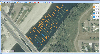 Eye4Software Hydromagic is hydrographic survey software for Windows. It can be used to generare depth maps using a GPS or RTK receiver and an echosounder or fishfinder.
After recording the sounding, you can generate DTM's (Digital Terrain Models), depth contours, 3D views and cross-sections....
Platforms: Windows, Windows 8, Windows 7, Windows Server
Eye4Software Hydromagic is hydrographic survey software for Windows. It can be used to generare depth maps using a GPS or RTK receiver and an echosounder or fishfinder.
After recording the sounding, you can generate DTM's (Digital Terrain Models), depth contours, 3D views and cross-sections....
Platforms: Windows, Windows 8, Windows 7, Windows Server
| License: Demo | Cost: $1549.93 USD | Size: 83.02 MB | Download (170): Eye4Software Hydromagic Download |
Released: September 26, 2012
|
Added: September 26, 2012 | Visits: 539
 GeoMapApp is an earth science exploration and visualization application that is continually being expanded as part of the Marine Geoscience Data System (MGDS) at the Lamont-Doherty Earth Observatory of Columbia University.
The application provides direct access to the Global Multi-Resolution...
Platforms: Windows
GeoMapApp is an earth science exploration and visualization application that is continually being expanded as part of the Marine Geoscience Data System (MGDS) at the Lamont-Doherty Earth Observatory of Columbia University.
The application provides direct access to the Global Multi-Resolution...
Platforms: Windows
| License: Freeware | Size: 9 MB | Download (446): GeoMapApp Download |
Released: June 13, 2012
|
Added: June 13, 2012 | Visits: 729
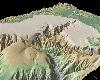
 View maps of Earth and other planets with PrettyMap! See current day and night regions, learn geography by taking the quiz, enjoy 3D elevation surfaces, measure distances between locations and create your own maps with special places! PrettyMap lets you view vector and raster maps and images...
Platforms: Windows, Pocket PC
View maps of Earth and other planets with PrettyMap! See current day and night regions, learn geography by taking the quiz, enjoy 3D elevation surfaces, measure distances between locations and create your own maps with special places! PrettyMap lets you view vector and raster maps and images...
Platforms: Windows, Pocket PC
| License: Shareware | Cost: $19.95 USD | Size: 4.02 MB | Download (56): PrettyMap - World Atlas and Maps, GPS Download |
Added: November 01, 2013 | Visits: 450
 Java OceanAtlas (or simply JOA) is a software application for viewing and manipulating oceanographic profile data. JOA was designed primarily for oceanographic sections but is also useful for looking at data also in the latitude-longitude domain. Here's a brief list of what JOA can do: * Open a...
Platforms: Mac
Java OceanAtlas (or simply JOA) is a software application for viewing and manipulating oceanographic profile data. JOA was designed primarily for oceanographic sections but is also useful for looking at data also in the latitude-longitude domain. Here's a brief list of what JOA can do: * Open a...
Platforms: Mac
| License: Freeware | Size: 14.1 MB | Download (46): Java OceanAtlas Download |