


Arcview Gis software
Arcview Gis
Released: April 22, 2008
|
Added: April 26, 2008 | Visits: 9.510
 The free AvisMap Viewer opens most GIS/CAD and raster image file types and most ArcView, ArcExplorer, and MapInfo projects. Besides just opening and viewing files, the Viewer supports an extensive list of features including visual layer properties control, legend control, thematic mapping,...
Platforms: Windows
| License: Freeware | Size: 22.28 MB | Download (1734): AvisMap Free Viewer Download |
Released: November 10, 2007
|
Added: November 20, 2007 | Visits: 6.089
 Geocode digital images with latitude, longitude, altitude, and direction information. RoboGEO stamps this information onto the actual photo or writes it to the EXIF headers, allowing you to permanently geotag and link your photos to the GPS coordinates. All writing to the EXIF and IPTC headers...
Platforms: Windows
| License: Demo | Cost: $39.95 USD | Size: 8.28 MB | Download (1179): RoboGEO Download |
Released: June 13, 2010
|
Added: September 08, 2011 | Visits: 927
 Silverlight Map Viewer is a .NET native GIS viewer control which allows developers to create interactive mapping application on the web browser. Packed with powerful AJAX interactive, simple API that makes coding easy. It is compatible with Silveright 4.0 and Visual Studio 2010. It includes many...
Platforms: Windows
| License: Shareware | Cost: $199.00 USD | Size: 4.96 MB | Download (758): SwiftGIS Silverlight MapViewer Download |
Added: August 07, 2008 | Visits: 1.770
 Total GIS Converter is an affordable converter of GIZ files. It converts AEP, GRD, ADF, E00, FLT, APR, SHP, DXF, BT, TOC, RT1, DEM, DLG, ECW, IMG, DGF, GML, SID, MIF, TAB, WOR, DNG, DDF, BIL, TIF, JPEG, TTKPS, TTKGP, TTKLS, LFT, PFT, and TFT files. The target formats are TIFF, PNG, JPEG, BMP....
Platforms: Windows
| License: Shareware | Cost: $99.90 USD | Size: 2.66 KB | Download (648): Total GIS Converter Download |
Added: August 18, 2008 | Visits: 1.357
 Genesis IV is a landscape database and graphics system particularly targeted at Professional GIS and Educational users. Create great graphics for your clients, enthuse and educate your students, or explore geographical data, GenesisIV is unique multifaceted software and much more than a simple...
Platforms: Windows
| License: Freeware | Size: 23.84 MB | Download (606): GenesisIV Download |
Released: January 29, 2013
|
Added: January 29, 2013 | Visits: 582
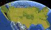
 SWIFT WX Professional runs on any desktop or laptop computer and provides you with up-to-the-minute Radar, Satellite, Storm Warnings, and Hail Reports. It will even alert you up to an hour in advance of approaching rain or thunderstorms, and predict to the nearest minute when those storms will...
Platforms: Windows
| License: Shareware | Cost: $159.50 USD | Size: 20.45 MB | Download (574): SWIFT WX Professional Download |
Added: August 12, 2008 | Visits: 951
NewCyber3D provides full source code CDs covering a wide range of topics relevant to OpenGL GIS, terrain, stereo display, image processing and visualization. Each CD includes the entire OpenGL program and demonstrations with full source codes (including library source codes), project files,...
Platforms: Windows
| License: Freeware | Download (549): NewCyber3D Download |
Released: October 01, 2012
|
Added: October 01, 2012 | Visits: 377
 An expensive GIS software is maybe not suitable for your purpose. If you are using one for analysis or simulation and feeling one of these: huge, complicated, slow and unremovable, it's time to change. Why MicroCity? Versatile: Additional to fundamental GIS functions, many unique libraries such...
Platforms: Windows
| License: Freeware | Size: 3.95 MB | Download (538): Portable MicroCity Download |
Added: August 04, 2008 | Visits: 1.164
 GIS ObjectLand is a universal Geographic Information System for Windows. Key capabilities: vector-raster maps; multiuser data editing; import and export for MIF/MID (MapInfo), SHP (ArcView), DXF (AutoCAD), DBF (dBASE), CSV; setting access permissions to data for different categories of users;...
Platforms: Windows
| License: Shareware | Cost: $99.00 USD | Size: 23.54 MB | Download (537): GIS ObjectLand Download |
Released: August 18, 2012
|
Added: August 18, 2012 | Visits: 365
 An expensive GIS software is maybe not suitable for your purpose. If you are using one for analysis or simulation and feeling one of these: huge, complicated, slow and unremovable, it's time to change. Why MicroCity? Versatile: Additional to fundamental GIS functions, many unique libraries such...
Platforms: Windows
| License: Freeware | Size: 3 MB | Download (530): MicroCity Download |
Released: November 04, 2012
|
Added: November 04, 2012 | Visits: 1.369
 Software development kit for CAD/CAM/ GIS and graphic software developers. Converts from raster to vector and refines architect, mechanical, tech drawing, maps, math graphs, graphics for books and journals and more. ActiveX and Com Component are also available. Refines vector graphics, creates...
Platforms: Windows
| License: Freeware | Size: 2.67 MB | Download (526): Algolab Raster to Vector Conversion CAD/ Download |
Released: September 14, 2014
|
Added: October 16, 2014 | Visits: 6.483
 Vextractor is a vectorizer program for transforming raster images into vector formats by building centerlines and outlines. This tool could be used for the vectorizing photo, logotypes and other line art images for use in Vector Graphics Design software. You can also vectorize charts, drawings,...
Platforms: Windows, Windows 7
| License: Shareware | Cost: $99.95 USD | Size: 2.97 MB | Download (517): Vextractor Download |
Released: August 02, 2012
|
Added: August 02, 2012 | Visits: 409
 Visualize your data...in 3D! Quick, easy and inexpensive. GraphEarth enables marketing and other business professionals to create stunning visual representations of their data, all without the time and costs associated with a full-featured GIS. Create one of a kind deliverables and distribute...
Platforms: Windows
| License: Demo | Cost: $19.95 USD | Size: 463 KB | Download (498): GraphEarth Download |
Released: November 23, 2012
|
Added: November 23, 2012 | Visits: 411
 The goal of VTP is to foster the creation of tools for easily constructing any part of the real world in interactive, 3D digital form.
This goal will require a synergetic convergence of the fields of CAD, GIS, visual simulation, surveying and remote sensing. VTP gathers information and tracks...
The goal of VTP is to foster the creation of tools for easily constructing any part of the real world in interactive, 3D digital form.
This goal will require a synergetic convergence of the fields of CAD, GIS, visual simulation, surveying and remote sensing. VTP gathers information and tracks...
Platforms: Windows
| License: Freeware | Size: 1024 KB | Download (496): Virtual Terrain Project for Windows 1.1 Download |
Released: November 16, 2012
|
Added: November 16, 2012 | Visits: 489
 The goal of VTP is to foster the creation of tools for easily constructing any part of the real world in interactive, 3D digital form.
This goal will require a synergetic convergence of the fields of CAD, GIS, visual simulation, surveying and remote sensing. VTP gathers information and tracks...
The goal of VTP is to foster the creation of tools for easily constructing any part of the real world in interactive, 3D digital form.
This goal will require a synergetic convergence of the fields of CAD, GIS, visual simulation, surveying and remote sensing. VTP gathers information and tracks...
Platforms: Mac, Linux
| License: Freeware | Size: 2.2 MB | Download (492): Virtual Terrain Project for Mac OS X and Linux Download |
Released: August 21, 2012
|
Added: August 21, 2012 | Visits: 425
 AGIS for Windows is a mapping and simple GIS shareware package. Plot your own geographic data on the map of the world provided without the high cost and steep learning curve usually associated with this kind of software. Create high resolution publication quality images that can be pasted into...
Platforms: Windows
| License: Shareware | Cost: $49.00 USD | Size: 3.57 MB | Download (478): AGIS for Windows Download |
Released: October 22, 2012
|
Added: October 22, 2012 | Visits: 585
IrriPro is the only software that let you design an irrigation system only by drawing the elements: now it's possible, thanks to the INDO technology (Irrigation Network Data Object) developed by Irriworks, to draw the elements of a system (such as outlets, pipes, etc) and of a terrain, not only...
Platforms: Windows
| License: Freeware | Size: 161 MB | Download (467): IrriPro Download |
Released: October 12, 2012
|
Added: October 12, 2012 | Visits: 903
Easy Trace Pro is a complete application designed to help you generate and edit vector maps.
The program supports export and import to / from most popular GIS formats (ArcINFO, ArcView, AutoCAD, Credo, MapInfo, MicroStation.
Platforms: Windows, 2003, Windows Vista, 2008, 7, 7x64
| License: Freeware | Download (464): Easy Trace Free Download |
Released: October 24, 2012
|
Added: October 24, 2012 | Visits: 674
 QGIS supports vector, raster, and database formats and lets you browse and create map data on your computer.
Quantum GIS (QGIS) supports many common spatial data formats (e.g. ESRI ShapeFile, geotiff). QGIS supports plugins to do things like display tracks from your GPS.
QGIS aims to be an...
QGIS supports vector, raster, and database formats and lets you browse and create map data on your computer.
Quantum GIS (QGIS) supports many common spatial data formats (e.g. ESRI ShapeFile, geotiff). QGIS supports plugins to do things like display tracks from your GPS.
QGIS aims to be an...
Platforms: Linux
| License: Freeware | Size: 1024 KB | Download (460): Quantum GIS form Linux Download |
Released: October 16, 2012
|
Added: October 16, 2012 | Visits: 423
 Finally, high-quality map production software that works. MAPublisher® cartography software seamlessly integrates over 40 GIS tools into the Adobe Illustrator environment to help you create maps the way you want, how you want. Import the most widely used GIS data formats, including those from...
Platforms: Mac
| License: Shareware | Cost: $1399.00 USD | Size: 222.9 MB | Download (459): MAPublisher Download |