


Analyze Vector Map software
Analyze Vector Map
Released: October 11, 2012
|
Added: October 11, 2012 | Visits: 605
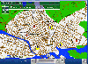
 QLandkarte GT is a handy, easy to use program specially designed to offer users a ultimate outdoor aficionado's tool.
This application offers support for GPS maps in GeoTiff format as well as Garmin's img vector map format.
for WindowsXP, Vista, 7
Platforms: Windows, Windows Vista, 7
QLandkarte GT is a handy, easy to use program specially designed to offer users a ultimate outdoor aficionado's tool.
This application offers support for GPS maps in GeoTiff format as well as Garmin's img vector map format.
for WindowsXP, Vista, 7
Platforms: Windows, Windows Vista, 7
| License: Freeware | Download (498): QLandkarte GT Download |
Added: August 30, 2008 | Visits: 1.870
 Flash based map software that provides easy way to integrate interactive maps into any web application. It consists of Flash map engine (any maps can be loaded into it) and JavaScript bridge. JavaScript bridge provides connectivity functions - for example Flash map can be connected to database...
Platforms: Windows, *nix
Flash based map software that provides easy way to integrate interactive maps into any web application. It consists of Flash map engine (any maps can be loaded into it) and JavaScript bridge. JavaScript bridge provides connectivity functions - for example Flash map can be connected to database...
Platforms: Windows, *nix
| License: Shareware | Cost: $69.00 USD | Size: 639 KB | Download (524): Loris Vector Map Engine Download |
Added: August 24, 2013 | Visits: 391
Vector maps of arbitrary areas: free conversion utility With the shapefile-to-pmap converter, you can have vector maps of areas you are interested in converted for PrettyMap. ESRI provides shapefile maps for most areas of the world (however, their on-line service is no longer available)....
Platforms: Mac
| License: Shareware | Cost: $0.00 USD | Size: 6.01 MB | Download (41): PrettyMap vector map converter Download |
Released: September 09, 2012
|
Added: September 09, 2012 | Visits: 430
GISEYE Vector Converter software for Windows is designed to convert vector data from one presentation format into another. The user has a rich functional that allows him to re-project vector maps into a wide range of available projections, to change vector name file, to combine vector maps by...
Platforms: Windows
| License: Shareware | Cost: $29.00 USD | Size: 9.77 MB | Download (444): GISEYE Vector Converter Download |
Released: May 01, 2011
|
Added: May 21, 2011 | Visits: 2.589
 Anychart is a flexible Flash based-solution, which allows you to easily display any sort of data dealing with geographical locations. It contains United States Maps with Counties, World Map, etc. XML data file and a set of customizable options make AnyChart Maps a universal solution for web...
Platforms: OS/2, Windows, Mac, *nix, Windows CE, Pocket PC, Palm OS 6.0,Not Applicable,Handheld/Mobile Other,Java,MS-DOS,AS/400
Anychart is a flexible Flash based-solution, which allows you to easily display any sort of data dealing with geographical locations. It contains United States Maps with Counties, World Map, etc. XML data file and a set of customizable options make AnyChart Maps a universal solution for web...
Platforms: OS/2, Windows, Mac, *nix, Windows CE, Pocket PC, Palm OS 6.0,Not Applicable,Handheld/Mobile Other,Java,MS-DOS,AS/400
| License: Shareware | Cost: $399.00 USD | Size: 10.27 MB | Download (118): AnyChart Flash Map Component Download |
Released: June 13, 2012
|
Added: June 13, 2012 | Visits: 729
 View maps of Earth and other planets with PrettyMap! See current day and night regions, learn geography by taking the quiz, enjoy 3D elevation surfaces, measure distances between locations and create your own maps with special places! PrettyMap lets you view vector and raster maps and images...
Platforms: Windows, Pocket PC
View maps of Earth and other planets with PrettyMap! See current day and night regions, learn geography by taking the quiz, enjoy 3D elevation surfaces, measure distances between locations and create your own maps with special places! PrettyMap lets you view vector and raster maps and images...
Platforms: Windows, Pocket PC
| License: Shareware | Cost: $19.95 USD | Size: 4.02 MB | Download (56): PrettyMap - World Atlas and Maps, GPS Download |
Added: May 10, 2013 | Visits: 333
MATLAB has a built-in function called min that returns the smallest value in some numeric vector.This function does the same thing, but it returns the smallest min from all the vectors. Requirements: - MATLAB 7.6 or higher
Platforms: Windows, Mac, *nix, Matlab, BSD Solaris
| License: Freeware | Download (57): smallestMin Download |
Released: August 23, 2012
|
Added: August 23, 2012 | Visits: 670
 All-in-one software for creation of custom GPS maps compatible with Garmin GPS units. Mapwel supports routing, ESRI shapefiles, OpenStreetMap OSM, Google Earth KML and KMZ, cGPSmapper MP and GPX files. Mapwel custom GPS mapping capability and user icons editor are often used in forestry,...
Platforms: Windows
All-in-one software for creation of custom GPS maps compatible with Garmin GPS units. Mapwel supports routing, ESRI shapefiles, OpenStreetMap OSM, Google Earth KML and KMZ, cGPSmapper MP and GPX files. Mapwel custom GPS mapping capability and user icons editor are often used in forestry,...
Platforms: Windows
| License: Shareware | Cost: $45.00 USD | Size: 12.28 MB | Download (454): Mapwel Download |
Released: July 23, 2012
|
Added: July 23, 2012 | Visits: 487
T2K Pro integrates the rich world of GIS datasets and transfers your Geographic information data into Google earth. T2K Pro handles rich data types and access large volumes of geographic data stored in files and databases; T2K PRO handles raster (imagery), Vector Map data and GPS Tracks/...
Platforms: Windows
| License: Shareware | Cost: $90.00 USD | Size: 20.89 MB | Download (54): T2K Pro Download |
Added: May 24, 2006 | Visits: 2.871
 Mind Mapping involves writing down a central idea and thinking up new and related ideas, which radiate out from the center. By focusing on key ideas written in your own words, and then looking for branches out and connections between the ideas, you are mapping your thoughts in a manner which will...
Platforms: Windows
Mind Mapping involves writing down a central idea and thinking up new and related ideas, which radiate out from the center. By focusing on key ideas written in your own words, and then looking for branches out and connections between the ideas, you are mapping your thoughts in a manner which will...
Platforms: Windows
| License: Commercial | Cost: $79.00 USD | Size: 5.86 MB | Download (543): MindChart Business-Edition Download |
Released: July 25, 2007
|
Added: September 26, 2007 | Visits: 3.509
 AvisMap GIS Engine is a comprehensive SDK for the development of custom GIS applications and solutions. This SDK provides several ActiveX (OCX) controls which support Visual Basic, VB.NET, C#, Visual C++ and other ActiveX compatible programming languages, with Microsoft Visual Studio versions 6,...
Platforms: Windows
AvisMap GIS Engine is a comprehensive SDK for the development of custom GIS applications and solutions. This SDK provides several ActiveX (OCX) controls which support Visual Basic, VB.NET, C#, Visual C++ and other ActiveX compatible programming languages, with Microsoft Visual Studio versions 6,...
Platforms: Windows
| License: Shareware | Cost: $199.00 USD | Size: 43.76 MB | Download (157): AvisMap GIS Engine Download |
Released: November 25, 2012
|
Added: November 25, 2012 | Visits: 629
 GENtle is a software for DNA and amino acid editing, database management, plasmid maps, restriction and ligation, alignments, sequencer data import, calculators, gel image display, PCR, and much more.
It is free software under GPLv2+.
Requested Features:
- Import of Vector NTI...
Platforms: Mac
GENtle is a software for DNA and amino acid editing, database management, plasmid maps, restriction and ligation, alignments, sequencer data import, calculators, gel image display, PCR, and much more.
It is free software under GPLv2+.
Requested Features:
- Import of Vector NTI...
Platforms: Mac
| License: Freeware | Size: 3.7 MB | Download (602): GENtle for Mac OS X Download |
Released: July 12, 2012
|
Added: July 12, 2012 | Visits: 640
 GENtle is a software for DNA and amino acid editing, database management, plasmid maps, restriction and ligation, alignments, sequencer data import, calculators, gel image display, PCR, and much more.
It is free software under GPLv2+.
Requested Features:
- Import of Vector NTI...
Platforms: Linux
GENtle is a software for DNA and amino acid editing, database management, plasmid maps, restriction and ligation, alignments, sequencer data import, calculators, gel image display, PCR, and much more.
It is free software under GPLv2+.
Requested Features:
- Import of Vector NTI...
Platforms: Linux
| License: Freeware | Size: 1.7 MB | Download (529): GENtle for Linux Download |
Released: September 02, 2012
|
Added: September 02, 2012 | Visits: 695
 GENtle is a software for DNA and amino acid editing, database management, plasmid maps, restriction and ligation, alignments, sequencer data import, calculators, gel image display, PCR, and much more.
It is free software under GPLv2+.
Requested Features:
- Import of Vector NTI...
Platforms: Windows
GENtle is a software for DNA and amino acid editing, database management, plasmid maps, restriction and ligation, alignments, sequencer data import, calculators, gel image display, PCR, and much more.
It is free software under GPLv2+.
Requested Features:
- Import of Vector NTI...
Platforms: Windows
| License: Freeware | Size: 2.7 MB | Download (512): GENtle for Windows Download |
Released: September 07, 2014
|
Added: September 21, 2014 | Visits: 755
![]() With the new Icons-Land GIS/GPS/Map Vector Icons now it is much more comfortable to use local service applications, GPS tracking and GIS applications, and any kind of mapping applications.
GIS/GPS/Map Icons are meant to help users to orient oneself when using maps, to facilitate their...
Platforms: Windows, Mac, Windows 8, Windows 7, iOS
With the new Icons-Land GIS/GPS/Map Vector Icons now it is much more comfortable to use local service applications, GPS tracking and GIS applications, and any kind of mapping applications.
GIS/GPS/Map Icons are meant to help users to orient oneself when using maps, to facilitate their...
Platforms: Windows, Mac, Windows 8, Windows 7, iOS
| License: Demo | Cost: $180.00 USD | Size: 5.56 MB | Download (40): Icons-Land GIS/GPS/MAP Vector Icons Download |
Released: August 07, 2012
|
Added: August 07, 2012 | Visits: 643
![]() Icons-Land Company advertises exclusive set of icons - Points of Interest Vector Icons. The images are represented in 4 variations of colors (green, blue, red, orange) and 2 variations of backgrounds (plain and circled). Colors variety helps distinguishing the same objects on the map by different...
Platforms: Windows
Icons-Land Company advertises exclusive set of icons - Points of Interest Vector Icons. The images are represented in 4 variations of colors (green, blue, red, orange) and 2 variations of backgrounds (plain and circled). Colors variety helps distinguishing the same objects on the map by different...
Platforms: Windows
| License: Demo | Cost: $150.00 USD | Size: 1.48 MB | Download (57): Icons-Land POI Vector Icons Download |
Added: May 10, 2013 | Visits: 624
Using 'reduce' and 'map', this code shows how a matrix vector multiplication can be reduced to a single loop.
Platforms: Windows, Mac, *nix, Python, BSD Solaris
| License: Freeware | Download (54): Matrix vector multiplication Download |
Added: November 17, 2006 | Visits: 4.773
 Raster To Vector converter is the most powerful and absolutely free solution for digitizing vector data from image sources. It combines the power of outline vectorizing technology with many unique features such as:
- Customizable noise suppression;
- Autoincrease quality for small-sized...
Platforms: Windows
Raster To Vector converter is the most powerful and absolutely free solution for digitizing vector data from image sources. It combines the power of outline vectorizing technology with many unique features such as:
- Customizable noise suppression;
- Autoincrease quality for small-sized...
Platforms: Windows
| License: Freeware | Size: 9.98 MB | Download (1074): Raster To Vector Download |
Released: November 11, 2005
|
Added: September 06, 2006 | Visits: 6.043
 Vector Graphics ActiveX is professional graphics solution for creating business and technical drawings and the most powerful for today. It provides 500+ methods, properties and events and is fully object oriented. Developers get full control of all objects at run time and can process graphic...
Platforms: Windows
Vector Graphics ActiveX is professional graphics solution for creating business and technical drawings and the most powerful for today. It provides 500+ methods, properties and events and is fully object oriented. Developers get full control of all objects at run time and can process graphic...
Platforms: Windows
| License: Freeware | Size: 5.93 MB | Download (765): Vector Graphics ActiveX Download |
Released: May 06, 2009
|
Added: May 11, 2009 | Visits: 2.298
 FlashMapOne provides a most effective interactive map solutions for your project. Use FlashMapOne, you can create animated, interactive and data-driven Flash Maps for your dynamic web applications. That is a collection of vector maps are driven by XML, can easily be integrated with any scripting...
Platforms: Windows, Mac, *nix
FlashMapOne provides a most effective interactive map solutions for your project. Use FlashMapOne, you can create animated, interactive and data-driven Flash Maps for your dynamic web applications. That is a collection of vector maps are driven by XML, can easily be integrated with any scripting...
Platforms: Windows, Mac, *nix
| License: Demo | Cost: $199.95 USD | Size: 1.67 MB | Download (151): Flash Map One Download |