


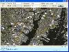
Aerial View Map software
Aerial View Map
Added: January 25, 2010 | Visits: 691
 Holding Pattern Coach Class turns your idle computer screen into an airplane window, complete with a moving aerial view. Each time it plays, the screensaver creates a unique flight sequence. Realistic, gentle animation and superb photography make it a truly distinctive screen saver. Enjoy the...
Platforms: Mac
Holding Pattern Coach Class turns your idle computer screen into an airplane window, complete with a moving aerial view. Each time it plays, the screensaver creates a unique flight sequence. Realistic, gentle animation and superb photography make it a truly distinctive screen saver. Enjoy the...
Platforms: Mac
| License: Freeware | Download (103): Holding Pattern Coach Class Download |
Released: August 13, 2012
|
Added: August 13, 2012 | Visits: 656
Turns your idle computer screen into an airplane window, complete with a moving aerial view. Each time it plays, the screensaver creates a unique flight sequence.
Realistic, gentle animation and superb photography make it a truly distinctive screen saver. Enjoy the visual splendor of 15 fresh...
Platforms: Mac
| License: Freeware | Size: 5.7 MB | Download (49): Holding Pattern Screen Saver: Coach Class for Mac OS Download |
Added: September 26, 2006 | Visits: 2.852
Mapbuilder is designed for creating bird&aposs-eye city map. Mapbuilder can help you quick-build a bird&aposs-eye view map if you have a traditional plane map. Mapbuilder supports up to 99 map layers. You can add description for each map objects and you can find any location very quickly....
Platforms: Windows
| License: Shareware | Cost: $29.00 USD | Size: 676 KB | Download (149): Pipalsoft Mapbuilder Personal License Download |
Released: June 09, 2012
|
Added: June 09, 2012 | Visits: 580
jazzi is a Java based application designed to enable you to manage, view, edit map files created by OziExplorer.
This handy piece of software is developed in order to support map, waypoint and track files. for WindowsAll
Platforms: Windows
| License: Freeware | Download (420): jazzi Download |
Added: November 11, 2013 | Visits: 508
Bit Map Imager was developed as a companion tool to the iOS application 'Bit Map' which can use OZF2 and OZFX3 files (amongst others) to view map images on the iPhone and iPad, but is also a useful standalone tool for anyone who has any need to view or convert OZF2 or OZFX3 files on Mac OS X. It...
Platforms: Mac
| License: Freeware | Size: 645.12 KB | Download (40): Bit Map Imager Download |
Added: August 02, 2008 | Visits: 1.219
Dubai is one of the seven constituent Emirates the make up the United Arab Emirates, and has become an authentic paradise of luxury and tourism. In this spectacular panorama you can see a view of the beach, with the world-famous Hotel Burj al-Arab in close-up. This tower, in the form of a ship`s...
Platforms: Windows
| License: Freeware | Size: 2 KB | Download (147): Dubai Download |
Added: August 12, 2008 | Visits: 963
Just one tank to rule everything! Embark on a mission without precedent in your tank, and taste victory with Tanks Territory. Your objective is to protect your military base from attacks from all types of enemy troops.Tanks Territory has an aerial view, well done graphics and realistic sound...
Platforms: Windows
| License: Freeware | Size: 1024 B | Download (123): Tanks Territory Download |
Added: August 02, 2008 | Visits: 1.357
Not many people, it is safe to say, have seen an F-22 fighter up as close as this photo, and even fewer this close in plain flight.This spectacular photo taken from another plane shows the F-22 fighter in flight and at the same time a lovely mosaic of fields and forests thousands of feet...
Platforms: Windows
| License: Freeware | Size: 1024 B | Download (229): Camo Download |
Added: August 04, 2008 | Visits: 923
The good and the bad, black and white, cruelty and nicety ... the eternal dichotomy of human existence condensed and presented in this illustration in a strange and, without doubt, original way. On a panoramic aerial view of a large city you can see two enormous figures that represent these two...
Platforms: Windows
| License: Freeware | Size: 1024 B | Download (91): El Bueno y el Malo Download |
Released: September 01, 2012
|
Added: September 01, 2012 | Visits: 572
The WorldWide Telescope (WWT) is a Web 2.0 visualization software environment that enables your computer to function as a virtual telescope-bringing together imagery from the world's best ground- and space-based telescopes for the exploration of the universe.
WWT blends terabytes of images,...
Platforms: Windows, Windows Vista, 7
| License: Freeware | Download (442): Microsoft WorldWide Telescope Download |
Released: August 25, 2012
|
Added: August 25, 2012 | Visits: 434
XNavigator is an interactive 3D viewer and integrated client that lets you explore virtual cities and landscape models.
A wide range of interaction and navigation possibilities makes it easy to visualize and analyze very detailed virtual urban environments.
Platforms: Windows, 2K, XP, 2003, Windows Vista, 7, 7x64
| License: Freeware | Download (447): XNavigator Download |
Released: September 14, 2012
|
Added: September 14, 2012 | Visits: 554
Aimed at people who wants to design their interior quickly.
The user may:
- draw the walls of his rooms upon the image of an existing plan
- change the color or the texture of the walls, the floors and the ceilings
- drag and drop doors, windows and furniture onto the plan from a catalog...
Platforms: Mac
| License: Freeware | Size: 13 MB | Download (447): Sweet Home 3D for Mac OS Download |
Released: December 07, 2012
|
Added: April 08, 2013 | Visits: 643
 No matter you love swinging the club or not, you will surely enjoy throwing a disc or two in the fascinating sport-and-action game of Disc Golf! Your goal is to throw the disc into the target baskets with as few attempts as possible. You will be given a disc when the game starts, while the...
Platforms: Windows
No matter you love swinging the club or not, you will surely enjoy throwing a disc or two in the fascinating sport-and-action game of Disc Golf! Your goal is to throw the disc into the target baskets with as few attempts as possible. You will be given a disc when the game starts, while the...
Platforms: Windows
| License: Freeware | Size: 288.83 KB | Download (60): Disc Golf Download |
Released: September 02, 2012
|
Added: September 02, 2012 | Visits: 491
 The Map View SDK is available as a stand alone Developer kit. The Map View SDK offers a Direct DLL method to draw multi-type maps by region within your application. The satellite maps and the street maps will be easily used as background maps within your application such as GIS. The Map View SDK...
Platforms: Windows
The Map View SDK is available as a stand alone Developer kit. The Map View SDK offers a Direct DLL method to draw multi-type maps by region within your application. The satellite maps and the street maps will be easily used as background maps within your application such as GIS. The Map View SDK...
Platforms: Windows
| License: Shareware | Cost: $999.95 USD | Size: 1.12 MB | Download (45): Map View SDK Download |
Released: August 29, 2008
|
Added: September 04, 2008 | Visits: 3.647
 Map View is a professional map browser. Both satellite imagery and maps online can be viewed through it. With the cache technology, it improve the user experience of viewing map. And more, the map can be viewed even when the computer is offline. It's a multi-window application, different places...
Platforms: Windows
Map View is a professional map browser. Both satellite imagery and maps online can be viewed through it. With the cache technology, it improve the user experience of viewing map. And more, the map can be viewed even when the computer is offline. It's a multi-window application, different places...
Platforms: Windows
| License: Shareware | Cost: $29.95 USD | Size: 1.91 MB | Download (286): Map View Download |
Released: November 17, 2012
|
Added: November 17, 2012 | Visits: 612
Aerial Ocean ViewLooping OceanscapeOpens with any version of flashIn a self contained movieclipNo actionscript required
Platforms: Not Applicable
| License: Commercial | Cost: $5.00 USD | Size: 666 KB | Download (45): Aerial Ocean View Download |
Added: May 22, 2010 | Visits: 1.539
Maps project is a topographal map and aerial photo generator and viewer. Maps allows users to generate topographical maps and aerial photographs of any region in the United States. It uses data provided by the USGS through the geoserver system. The interactive view lets you move around,...
Platforms: *nix
| License: Freeware | Size: 11.26 KB | Download (139): Maps Download |
Released: July 25, 2012
|
Added: July 25, 2012 | Visits: 1.220
Character Map is a compact application that allows you to view the characters for a selected font, making it easy to select and paste any character into your current document.
The program is very useful if you are constantly working with special characters and you do not have the time to search...
Platforms: Windows
| License: Freeware | Download (411): Character Map Download |
Added: May 10, 2013 | Visits: 457
Individuals may also give the markers titles and descriptions, as well as position the map and choose between the map, satellite, and hybrid view types.Installation - Unpack in your modules folder (usually /sites/all/modules/) and enable under Administer > Site Building > Modules. Requirements:...
Platforms: Windows, Mac, *nix, PHP, BSD Solaris
| License: Freeware | Download (54): CCK Map Download |
Added: December 03, 2012 | Visits: 507
The location marked on the map is displayed in a block on node view.Installation Unpack in your modules folder (usually /sites/all/modules/) and enable under Administer > Site Building > Modules. Key features "Node Map": - Search location - search for a location, just like @ !Yahoo Maps, or...
Platforms: BSD Solaris
| License: Freeware | Download (55): Node Map 6.x- / 5.x-9.1-2 Download |