


Filter:
All | Freeware
Geography
Added: August 18, 2008 | Visits: 789
 LearnEurope is a game that helps you to learn the names and locations of the countries of Europe. It's a fun and colourful way to learn geography, the game times you for accuracy and speed - the most points wins. You lose points when you get countries or capitals wrong. You get mega-bonuses for...
Platforms: Windows XP
Keyword: 3d, Animation, Arctic, Bowl, Christmas, Fall, Holiday, Owl, Patterns, Screensaver, Seasonal, Snowfall, Snowflake, Snowflakes, Software, Spring, Summer, Super, Thanksgiving, Winamp, Winter
| License: Freeware | Size: 4.27 MB | Download (105): LearnEurope Download |
Added: August 14, 2008 | Visits: 1.308
Puzzle Maps are interactive educational games, small in size and portable, no installation required just unzip and run. The player must find the "?" in the correct location and double-click on it to place the name there. Currently four puzzle maps are available: Boroughs of Greater London;...
Platforms: Windows XP
Keyword: Districts, Download, Educational, Freeware, Globe, Mapa, Mappa, Mappe, Maps, Region, Software, Winamp
| License: Freeware | Size: 450 KB | Download (138): Puzzle Maps Download |
Added: August 14, 2008 | Visits: 1.835
GPS (Global Positioning System) receivers tell you where you are anywhere on the planet! The Global Positioning System (GPS) is a collection of 24 earth-orbiting satellites and these satellites allow any person who owns a GPS receiver to determine his or her precise longitude, latitude and...
Platforms: ALL
Keyword: Educational, Explain, Explanation, Help, Helpful, How, Information, K-12, K12, Learn, Learning, Research, Resources, Students, Study, Stuff, Teachers, Tutorials, Understand, Understanding, Winamp, Works
| License: Freeware | Download (223): How a GPS Receiver Works Download |
Added: August 10, 2008 | Visits: 1.007
Want to brush up on the names and locations of the 40 or so countries of the new Europe? This program from the Family Games Web Center will help you. A study mode and two quiz modes make the learning easy.
Platforms: Windows XP
Keyword: Africa, America, Europe, Geography, Geography Tutors, Hierophant, Jumble, Magic Slate, Notecard, Oktagon, Pic-tac-toe, Tic-tac-toe, Usa, Valvo, Venables, Whirlwords
| License: Freeware | Size: 508 KB | Download (101): European Geography Tutor Download |
Added: August 07, 2008 | Visits: 782
Versamap draws outline maps on 16 map projections. The program allows users to print publication quality maps; and to export maps in vector graphic (WMF, CGM, DXF, ASCII) and bitmapped (BMP) formats. Versamap is supplied with digital maps from the Versamap Micro World Database, a world map with...
Platforms: Windows 2000, Windows XP, Windows 2003
Keyword: Ascii, Bmp, Cartography, Cgm, Databases, Digital, Dxf, Features, Geographic, Map, Mapping, Maps, Outline, Outline Maps, Projections, Software, Versamap, Winamp, Wmf
| License: Shareware | Cost: $30.00 USD | Size: 4.07 KB | Download (103): Versamap 3 for Windows Download |
Added: August 06, 2008 | Visits: 1.020
LearnProvinces is a game that helps you to learn the names and locations of the Provinces in Canada, it's a fun and colourful way to learn about Canada. The game times you for accuracy and speed - the most points wins, play against your friends to get the highest scores or just challenge yourself...
Platforms: Windows XP
Keyword: 3d, Animation, Arctic, Autumnleaves, Bowl, Christmas, Fall, Holiday, Owl, Patterns, Screensaver, Seasonal, Snowfall, Snowfall3d, Snowflake, Snowflakes, Software, Spring, Summer, Super, Thanksgiving, Winter
| License: Freeware | Size: 4.19 MB | Download (96): LearnProvinces Download |
Added: November 23, 2006 | Visits: 3.116
 Educational Simulations offers Real Lives, the life simulation that gives you the opportunity to learn how people really live in other countries.
Real Lives is an interactive life simulation software program that enables you and your students to live one of billions of lives in any country in...
Educational Simulations offers Real Lives, the life simulation that gives you the opportunity to learn how people really live in other countries.
Real Lives is an interactive life simulation software program that enables you and your students to live one of billions of lives in any country in...
Platforms: Windows 3.x, Windows 95, Windows 98, Windows NT 3.x, Windows NT 4.x, Windows 2000, Windows XP
Keyword: Culture, Geography, Life, Real, Simulation, World
| License: Demo | Cost: $40.00 USD | Size: 11.69 MB | Download (323): Real Lives Download |
Released: November 09, 2006
|
Added: November 14, 2006 | Visits: 4.287
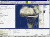
 Geo World is a handy application for finding out detailed information about any country in the world. One of its advantages is that you can find the country you were looking for by Internet Country Code, Capital and etc. Also it's supplied with more than 530 images which represent flags and maps...
Platforms: Windows 95, Windows 98, Windows Me, Windows NT 3.x, Windows 2000, Windows XP, Windows 2003, Windows Vista
Keyword: Area, Capital, Country, Country Code, Current Time, Daylight Time, Flag, Geo World, Geographic, Geography, Gmt, Internet Country Code, Island, Local Time, Locat, Map, Ocean, Population, Powerful Tool, Religion, State, States, Time Zone, Time Zones
| License: Shareware | Cost: $25.00 USD | Size: 6.24 MB | Download (324): Geo World Download |
Added: October 06, 2006 | Visits: 3.915
MBBuilder is a visual Rapid Application Development (RAD) tool for MapInfo MapBasic with features, typical for this products category:
- Menu Editor
- Toolbar Editor
- Project Manager
- Component Editor
- Object Inspector
- Dialog Editor.
The main feature of MBBuilder is Component...
Platforms: Windows 95, Windows 98, Windows Me, Windows NT 4.x, Windows 2000, Windows XP
Keyword: Application, Convert, Converter, Converting, Erdas, Free, Gis, Imagine, Mapbasic, Mapinfo, Mbx, Rad, Raster, Register, Tool, Vector, Visual
| License: Shareware | Cost: $99.95 USD | Size: 1.09 MB | Download (266): MBBuilder Download |
Added: September 09, 2006 | Visits: 3.801
 EasyMap VCL is a Delphi/C++Builder components set for creating your own GIS-related solutions without MapInfo, MapX, MapObjects, WinGIS etc.
EasyMap VCL allows to add following functionalities in Delphi/C++Builder application:
- MIF/MID vector maps displaying in Longitude/Lantitude...
EasyMap VCL is a Delphi/C++Builder components set for creating your own GIS-related solutions without MapInfo, MapX, MapObjects, WinGIS etc.
EasyMap VCL allows to add following functionalities in Delphi/C++Builder application:
- MIF/MID vector maps displaying in Longitude/Lantitude...
Platforms: Windows 95, Windows 98, Windows Me, Windows NT 4.x, Windows 2000, Windows XP
Keyword: Alternative, Borland, C++builder, Delphi, Geo, Geographical, Inprise, Jpeg, Map, Polygon, Replacement, Spatial
| License: Shareware | Cost: $69.95 USD | Size: 1.37 MB | Download (196): EasyMap VCL Download |
Added: July 05, 2006 | Visits: 5.300
Allows to display and register rasters of ERDAS Imagine (*.IMG files) in MapInfo.Georeferenced *.IMG images will be displayed directly in MapInfo Professional, MapX, and MapXtreme environments.For free:img2tab utility - creates *.TAB file for each *.IMG file in batch mode. MapInfo Table is...
Platforms: Windows 95, Windows 98, Windows Me, Windows 2000, Windows XP
Keyword: Application, Convert, Converter, Converting, Erdas, Free, Gis, Imagine, Mapbasic, Mapinfo, Mbx, Rad, Raster, Register, Tool, Vector, Visual
| License: Shareware | Cost: $199.95 USD | Size: 1.1 MB | Download (226): Raster Handler for ERDAS Imagine to MapInfo Download |
Released: June 19, 2004
|
Added: May 19, 2006 | Visits: 3.261
 Complete voyage planning utility for ocean and coastal shipping and yachts,
unlimited number of waypoints, greatcircle or rhumbline. Caculates average weather enroute
as well as estimated vessels performance and optimal speed settings.
Includes hurricane tracking, calculation of CPA and TCPA...
Complete voyage planning utility for ocean and coastal shipping and yachts,
unlimited number of waypoints, greatcircle or rhumbline. Caculates average weather enroute
as well as estimated vessels performance and optimal speed settings.
Includes hurricane tracking, calculation of CPA and TCPA...
Platforms: Windows 95, Windows 98, Windows Me, Windows NT 4.x, Windows 2000, Windows XP
Keyword: Navigation, Sailing, Shipping, Voyageplanning, Waypoints
| License: Shareware | Cost: $75.00 USD | Size: 1.58 MB | Download (173): NavTools Route Download |
Added: May 16, 2006 | Visits: 14.375
 Learn the U.S. states and capitals in a fun (and funny) way. A full screen clickable map of the U.S. is used to teach names and locations of states and capitals in a variety of ways. When the student completes ten problems they are rewarding with a silly animation using 3D graphics. The...
| License: Shareware | Cost: $18.00 USD | Size: 9.29 MB | Download (578): Animated States and Capitals Download |
Added: April 09, 2006 | Visits: 4.383
 AllTrans can be used for world wide professional coordinate transformations between international and national coordinate systems with or without geodetic datum change.
Transformations between State-Plane-Coordinates (NAD83, NAD27, Transverse Mercator, Lambert, Soldner-Cassini, Mercator, EOV,...
AllTrans can be used for world wide professional coordinate transformations between international and national coordinate systems with or without geodetic datum change.
Transformations between State-Plane-Coordinates (NAD83, NAD27, Transverse Mercator, Lambert, Soldner-Cassini, Mercator, EOV,...
Platforms: Windows 95, Windows 98, Windows Me, Windows NT 3.x, Windows NT 4.x, Windows 2000, Windows XP
Keyword: Conversion, Coordinates, Geodetic, Geographic, Gps, Lambert, Nad27, Nad83, Transformation, Transverse Mercator, Wgs84
| License: Demo | Cost: $99.00 USD | Size: 4.41 MB | Download (470): AllTrans Download |
Added: March 19, 2006 | Visits: 2.519
Take a spin across the USA! Package of challenging puzzles for the states and capitals of the United States. Used in schools and homes around the world; geography scores improve rapidly. Serves as level one for the worldwide version "GeoPuzzle!"
| License: Freeware | Size: 850 KB | Download (276): USAPuzzle! Download |
Added: January 05, 2006 | Visits: 3.129
 NavTools GPS is a small and easy to use application to connect your PC or laptop to an existing GPS (NMEA 0183 serial connection) installation. Position cata will automatically be displayed and logged on your screen, and voyage data can be exchanged and shared with the NavTools Route voyage...
Platforms: Windows 95, Windows 98, Windows Me, Windows NT 4.x, Windows 2000, Windows XP
Keyword: Gps, Navigation, Navtools, Nmea, Route, Yachting
| License: Shareware | Cost: $25.00 USD | Size: 1.5 MB | Download (254): NavTools GPS Download |